Bamboesberg: Difference between revisions
Content deleted Content added
Paul venter (talk | contribs) No edit summary |
No edit summary Tags: Mobile edit Mobile app edit iOS app edit |
||
| (16 intermediate revisions by 10 users not shown) | |||
| Line 1: | Line 1: | ||
{{Short description|Mountain range in Eastern Cape, South Africa}} |
|||
{{Infobox mountain range |
{{Infobox mountain range |
||
| name = Bamboesberg |
| name = Bamboesberg |
||
| |
| photo = R56 Road-001.JPG |
||
| |
| photo_caption =The Bamboesberg from highway R56 between [[Steynsburg]] and [[Molteno]] |
||
| highest =Aasvoëlberg |
| highest =Aasvoëlberg |
||
| |
| elevation_m = 2208 |
||
| |
| listing = |
||
| |
| country = [[South Africa]] |
||
| region_type = Province | region = [[Eastern Cape]] |
|||
| parent = [[Stormberg Mountains]] |
| parent = [[Stormberg Mountains]] |
||
| ⚫ | |||
| nearest_city = |
|||
| range_coordinates = |
|||
| ⚫ | |||
| map_caption = |
| map_caption = |
||
| label_position = right |
| label_position = right |
||
| coordinates = {{coord|31|36|24|S|26|07|12|E|type:mountain_region:ZA_scale:100000|format=dms|display=inline,title}} |
|||
| lat_d = 31 | lat_m = 36 | lat_s = 24 | lat_NS = S |
|||
| long_d= 26 | long_m= 07 | long_s= 12 | long_EW= E |
|||
| coordinates_ref = |
| coordinates_ref = |
||
| geology=[[Bushveld igneous complex]], [[sandstone]] |
| geology=[[Bushveld igneous complex]], [[sandstone]] |
||
| Line 22: | Line 23: | ||
| easiest_route = |
| easiest_route = |
||
}} |
}} |
||
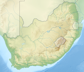
The '''Bamboesberg''' is a mountain range in the [[Eastern Cape]], [[South Africa]]. This range was named for the bamboo ''[[Thamnocalamus tessellatus]]'' growing in its ravines. |
The '''Bamboesberg''' is a mountain range in the [[Eastern Cape]], [[South Africa]]. This range was named for the bamboo ''[[Thamnocalamus tessellatus]]'' growing in its ravines.<ref name=dosapn>{{cite book|last=Raper|first=Peter E.|title=Dictionary of Southern African Place Names |url=https://archive.org/stream/DictionaryOfSouthernAfricanPlaceNames/SaPlaceNames#page/n68/mode/2up |publisher=Internet Archive|accessdate=30 October 2013|page=68|year=1987}}</ref> |
||
The Bamboesberg is |
The Bamboesberg is an outlier of the [[Stormberg Mountains]] and part of the range is seen parallel to and east of the road linking [[Hofmeyr]] and [[Tarkastad]]. Some of its peaks are over {{convert|6000|ft|m}} – [[Aasvoëlberg]], 35 km west of [[Sterkstroom]], rises to {{convert|7245|ft|m}}. The [[Stormbergspruit]] is a tributary of the [[Orange River]]. |
||
The rocks are composed of sediments of the [[Stormberg Series]] of the [[Karoo System]].<ref>''Standard Encyclopaedia of Southern Africa'' - vol 2</ref><ref>[http://www.mcsa.org.za/cent/06_archive/d_conservation_a/reports/stateofnations01app1.html Preliminary overview of mountains in South Africa]</ref> |
The rocks are composed of sediments of the [[Stormberg Series]] of the [[Karoo System]].<ref>''Standard Encyclopaedia of Southern Africa'' - vol 2</ref><ref>[http://www.mcsa.org.za/cent/06_archive/d_conservation_a/reports/stateofnations01app1.html Preliminary overview of mountains in South Africa] {{webarchive|url=https://web.archive.org/web/20110719034856/http://www.mcsa.org.za/cent/06_archive/d_conservation_a/reports/stateofnations01app1.html |date=2011-07-19 }}</ref> |
||
[[File:Wilson-stormberg-map-121.jpg|thumb|none|Positions at the [[Battle of Stormberg]], 10 December 1899]] |
|||
==See also== |
==See also== |
||
| Line 34: | Line 36: | ||
{{reflist}} |
{{reflist}} |
||
[[Category:Mountain ranges of |
[[Category:Mountain ranges of the Eastern Cape]] |
||
[[pl:Bamboesberg]] |
|||
Latest revision as of 16:04, 10 June 2022
| Bamboesberg | |
|---|---|
 The Bamboesberg from highway R56 between Steynsburg and Molteno | |
| Highest point | |
| Peak | Aasvoëlberg |
| Elevation | 2,208 m (7,244 ft) |
| Coordinates | 31°36′24″S 26°07′12″E / 31.60667°S 26.12000°E |
| Geography | |
| Country | South Africa |
| Province | Eastern Cape |
| Parent range | Stormberg Mountains |
| Geology | |
| Orogeny | Kaapvaal craton |
| Age of rock | Neoarchean to early Paleoproterozoic |
| Type of rock | Bushveld igneous complex, sandstone |
The Bamboesberg is a mountain range in the Eastern Cape, South Africa. This range was named for the bamboo Thamnocalamus tessellatus growing in its ravines.[1]
The Bamboesberg is an outlier of the Stormberg Mountains and part of the range is seen parallel to and east of the road linking Hofmeyr and Tarkastad. Some of its peaks are over 6,000 feet (1,800 m) – Aasvoëlberg, 35 km west of Sterkstroom, rises to 7,245 feet (2,208 m). The Stormbergspruit is a tributary of the Orange River.
The rocks are composed of sediments of the Stormberg Series of the Karoo System.[2][3]

See also[edit]
References[edit]
- ^ Raper, Peter E. (1987). Dictionary of Southern African Place Names. Internet Archive. p. 68. Retrieved 30 October 2013.
- ^ Standard Encyclopaedia of Southern Africa - vol 2
- ^ Preliminary overview of mountains in South Africa Archived 2011-07-19 at the Wayback Machine

