
Kalinchowk Rural Municipality: Difference between revisions
No edit summary |
WOSlinkerBot (talk | contribs) m Fix lint errors with image options |
||
| (23 intermediate revisions by 14 users not shown) | |||
| Line 1: | Line 1: | ||
{{orphan|date=December 2020}} |
|||
{{Infobox settlement |
{{Infobox settlement |
||
<!--See the table at Infobox settlement for all fields and descriptions of usage--> |
<!--See the table at Infobox settlement for all fields and descriptions of usage--> |
||
<!-- Basic info --> |
<!-- Basic info -->| name = Kalinchowk Rural Municipality |
||
| |
| other_name = |
||
| native_name = कालिन्चोक गाउँपालिका |
|||
|other_name = |
|||
| settlement_type = [[Rural Municipality]] |
|||
|native_name = कालिनचोक गाउँपालिका |
|||
| |
| subdivision_type = Country |
||
| subdivision_name = {{flag|Nepal}} |
|||
|settlement_type = [[Rural Municipality]] |
|||
| subdivision_type1 = [[Provinces of Nepal|Province]] |
|||
|motto = |
|||
| subdivision_name1 = [[Bagmati Province|Bagmati]] |
|||
<!-- images and maps -----------> |
|||
| subdivision_type2 = [[Districts of Nepal|District]] |
|||
|image_skyline = Kuri Bazzar.JPG |
|||
| subdivision_name2 = [[Dolakha District|Dolakha]] |
|||
|imagesize = 300 |
|||
| subdivision_type3 = Wards |
|||
|image_caption =Kuri Bazar in Kalinchowk RM |
|||
| |
| subdivision_name3 = 9 |
||
| |
| government_type = [[Local Government]] |
||
| |
| leader_title = Chairperson |
||
| |
| leader_name = Mr. Arjun Prashad Shiwakoti |
||
| leader_title1 = Vice-Chairperson<!-- for places with, say, both a mayor and a city manager --> |
|||
| pushpin_map = Nepal Bagmati Pradesh#Nepal |
|||
| leader_name1 = Mr. Kul Bahadur Budathoki |
|||
|pushpin_label_position = <!-- the position of the pushpin label: left, right, top, bottom, none --> |
|||
| |
| established_title = Established |
||
| established_date = 10 March 2017 |
|||
<!-- Location ------------------> |
|||
<!-- Area -->| area_total_km2 = 132.49 <!-- ALL fields dealing with a measurements are subject to automatic unit conversion--> |
|||
|pushpin_map_caption = Location |
|||
| |
<!-- Population -->| population_as_of = 2011 |
||
| population_footnotes = |
|||
|coordinates = {{coord|27.79|86.06|type:adm2nd_region:NP_source:unmaps-enwiki|display=inline,title}} |
|||
| |
| population_note = |
||
| |
| population_total = 22,954 |
||
| population_density_km2 = auto |
|||
|subdivision_type1 = [[Provinces of Nepal|Province]] |
|||
| population_blank1_title = Ethnicities |
|||
|subdivision_name1 = [[Bagmati Province|Bagmati]] |
|||
<!-- General information -->| timezone = [[Nepal Standard Time]] |
|||
|subdivision_type2 = [[Districts of Nepal|District]] |
|||
| utc_offset = +5:45 |
|||
|subdivision_name2 = [[Dolakha District|Dolakha]] |
|||
| timezone_DST = |
|||
|subdivision_type3 = Wards |
|||
| |
| utc_offset_DST = |
||
| postal_code_type = Postal Code |
|||
|<!-- Politics --> |
|||
| postal_code = 45500 |
|||
|government_footnotes = |
|||
| area_code = +977 |
|||
|government_type = [[Rural Council]] |
|||
| |
| website = {{website| kalinchowkmun.gov.np}} |
||
| |
| leader_party = Nepali Congress |
||
| image_skyline = Kuri Village.jpg |
|||
|leader_title1 = Vice-chairperson<!-- for places with, say, both a mayor and a city manager --> |
|||
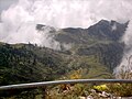
| image_caption = Kuri village, an touristic village near to [[Kalinchowk Bhagwati Temple]] |
|||
|leader_name1 = Mrs. Kalika Pathak |
|||
}} |
|||
|established_title = Established |
|||
|established_date = 10 March 2017 |
|||
<!-- Area --> |
|||
|unit_pref = <!--Enter: Imperial, if Imperial (metric) is desired--> |
|||
|area_footnotes = |
|||
|area_total_km2 = 132.49 <!-- ALL fields dealing with a measurements are subject to automatic unit conversion--> |
|||
<!-- Population --> |
|||
|area_rank = |
|||
|population_as_of = 2011 |
|||
|population_footnotes = |
|||
|population_note = |
|||
|population_total = 22,954 |
|||
|population_density_km2 = auto |
|||
|population_blank1_title = Ethnicities |
|||
<!-- General information --> |
|||
|timezone = [[Nepal Standard Time]] |
|||
|utc_offset = +5:45 |
|||
|timezone_DST = |
|||
|utc_offset_DST = |
|||
|elevation_footnotes = <!--for references: use <ref> </ref> tags--> |
|||
|elevation_m = |
|||
<!-- Area/postal codes & others --> |
|||
|postal_code_type = Postal Code |
|||
|postal_code = |
|||
|area_code = |
|||
|blank_name = Headquarter |
|||
|blank_info = [[Sunakhani]] |
|||
|website = {{website| kalinchowkmun.gov.np}} |
|||
|footnotes = |
|||
}} |
|||
'''Kalinchowk''' is a [[Rural municipality]] located within the [[Dolakha District]] of the [[Bagmati Province]] of [[Nepal]]. The municipality spans {{convert|132.49|km2}} of area, with a total population of 22,954 according to a [[2011 Nepal census]].< |
'''Kalinchowk''' is a [[Gaunpalika|Rural municipality]] located within the [[Dolakha District|Dolakha district]] of the [[Bagmati Province|Bagmati province]] of [[Nepal]]. The municipality spans {{convert|132.49|km2}} of area, with a total population of 22,954 according to a [[2011 Nepal census]].<ref>{{cite web |url= http://mofald.gov.np/sites/default/files/News_Notices/Final%20District%201-75%20Corrected%20Last%20for%20RAJPATRA.pdf |title=District Corrected Last for RAJAPATRA |website=www.mofald.gov.np |access-date=17 July 2018}}</ref><ref>{{cite web |url= http://103.69.124.141/ |title= स्थानीय तहहरुको विवरण |trans-title =Details of the local level bodies |language =ne |access-date= 17 July 2018 |website= www.mofald.gov.np/en |publisher=[[Ministry of Federal Affairs and Local Development (Nepal)|Ministry of Federal Affairs and Local Development]]}}</ref> |
||
On March 10, 2017, the [[Government of Nepal]] restructured the local level bodies into 753 new local level structures. |
On March 10, 2017, the [[Government of Nepal]] restructured the local level bodies into 753 new local level structures.<ref>{{cite news |url= https://thehimalayantimes.com/nepal/new-local-level-structure-comes-effect-today/ |title= New local level structure comes into effect from today |date=10 March 2017 |website=www.thehimalayantimes.com |publisher=[[The Himalayan Times]] |access-date=17 July 2018}}</ref><ref>{{cite web |url= http://kathmandupost.ekantipur.com/news/2017-03-11/new-local-level-units-come-into-existence.html |title= New local level units come into existence |date=11 March 2017 |website=www.kathmandupost.ekantipur.com |access-date=18 July 2018}}</ref> The previous [[Kalinchok|Kalinchowk]], [[Babare]], [[Lamidanda, Dolakha|Lamidanda]], [[Lapilang]], [[Sunakhani]], and [[Sundrawati]] [[Village development committee (Nepal)|VDCs]] were merged to form Kalinchowk Rural Municipality. Kalinchowk is divided into 9 [[Ward (electoral subdivision)|wards]], with [[Sunakhani]] declared the administrative center of the rural municipality. |
||
Kalinchowk is a hill station and a tourist hotspot. It is located |
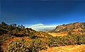
Kalinchowk is a hill station and a tourist hotspot. It is located at 3842 meters of altitude and about 150km northeast from national capital [[Kathmandu]]. The place is best known for trekking and skiing.<ref>{{cite web |url=http://kalinchowkdarshan.com.np/kalinchowk-temple |title=Kalinchowk Darshan |access-date=2 December 2020}}</ref> During the December, January and February (mainly Paush and Magh in Nepali months) snowfalls in Kalinchowk.<ref>{{cite web |url=https://www.hikingannapurna.com/kalinchowk-tour-package |title=Kalinchowk tour |access-date=2 December 2020}}</ref> |
||
==Demographics== |
|||
At the time of the [[2011 Nepal census]], Kalinchowk Rural Municipality had a population of 22,954. Of these, 60.2% spoke [[Nepali language|Nepali]], 34.0% [[Thangmi language|Thangmi]], 3.9% [[Tamang language|Tamang]], 1.0% [[Newar language|Newar]], 0.5% [[Sherpa language|Sherpa]], 0.1% [[Magar language|Magar]], 0.1% [[Maithili language|Maithili]], 0.1% [[Majhi language|Majhi]] and 0.1% other languages as their first language.<ref> NepalMap Language [https://nepalmap.org/data/table/?table=LANGUAGE&primary_geo_id=local-22006&geo_ids=local-22006,district-20,province-3,country-NP]</ref> |
|||
In terms of ethnicity/caste, 36.7% were [[Thami]], 35.8% [[Chhetri]], 13.2% [[Bahun|Hill Brahmin]], 4.0% [[Tamang people|Tamang]], 3.0% [[Newar people|Newar]], 1.9% [[Damai]]/Dholi, 1.9% [[Kami (caste)|Kami]], 1.2% [[Sarki (ethnic group)|Sarki]], 0.6% Majhi, 0.5% [[Sherpa people|Sherpa]], 0.3% [[Magars|Magar]], 0.3% [[Thakuri]], 0.2% Gharti/[[Bhujel]], 0.1% [[Badi people|Badi]], 0.1% Terai [[Brahmin]], 0.1% Sunuwar and 0.3% others.<ref> NepalMap Caste [https://nepalmap.org/data/table/?table=CASTE&primary_geo_id=local-22006&geo_ids=local-22006,district-20,province-3,country-NP]</ref> |
|||
In terms of religion, 69.7% were [[Hinduism in Nepal|Hindu]], 24.0% [[Animism|Prakriti]], 4.5% [[Buddhism in Nepal|Buddhist]], 1.6% [[Christianity in Nepal|Christian]] and 0.1% others.<ref> NepalMap Religion [https://nepalmap.org/data/table/?table=RELIGION&primary_geo_id=local-22006&geo_ids=local-22006,district-20,province-3,country-NP]</ref> |
|||
In terms of literacy, 62.6% could read and write, 2.7% could only read and 34.3% could neither read nor write.<ref> NepalMap Literacy [https://nepalmap.org/data/table/?table=LITERACY_SEX&primary_geo_id=local-22006&geo_ids=local-22006,district-20,province-3,country-NP]</ref> |
|||
==Kalinchowk VDC== |
==Kalinchowk VDC== |
||
'''Kalinchowk''' is now a neighborhood (village) within '''Kalinchowk Rural Municipality'''. It was a separate [[Village development committee (Nepal)|village development committee]] (VDC) from 1990 to 2017. Kalinchowk village had {{convert|38.19|km2}} and population according to 2011 had 2806 with 458 individual households. This whole village is now a ward (ward no. 1) of Kalinchowk RM.<ref>{{Citation|url=http://www.digitalhimalaya.com/collections/nepalcensus/form.php?selection=1 |title=Nepal Census 2001 |magazine=Nepal's Village Development Committees |publisher=[[Digital Himalaya]] | |
'''Kalinchowk''' is now a neighborhood (village) within '''Kalinchowk Rural Municipality'''. It was a separate [[Village development committee (Nepal)|village development committee]] (VDC) from 1990 to 2017. Kalinchowk village had {{convert|38.19|km2}} of area and population according to 2011 had 2806 with 458 individual households. This whole village is now a ward (ward no. 1) of Kalinchowk RM.<ref>{{Citation|url=http://www.digitalhimalaya.com/collections/nepalcensus/form.php?selection=1 |title=Nepal Census 2001 |magazine=Nepal's Village Development Committees |publisher=[[Digital Himalaya]] |access-date=15 November 2009 |url-status=dead |archive-url=https://web.archive.org/web/20081012163506/http://www.digitalhimalaya.com/collections/nepalcensus/form.php?selection=1 |archive-date=12 October 2008 }}</ref> |
||
==Ward division== |
|||
Kalinchowk RM divided into 9 wards as below: |
|||
{| class="wikitable" |
|||
|+ Kalinchowk RM |
|||
|- |
|||
! Village !! Ward no. !! area (KM<sup>2</sup>) !! population (2011) |
|||
|- |
|||
|Kalinchowk ||1 || 38.19 || 2,806 |
|||
|- |
|||
| [[Babare]]||2 || 16.67|| 3,533 |
|||
|- |
|||
|Rowspan=2|[[Lamidanda, Dolakha|Lamidanda]] || 3|| 5.82|| 1,888 |
|||
|- |
|||
| 4|| 7.93 || 2,344 |
|||
|- |
|||
|Rowspan=2|[[Lapilang]]|| 5 || 8.96|| 2,248 |
|||
|- |
|||
| 6 || 24.36|| 2,694 |
|||
|- |
|||
|Rowspan=2| [[Sunakhani]] || 7|| 9.93|| 2,369 |
|||
|- |
|||
| 8|| 8.23 || 2,306 |
|||
|- |
|||
| [[Sundrawati]]|| 9|| 12.4|| 2,766 |
|||
|- |
|||
!Kalinchowk RM || 9 || 132.49||22,954 |
|||
|} |
|||
==Photo gallery== |
==Photo gallery== |
||
<gallery> |
<gallery> |
||
File:Kalinchowk Landscape (3328610867).jpg|Kalinchowk landscape |
|||
File:कालीञ्चोक प्रवेशदुवार.jpg|[[Kalinchok]] entrance |
|||
File:From the top of Kalinchowk, Dolakha.jpg|Kalinchowk view |
|||
File:कालीञ्चोक दृश्य.jpg|[[Kalinchok]] view |
|||
File:Kalinchok 40.JPG| |
File:Kalinchok 40.JPG|Kalinchowk in {{NepaliDateConverter|2061}} |
||
File:Kalinchok 36.JPG| |
File:Kalinchok 36.JPG|Kalinchowk Bhagwati Temple |
||
File:Kalinchowk Bhagawati temple1.jpg|Bell at Kalinchowk Bhagwati Temple |
|||
File:Kalinchowk Bhagawati temple9.jpg|Kalinchowk Bhagawati temple{{NepaliDateConverter|2079}} |
|||
File:Kalinchowk Bhagawati temple4.jpg|Bell and Himalaya's view from Kalinchowk Bhagawati temple |
|||
File:Kalinchowk112.jpg|Himalaya view from Kalinchowk Bhagawati temple. |
|||
</gallery> |
</gallery> |
||
==See also== |
|||
*[[Kalinchowk Bhagwati Shrine]] |
|||
== References == |
== References == |
||
{{Reflist}} |
{{Reflist}} |
||
==External links== |
==External links== |
||
*[http://www.kalinchowkmun.gov.np/ official website of the rural municipality] |
*[http://www.kalinchowkmun.gov.np/ official website of the rural municipality] |
||
| Line 96: | Line 110: | ||
[[Category:Rural municipalities in Dolakha District]] |
[[Category:Rural municipalities in Dolakha District]] |
||
[[Category: |
[[Category:Rural municipalities of Nepal established in 2017]] |
||
{{Dolakha-geo-stub}} |
{{Dolakha-geo-stub}} |
||
Latest revision as of 07:21, 29 April 2023
Kalinchowk Rural Municipality
कालिन्चोक गाउँपालिका | |
|---|---|
 Kuri village, an touristic village near to Kalinchowk Bhagwati Temple | |
| Country | |
| Province | Bagmati |
| District | Dolakha |
| Wards | 9 |
| Established | 10 March 2017 |
| Government | |
| • Type | Local Government |
| • Chairperson | Mr. Arjun Prashad Shiwakoti (Nepali Congress) |
| • Vice-Chairperson | Mr. Kul Bahadur Budathoki |
| Area | |
| • Total | 132.49 km2 (51.15 sq mi) |
| Population (2011) | |
| • Total | 22,954 |
| • Density | 170/km2 (450/sq mi) |
| Time zone | UTC+5:45 (Nepal Standard Time) |
| Postal Code | 45500 |
| Area code | +977 |
| Website | kalinchowkmun |
Kalinchowk is a Rural municipality located within the Dolakha district of the Bagmati province of Nepal. The municipality spans 132.49 square kilometres (51.15 sq mi) of area, with a total population of 22,954 according to a 2011 Nepal census.[1][2]
On March 10, 2017, the Government of Nepal restructured the local level bodies into 753 new local level structures.[3][4] The previous Kalinchowk, Babare, Lamidanda, Lapilang, Sunakhani, and Sundrawati VDCs were merged to form Kalinchowk Rural Municipality. Kalinchowk is divided into 9 wards, with Sunakhani declared the administrative center of the rural municipality.
Kalinchowk is a hill station and a tourist hotspot. It is located at 3842 meters of altitude and about 150km northeast from national capital Kathmandu. The place is best known for trekking and skiing.[5] During the December, January and February (mainly Paush and Magh in Nepali months) snowfalls in Kalinchowk.[6]
Demographics[edit]
At the time of the 2011 Nepal census, Kalinchowk Rural Municipality had a population of 22,954. Of these, 60.2% spoke Nepali, 34.0% Thangmi, 3.9% Tamang, 1.0% Newar, 0.5% Sherpa, 0.1% Magar, 0.1% Maithili, 0.1% Majhi and 0.1% other languages as their first language.[7]
In terms of ethnicity/caste, 36.7% were Thami, 35.8% Chhetri, 13.2% Hill Brahmin, 4.0% Tamang, 3.0% Newar, 1.9% Damai/Dholi, 1.9% Kami, 1.2% Sarki, 0.6% Majhi, 0.5% Sherpa, 0.3% Magar, 0.3% Thakuri, 0.2% Gharti/Bhujel, 0.1% Badi, 0.1% Terai Brahmin, 0.1% Sunuwar and 0.3% others.[8]
In terms of religion, 69.7% were Hindu, 24.0% Prakriti, 4.5% Buddhist, 1.6% Christian and 0.1% others.[9]
In terms of literacy, 62.6% could read and write, 2.7% could only read and 34.3% could neither read nor write.[10]
Kalinchowk VDC[edit]
Kalinchowk is now a neighborhood (village) within Kalinchowk Rural Municipality. It was a separate village development committee (VDC) from 1990 to 2017. Kalinchowk village had 38.19 square kilometres (14.75 sq mi) of area and population according to 2011 had 2806 with 458 individual households. This whole village is now a ward (ward no. 1) of Kalinchowk RM.[11]
Ward division[edit]
Kalinchowk RM divided into 9 wards as below:
| Village | Ward no. | area (KM2) | population (2011) |
|---|---|---|---|
| Kalinchowk | 1 | 38.19 | 2,806 |
| Babare | 2 | 16.67 | 3,533 |
| Lamidanda | 3 | 5.82 | 1,888 |
| 4 | 7.93 | 2,344 | |
| Lapilang | 5 | 8.96 | 2,248 |
| 6 | 24.36 | 2,694 | |
| Sunakhani | 7 | 9.93 | 2,369 |
| 8 | 8.23 | 2,306 | |
| Sundrawati | 9 | 12.4 | 2,766 |
| Kalinchowk RM | 9 | 132.49 | 22,954 |
Photo gallery[edit]
-
 Kalinchowk landscape
 -
 Kalinchowk view
 -
 Kalinchowk in 2061 BS (2004-2005)
 -
 Kalinchowk Bhagwati Temple
 -
 Bell at Kalinchowk Bhagwati Temple
 -
 Kalinchowk Bhagawati temple2079 BS (2022-2023)
 -
 Bell and Himalaya's view from Kalinchowk Bhagawati temple
 -
 Himalaya view from Kalinchowk Bhagawati temple.
.jpg)


See also[edit]
References[edit]
- ^ "District Corrected Last for RAJAPATRA" (PDF). www.mofald.gov.np. Retrieved 17 July 2018.
- ^ "स्थानीय तहहरुको विवरण" [Details of the local level bodies]. www.mofald.gov.np/en (in Nepali). Ministry of Federal Affairs and Local Development. Retrieved 17 July 2018.
- ^ "New local level structure comes into effect from today". www.thehimalayantimes.com. The Himalayan Times. 10 March 2017. Retrieved 17 July 2018.
- ^ "New local level units come into existence". www.kathmandupost.ekantipur.com. 11 March 2017. Retrieved 18 July 2018.
- ^ "Kalinchowk Darshan". Retrieved 2 December 2020.
- ^ "Kalinchowk tour". Retrieved 2 December 2020.
- ^ NepalMap Language [1]
- ^ NepalMap Caste [2]
- ^ NepalMap Religion [3]
- ^ NepalMap Literacy [4]
- ^ "Nepal Census 2001", Nepal's Village Development Committees, Digital Himalaya, archived from the original on 12 October 2008, retrieved 15 November 2009
External links[edit]
|  | |||||||
|
This article about a location in the Dolakha District of Nepal is a stub. You can help Wikipedia by expanding it. |