Josipovac: Difference between revisions
Content deleted Content added
No edit summary |
m Reflist |
||
| (14 intermediate revisions by 11 users not shown) | |||
| Line 1: | Line 1: | ||
{{Infobox settlement |
{{Infobox settlement |
||
| |
| name = |
||
| |
| official_name = Josipovac |
||
|native_name |
| native_name = |
||
| |
| other_name = |
||
|settlement_type |
| settlement_type = Village |
||
| |
| image_skyline = |
||
| |
| imagesize = |
||
| |
| image_caption = |
||
| |
| nickname = |
||
| |
| motto = |
||
| |
| image_map = |
||
| |
| mapsize = |
||
| |
| map_caption = |
||
| pushpin_map = Croatia Osijek-Baranja County#Croatia |
|||
|image_map = |
|||
| ⚫ | |||
|mapsize = |
|||
| coordinates = {{coord|45|34|46|N|18|35|09|E|display=inline}} |
|||
|map_caption = |
|||
| ⚫ | |||
|pushpin_map = |
|||
| ⚫ | |||
| ⚫ | |||
| ⚫ | |||
|pushpin_mapsize= |
|||
| ⚫ | |||
|pushpin_map_caption = |
|||
| ⚫ | |||
| ⚫ | |||
| subdivision_name2 = [[File:Flag of Osijek.svg|border|23px]] [[Osijek]] |
|||
| ⚫ | |||
| ⚫ | |||
| ⚫ | |||
| established_date = |
|||
| ⚫ | |||
| ⚫ | |||
| ⚫ | |||
| ⚫ | |||
|subdivision_name2 = {{flag|Osijek-Baranja}} |
|||
| ⚫ | |||
|subdivision_type3 = [[Municipalities of Croatia|Municipality]] |
|||
| |
| leader_name = |
||
| ⚫ | |||
| ⚫ | |||
| area_footnotes = <ref>{{Cite Q|Q119585703|mode=cs1}}</ref> |
|||
| ⚫ | |||
| ⚫ | |||
| ⚫ | |||
| |
| area_land_km2 = |
||
| elevation_footnotes = |
|||
| ⚫ | |||
| |
| elevation_ft = |
||
| population_footnotes = <ref name="Census 2021">{{Croatian Census 2021|S}}</ref> |
|||
| ⚫ | |||
| ⚫ | |||
| ⚫ | |||
| ⚫ | |||
|area_footnotes = |
|||
| population_density_km2 = auto |
|||
| ⚫ | |||
| population_urban = |
|||
|area_land_km2 = |
|||
| population_density_urban_km2 = |
|||
| ⚫ | |||
| population_note = |
|||
|population_footnotes = |
|||
| |
| timezone = [[Central European Time|CET]] |
||
| ⚫ | |||
| ⚫ | |||
| |
| utc_offset = +1 |
||
| ⚫ | |||
|timezone =[[Central European Time|CET]] |
|||
| postal_code_type = Postal code |
|||
|utc_offset = +1 |
|||
| ⚫ | |||
| ⚫ | |||
| ⚫ | |||
| ⚫ | |||
| registration_plate = [[Vehicle registration plates of Croatia|OS]] |
|||
|coordinates = |
|||
| |
| blank_name = |
||
| |
| blank_info = |
||
| |
| website = |
||
| |
| footnotes = |
||
| pushpin_mapsize1 = |
|||
| ⚫ | |||
| wwwwwwwwwwwarea_total_km2 = |
|||
|area_code = |
|||
|blank_name = |
|||
|blank_info = |
|||
|website = [http://josipovac.webs.com/ Josipovac] |
|||
|footnotes = |
|||
}} |
}} |
||
'''Josipovac |
'''Josipovac''' ({{lang-hu|Józseffalva}}) is a [[suburb]] of [[Osijek]] in [[Croatia]]. It is connected by the [[D2 (Croatia)|D2 highway]]. According to the 2011 census, it has 4,101 inhabitants. Josipovac has two churches, two graveyards, an elementary school, an ambulance and a lot more.<br> |
||
South of Josipovac, there is a broadcasting centre with a free-standing lattice tower and a 110.3 metres tall guyed mast. Latter mast is insulated against ground and was before 1978 used for broadcasting on 1412 kHz and after 1978 for broadcasting on 594 kHz with 10 kW. |
|||
==References== |
|||
{{coord|45|35|N|18|35|E|display=title|region:HR_type:city_source:GNS-enwiki}} |
|||
{{Reflist}} |
|||
{{Osijek}} |
|||
[[Category:Populated places in Osijek-Baranja County]] |
[[Category:Populated places in Osijek-Baranja County]] |
||
{{OsijekBaranja-geo-stub}} |
{{OsijekBaranja-geo-stub}} |
||
Latest revision as of 10:05, 24 September 2023
Josipovac | |
|---|---|
Village | |
| Coordinates: 45°34′46″N 18°35′09″E / 45.57944°N 18.58583°E | |
| Country | |
| County | |
| City | |
| Area | |
| • Total | 16.2 km2 (6.3 sq mi) |
| Population (2021)[2] | |
| • Total | 3,602 |
| • Density | 220/km2 (580/sq mi) |
| Time zone | UTC+1 (CET) |
| • Summer (DST) | UTC+2 (CEST) |
| Postal code | 31200 Josipovac |
| Area code | 031 |
| Vehicle registration | OS |
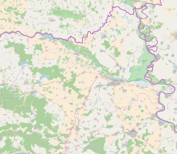
Josipovac (Hungarian: Józseffalva) is a suburb of Osijek in Croatia. It is connected by the D2 highway. According to the 2011 census, it has 4,101 inhabitants. Josipovac has two churches, two graveyards, an elementary school, an ambulance and a lot more.
South of Josipovac, there is a broadcasting centre with a free-standing lattice tower and a 110.3 metres tall guyed mast. Latter mast is insulated against ground and was before 1978 used for broadcasting on 1412 kHz and after 1978 for broadcasting on 594 kHz with 10 kW.
References[edit]
- ^ Register of spatial units of the State Geodetic Administration of the Republic of Croatia. Wikidata Q119585703.
- ^ "Population by Age and Sex, by Settlements" (xlsx). Census of Population, Households and Dwellings in 2021. Zagreb: Croatian Bureau of Statistics. 2022.


