Tiassalé: Difference between revisions
Content deleted Content added
m References after punctuation per WP:REFPUNCT, WP:CITEFOOT, WP:PAIC + other fixes |
Tom.Reding (talk | contribs) m +{{Authority control}} (2 IDs from Wikidata), WP:GenFixes on |
||
| Line 113: | Line 113: | ||
==Notes== |
==Notes== |
||
{{ |
{{Reflist}} |
||
{{Agnéby-Tiassa Region subdivisions}} |
{{Agnéby-Tiassa Region subdivisions}} |
||
{{Authority control}} |
|||
{{DEFAULTSORT:Tiassale}} |
{{DEFAULTSORT:Tiassale}} |
||
Revision as of 18:59, 23 May 2021
Tiassalé | |
|---|---|
Town, sub-prefecture, and commune | |
| Coordinates: 5°54′N 4°50′W / 5.900°N 4.833°W | |
| Country | |
| District | Lagunes |
| Region | Agnéby-Tiassa |
| Department | Tiassalé |
| Population (2014)[1] | |
| • Total | 58,248 |
| Time zone | UTC+0 (GMT) |
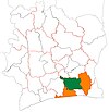
Tiassalé is a town in southern Ivory Coast. It is a sub-prefecture and the seat of Tiassalé Department in Agnéby-Tiassa Region, Lagunes District. Tiassalé is also a commune.
In 2014, the population of the sub-prefecture of Tiassalé was 58,248.[2]
Villages
The 19 villages of the sub-prefecture of Tiassalé and their population in 2014 are:[2]
- Dibykro (702)
- Komenan Kpekro (1 210)
- Mafia (650)
- Niamoué (2 645)
- Taboitien (723)
- Tiassalé (20 057)
- Ahua (1 491)
- Broukro (1 248)
- Eticoon (485)
- Gnankan-Gnankanso (1 470)
- Gnanzombly (1 310)
- Kouadio-Yaokro (5 969)
- M'brimbo (3 639)
- Nanan Yassouakro (732)
- N'zianouan (12 603)
- Sindressou (732)
- Sodefor Mopri (1 723)
- Tiassalékro (300)
- Tollakro (559)
Notes
- ^ "Côte d'Ivoire". geohive.com. Retrieved 7 December 2015.
- ^ a b "RGPH 2014, Répertoire des localités, Région Agnéby-Tiassa" (PDF). ins.ci. Retrieved 5 August 2019.


