East Victoria Park, Western Australia: Difference between revisions
Content deleted Content added
correct REIWA house price |
electorates and coords using AWB |
||
| Line 8: | Line 8: | ||
|area = 4 |
|area = 4 |
||
|postcode= 6101 |
|postcode= 6101 |
||
|pop = |
|pop = 8102 (2006 census)<ref name=abs>{{Census 2006 AUS|id=SSC51441|name=East Victoria Park (State Suburb)|quick=on|accessdate=2008-10-05}}</ref> |
||
|dist1 = 6 | location1 = [[Perth, Western Australia|Perth]] |
|dist1 = 6 | location1 = [[Perth, Western Australia|Perth]] |
||
|est = 1890s |
|est = 1890s |
||
|fedgov = [[Division of Swan|Swan]] |
|fedgov = [[Division of Swan|Swan]] |
||
|stategov= [[Electoral district of Victoria Park|Victoria Park]] and [[Electoral district of South Perth|South Perth]] |
|stategov= [[Electoral district of Victoria Park|Victoria Park]] and [[Electoral district of South Perth|South Perth]] |
||
|propval = $487,750 (Q2 2007)<ref name=reiwa>{{cite web|url=http://reiwa.com/res/res-iframe-suburbprofile-view.cfm?Stats_ID=57|title=Suburb Profile - East Victoria Park|author=Real Estate Institute of Western Australia|year=2006|accessdate=2007-09-17}}</ref> |
|||
|near-nw = [[Kensington, Western Australia|Kensington]] |
|near-nw = [[Kensington, Western Australia|Kensington]] |
||
|near-n = [[Victoria Park, Western Australia|Victoria Park]] |
|near-n = [[Victoria Park, Western Australia|Victoria Park]] |
||
| Line 22: | Line 21: | ||
|near-s = [[St James, Western Australia|St James]] |
|near-s = [[St James, Western Australia|St James]] |
||
|near-se = [[Welshpool, Western Australia|Welshpool]] |
|near-se = [[Welshpool, Western Australia|Welshpool]] |
||
}}{{coord|-31.988|115.904|type:city(8102)_region:AU-WA_scale:30000|format=dms|display=title}} |
|||
}} |
|||
'''East Victoria Park''' is a suburb of [[Perth, Western Australia]], located within the [[Town of Victoria Park]]. |
'''East Victoria Park''' is a suburb of [[Perth, Western Australia]], located within the [[Town of Victoria Park]]. |
||
==References== |
==References== |
||
{{reflist |
{{reflist}} |
||
{{coord|31|59|5|S|115|54|7|E|scale:20000|display=title}} |
|||
{{Town of Victoria Park suburbs}} |
{{Town of Victoria Park suburbs}} |
||
[[Category:Suburbs of Perth, Western Australia]] |
[[Category:Suburbs of Perth, Western Australia]] |
||
{{WesternAustralia-geo-stub}} |
{{WesternAustralia-geo-stub}} |
||
Revision as of 02:04, 13 October 2008
| East Victoria Park Perth, Western Australia | |||||||||||||||
|---|---|---|---|---|---|---|---|---|---|---|---|---|---|---|---|
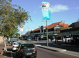
 The Albany Highway running through the centre of East Victoria Park | |||||||||||||||
| Population | 8102 (2006 census)[1] | ||||||||||||||
| • Density | Lua error: Unable to convert population "8102 (2006 census)'"`UNIQ--ref-00000000-QINU`"'" to a number. | ||||||||||||||
| Established | 1890s | ||||||||||||||
| Postcode(s) | 6101 | ||||||||||||||
| Area | 4 km2 (1.5 sq mi) | ||||||||||||||
| Location | 6 km (4 mi) from Perth | ||||||||||||||
| LGA(s) | Town of Victoria Park | ||||||||||||||
| State electorate(s) | Victoria Park and South Perth | ||||||||||||||
| Federal division(s) | Swan | ||||||||||||||
| |||||||||||||||
31°59′17″S 115°54′14″E / 31.988°S 115.904°E
East Victoria Park is a suburb of Perth, Western Australia, located within the Town of Victoria Park.
References
- ^ Australian Bureau of Statistics (25 October 2007). "East Victoria Park (State Suburb)". 2006 Census QuickStats. Retrieved 2008-10-05.
