Bamboesberg: Difference between revisions
Content deleted Content added
mNo edit summary |
mNo edit summary |
||
| Line 11: | Line 11: | ||
| map = South Africa | region = ZA |
| map = South Africa | region = ZA |
||
| map_caption = |
| map_caption = |
||
| label_position = |
| label_position = right |
||
| lat_d = 31 | lat_m = 36 | lat_s = 24 | lat_NS = S |
| lat_d = 31 | lat_m = 36 | lat_s = 24 | lat_NS = S |
||
| long_d= 26 | long_m= 07 | long_s= 12 | long_EW= E |
| long_d= 26 | long_m= 07 | long_s= 12 | long_EW= E |
||
Revision as of 16:36, 19 March 2012
| Bamboesberg | |
|---|---|
| Highest point | |
| Peak | Aasvoëlberg |
| Geography | |
| Region | ZA |
| Geology | |
| Orogeny | Kaapvaal craton |
| Age of rock | Neoarchean to early Paleoproterozoic |
| Type of rock | Bushveld igneous complex, sandstone |
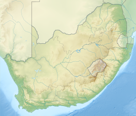
The Bamboesberg is a mountain range in the Eastern Cape, South Africa. This range was named for the bamboo Arundinaria tesselata growing in its ravines.
The Bamboesberg is a westward spur of the Stormberg Mountains and forms a watershed between the south-flowing Tarka and Black Kei Rivers. The Stormbergspruit is a tributary of the Orange River. Some of its peaks are over 6,000 feet (1,800 m) – Aasvoëlberg, 35 km west of Sterkstroom, rises to 7,245 feet (2,208 m).
The rocks are composed of sediments of the Stormberg Series of the Karoo System.[1][2]
See also
References
- ^ Standard Encyclopaedia of Southern Africa - vol 2
- ^ Preliminary overview of mountains in South Africa

