Selbsanft: Difference between revisions
Content deleted Content added
add |
added Category:Mountains of the canton of Glarus using HotCat |
||
| Line 31: | Line 31: | ||
[[Category:Alpine Three-thousanders]] |
[[Category:Alpine Three-thousanders]] |
||
[[Category:Mountains of Switzerland]] |
[[Category:Mountains of Switzerland]] |
||
[[Category:Mountains of the canton of Glarus]] |
|||
Revision as of 13:43, 28 July 2012
| Selbsanft | |
|---|---|
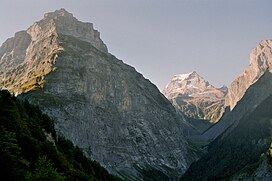
| Hinter Selbsanft | |
 Selbsanft (left) and Tödi (right) | |
| Highest point | |
| Elevation | 3,029 m (9,938 ft) |
| Prominence | 180 m (590 ft)[1] |
| Parent peak | Tödi |
| Geography | |
Lua error in Module:Location_map at line 526: Unable to find the specified location map definition: "Module:Location map/data/Switzerland relief" does not exist.
| |
| Location | Glarus, Switzerland |
| Region | CH |
| Parent range | Glarus Alps |
The Selbsanft is a mountain in the Glarus Alps, overlooking the valley of Linthal in the canton of Glarus. The Selbsanft is a large mountain consisting of several summits of which the highest is named Hinter Selbsanft. The massif is a buttress of the Bifertenstock and separates the valleys of the Sand (west) and Limmernsee (east). A small glacier lies east of the summit.
References
External links
