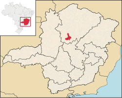
Várzea da Palma
| Várzea da Palma | |
|---|---|
| State | Minas Gerais |
| Geographical coordinates: | 17°35′52″S 44°43′51″W / 17.59778°S 44.73083°W |
| Area: | 2,195 km |
| Population: | 34,448 (IBGE 2007) |
| Elevation: | 519 m above sea level |
| Postal code (CEP): | 39260-000 |
| Became a city: | 1953 |
| Statistical Microregion: | Pirapora |
| Distance to Belo Horizonte: | 351 km. |
| Website: | not available |

Várzea da Palma is a municipality (município) in north-central Minas Gerais in Brazil. Its population in 2007 was 34,448 in a total area of 2,195 km².
See also
