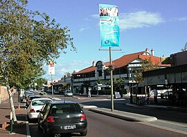
East Victoria Park, Western Australia
| East Victoria Park Perth, Western Australia | |||||||||||||||
|---|---|---|---|---|---|---|---|---|---|---|---|---|---|---|---|
 The Albany Highway running through the centre of East Victoria Park | |||||||||||||||
| Population | 8102 (2006 census)[1] | ||||||||||||||
| • Density | Lua error: Unable to convert population "8102 (2006 census)'"`UNIQ--ref-00000000-QINU`"'" to a number. | ||||||||||||||
| Established | 1890s | ||||||||||||||
| Postcode(s) | 6101 | ||||||||||||||
| Area | 4 km2 (1.5 sq mi) | ||||||||||||||
| Location | 6 km (4 mi) from Perth | ||||||||||||||
| LGA(s) | Town of Victoria Park | ||||||||||||||
| State electorate(s) | Victoria Park and South Perth | ||||||||||||||
| Federal division(s) | Swan | ||||||||||||||
| |||||||||||||||
31°59′17″S 115°54′14″E / 31.988°S 115.904°E
East Victoria Park is a suburb of Perth, Western Australia, located within the Town of Victoria Park.
References
- ^ Australian Bureau of Statistics (25 October 2007). "East Victoria Park (State Suburb)". 2006 Census QuickStats. Retrieved 2008-10-05.
