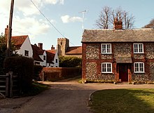
Great Sampford


Great Sampford is a village and civil parish on the B1053 road and the B1051 road in the Uttlesford District, in the English county of Essex. The village includes a primary school, two places of worship and a pub. It is located near the towns of Thaxted, Saffron Walden and Haverhill. It used to have a RAF base called RAF Great Sampford. The River Pant runs through the village.
It is connected to Hempstead by Howe Lane.
The village contains two churches - the Baptist Church, which also owns a small hall adjacent to the property, used by the community for the pre-school; and also a Church of England parish church, St Mary's.
Also in the village is a park and cricket club. The park includes a skatepark, donated by the National Lottery Fund, a small football pitch and a tennis court.
