Bhivpuri Road railway station
| Mumbai Suburban Railway station | |||||||||||
| General information | |||||||||||
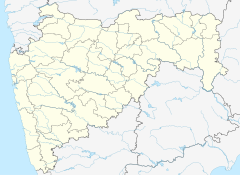
| Location | Bhivpuri, Raigad district18°58'12.0"N 73°19'53.0"E | ||||||||||
| Coordinates | 18°58′12″N 73°19′53″E / 18.97000°N 73.33139°E | ||||||||||
| Owned by | Ministry of Railways, Indian Railways | ||||||||||
| Line(s) | Central Line | ||||||||||
| Other information | |||||||||||
| Fare zone | Central Railways | ||||||||||
| History | |||||||||||
| Electrified | Yes | ||||||||||
| Services | |||||||||||
| |||||||||||
| |||||||||||
| |||||||||||
Bhivpuri Road is a railway station on the Central line of the Mumbai Suburban Railway network. It is on the Karjat route. Neral is the previous stop and Karjat is the next stop. Bhivpuri has state highway which is connecting to NH4, Panvel & Navi Mumbai and the other side connects to Badlapur & Thane District. In Bhivpuri there is one new multi facilities hospital (Raigad Hospital & Research Center) located which covers the area from Shelu, Neral to Karjat.
Bhivpuri is now developing by the builders after Badlapur & Neral Bhivpuri is the next money making land for the developers.
Bhivpuri has a waterfall where people comes from the nearest cities such as Mumbai, Navi Mumbai, Pune & Thane. Most of the visitors are college students who visits for a day picnic and enjoy in the waterfall.


