Ahrarne: Difference between revisions
Content deleted Content added
added Category:Rural settlements in Crimea using HotCat |
|||
| (4 intermediate revisions by 3 users not shown) | |||
| Line 1: | Line 1: | ||
{{Infobox settlement <!--See Template:Infobox Settlement--> |
{{Infobox settlement <!--See Template:Infobox Settlement--> |
||
|official_name= Ahrarne |
| official_name = Ahrarne |
||
|native_name= |
| native_name = Аграрне |
||
|image_skyline=Ahrarne_KT_Sport_Arena1.jpg |
| image_skyline = Ahrarne_KT_Sport_Arena1.jpg |
||
|pushpin_map = Crimea |
| pushpin_map = Crimea |
||
|settlement_type = |
| settlement_type = [[Urban-type settlement]] |
||
|subdivision_type = [[Countries of the world|Country]] |
| subdivision_type = [[Countries of the world|Country]] |
||
|subdivision_name = Disputed: {{Unordered list|{{UKR}} ([[United Nations General Assembly Resolution 68/262|de jure]])|{{RUS}} ([[Annexation of Crimea by the Russian Federation|de facto]])|}} |
| subdivision_name = Disputed: {{Unordered list|{{UKR}} ([[United Nations General Assembly Resolution 68/262|de jure]])|{{RUS}} ([[Annexation of Crimea by the Russian Federation|de facto]])|}} |
||
| subdivision_type1 = Region |
| subdivision_type1 = Region |
||
| subdivision_name1 = {{flagicon|Crimea}} Crimea{{smallsup|1}} |
| subdivision_name1 = {{flagicon|Crimea}} Crimea{{smallsup|1}} |
||
|subdivision_type2 = [[Municipality]] |
| subdivision_type2 = [[Municipality]] |
||
|subdivision_name2 = [[Simferopol Municipality|Simferopol]] |
| subdivision_name2 = [[Simferopol Municipality|Simferopol]] |
||
|timezone=[[Moscow Time|MSK]] |
| timezone = [[Moscow Time|MSK]] |
||
|utc_offset=+4 |
| utc_offset = +4 |
||
|timezone_DST= |
| timezone_DST = |
||
|utc_offset_DST= |
| utc_offset_DST = |
||
|coordinates={{coord|45|00|53|N|34|03|05|E|type:adm3rd_region:UA|display=inline,title}} |
| coordinates = {{coord|45|00|53|N|34|03|05|E|type:adm3rd_region:UA|display=inline,title}} |
||
|area_total_km2 = |
| area_total_km2 = |
||
|population_total= 3,754 |
| population_total = 3,754 |
||
|population_footnotes= |
| population_footnotes = |
||
|population_density_km2 = |
| population_density_km2 = |
||
|leader_title= |
| leader_title = |
||
|leader_name= |
| leader_name = |
||
|blank1_info = |
| blank1_info = |
||
|image_map= |
| image_map = |
||
|map_caption = |
| map_caption = |
||
|image_shield= |
| image_shield = |
||
|image_flag= |
| image_flag = |
||
| footnotes |
| footnotes = {{smallsup|1}} [[Autonomous Republic of Crimea]] ([[United Nations General Assembly Resolution 68/262|de jure]]) or [[Republic of Crimea]] ([[Annexation of Crimea by the Russian Federation|de facto]]), depending on jurisdiction. |
||
|website = |
| website = |
||
}} |
}} |
||
'''Ahrarne''' ({{lang-ru|Аграрное}}; {{lang-uk|Аграрне}}; {{lang-crh|Agrarne}}) is an [[urban-type settlement]] located in [[Simferopol Municipality]], Crimea.<ref>{{cite web|url=http://gska2.rada.gov.ua/pls/z7502/A005?rdat1=15.05.2008&rf7571=1186|title=City of Simferopol Autonomous Republic of Crimea|access-date=2008-05-14|work=[[Verkhovna Rada|Verkhovna Rada of Ukraine]]|language=uk|url-status=dead|archive-url=https://web.archive.org/web/20090220104841/http://gska2.rada.gov.ua/pls/z7502/A005?rdat1=15.05.2008&rf7571=1186|archive-date=20 February 2009|df=dmy-all}}</ref> Population: {{Crimea-census2014|3,754|punct=.}} |
'''Ahrarne''' ({{lang-ru|Аграрное}}; {{lang-uk|Аграрне}}; {{lang-crh|Agrarne}}) is an [[urban-type settlement]] located in [[Simferopol Municipality]], Crimea.<ref>{{cite web|url=http://gska2.rada.gov.ua/pls/z7502/A005?rdat1=15.05.2008&rf7571=1186|title=City of Simferopol Autonomous Republic of Crimea|access-date=2008-05-14|work=[[Verkhovna Rada|Verkhovna Rada of Ukraine]]|language=uk|url-status=dead|archive-url=https://web.archive.org/web/20090220104841/http://gska2.rada.gov.ua/pls/z7502/A005?rdat1=15.05.2008&rf7571=1186|archive-date=20 February 2009|df=dmy-all}}</ref> Population: {{Crimea-census2014|3,754|punct=.}} |
||
| Line 36: | Line 37: | ||
==References== |
==References== |
||
{{ |
{{Reflist}} |
||
{{Simferopol municipality}} |
{{Simferopol municipality}} |
||
{{Authority control}} |
|||
[[Category:Urban-type settlements in Crimea]] |
[[Category:Urban-type settlements in Crimea]] |
||
[[Category:Simferopol Municipality]] |
[[Category:Simferopol Municipality]] |
||
[[Category:Rural settlements in Crimea]] |
|||
Latest revision as of 11:02, 6 April 2024
Ahrarne
Аграрне | |
|---|---|
 | |
| Coordinates: 45°00′53″N 34°03′05″E / 45.01472°N 34.05139°E | |
| Country | Disputed: |
| Region | |
| Municipality | Simferopol |
| Population | |
| • Total | 3,754 |
| Time zone | UTC+4 (MSK) |
| 1 Autonomous Republic of Crimea (de jure) or Republic of Crimea (de facto), depending on jurisdiction. | |
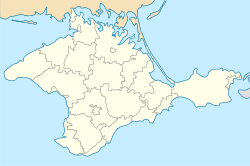
Ahrarne (Russian: Аграрное; Ukrainian: Аграрне; Crimean Tatar: Agrarne) is an urban-type settlement located in Simferopol Municipality, Crimea.[1] Population: 3,754 (2014 Census).[2]
See also[edit]
References[edit]
- ^ "City of Simferopol Autonomous Republic of Crimea". Verkhovna Rada of Ukraine (in Ukrainian). Archived from the original on 20 February 2009. Retrieved 14 May 2008.
- ^ Russian Federal State Statistics Service (2014). "Таблица 1.3. Численность населения Крымского федерального округа, городских округов, муниципальных районов, городских и сельских поселений" [Table 1.3. Population of Crimean Federal District, Its Urban Okrugs, Municipal Districts, Urban and Rural Settlements]. Федеральное статистическое наблюдение «Перепись населения в Крымском федеральном округе». ("Population Census in Crimean Federal District" Federal Statistical Examination) (in Russian). Federal State Statistics Service. Retrieved January 4, 2016.


