
Beeson Covered Bridge: Difference between revisions
Expanding History section |
m Removing from Category:Road bridges on the National Register of Historic Places in Indiana in subcat using Cat-a-lot |
||
| (36 intermediate revisions by 13 users not shown) | |||
| Line 1: | Line 1: | ||
{{Infobox bridge |
|||
{{Geobox|Bridge |
|||
| name = |
|||
<!-- *** Heading *** --> |
|||
| |
| image = Beeson Covered Bridge.jpg |
||
| caption = Beeson Covered Bridge in [[Billie Creek Village]] |
|||
| native_name = |
|||
| coordinates = {{coord|39|45|47.68|N|87|12|23.18|W|type:landmark_region:US|display=inline,title}} |
|||
| category = [[National Register of Historic Places]] |
|||
| official_name = Beeson Bridge |
|||
<!-- *** Image *** --> |
|||
| other_name = |
|||
| image = Beeson Covered Bridge.jpg |
|||
| named_for = The Beeson Family<ref name="beeson">{{cite web |url=http://ingenweb.org/inparke/Maps/1905ParkeCountyAtlasWashingtonTownship.jpg |title=Parke County 1908 |publisher= Geo A. Ogle |date=1908 |access-date=1 July 2021}}</ref> |
|||
| image_size = 300 |
|||
| carries = Pedestrian traffic (Not open to vehicular traffic) |
|||
| image_caption = Beeson Covered Bridge in [[Billie Creek Village]] |
|||
| crosses = <nowiki>William's Creek</nowiki> |
|||
<!-- *** Names **** --> |
|||
| locale = [[Rockville, Indiana|Rockville]], <br /> [[Adams Township, Parke County, Indiana]] |
|||
| official_name = Beeson Covered Bridge |
|||
| |
| maint = |
||
| id = 14-61-24<ref>{{cite web |url=http://www.indianacrossings.org/bridgeLinks/14-61-24.html |title= The Beeson Bridge |publisher= Indiana Covered Bridge Society |access-date= 1 July 2021}}</ref> |
|||
| etymology_type = Named for |
|||
| id_type = [[World Guide to Covered Bridges|WGCB #]] |
|||
| etymology = The Beeson Family<ref name="beeson">http://www.indianagenweb.com/inparke/Maps/1905ParkeCountyAtlasWashingtonTownship.jpg</ref> |
|||
| design = [[Burr Truss|Burr arch truss bridge]] |
|||
| nickname = |
|||
| material = Concrete (foundations) |
|||
<!-- *** Symbols *** --> |
|||
| |
| material1 = Wood |
||
| material2 = <!-- pier material --> |
|||
| flag_size = |
|||
| length = {{cvt|55|ft|1}} |
|||
| symbol = |
|||
| width = {{cvt|16|ft|1}} |
|||
| symbol_size = |
|||
| clearance = {{cvt|12.5|ft|1}} |
|||
<!-- *** Country *** --> |
|||
| number_spans = 1 |
|||
| country = United States |
|||
| |
| piers_in_water = |
||
| |
| load = |
||
| |
| cost = |
||
| extra = |
|||
| region_type = County |
|||
{{Infobox NRHP |
|||
| region = [[Parke County, Indiana|Parke]] |
|||
| embed=yes |
|||
| municipality_type = [[Indiana_townships| Township]] |
|||
| name = Beeson Covered Bridge (#38) |
|||
| municipality = [[Adams Township, Parke County, Indiana|Adams]] |
|||
| nrhp_type = nrhp |
|||
<!-- *** Family *** --> |
|||
| nrhp_type2 = cp |
|||
| parent_type = Road |
|||
| partof = Parke County Covered Bridges TR |
|||
| road = Pedestrian |
|||
| partof_refnum = 64000193 |
|||
| road_note = (Not open to commercial traffic.) |
|||
| image = |
|||
| city = [[Billie Creek Village]] |
|||
| image_size = |
|||
| landmark = |
|||
| alt = |
|||
| building = |
|||
| caption = |
|||
| river = William's Creek |
|||
| district_map = |
|||
| river_type = Crosses |
|||
| locmapin = USA Indiana Parke County#Indiana#USA |
|||
<!-- *** Locations *** --> |
|||
| map_label = Location of Beeson Covered Bridge |
|||
| location = |
|||
| label_position = |
|||
| elevation_imperial = |
|||
| label_size = |
|||
| lat_d = 39 |
|||
| label_background = |
|||
| lat_m = 45 |
|||
| map_width = |
|||
| lat_s = 47.68 |
|||
| map_alt = |
|||
| lat_NS = N |
|||
| map_caption = |
|||
| long_d = 87 |
|||
| coordinates = |
|||
| long_m = 12 |
|||
| location = |
|||
| long_s = 23.18 |
|||
| area = |
|||
| long_EW = W |
|||
| built = {{start date|1906}} |
|||
| coordinates_note = |
|||
| builder = Frankfort Construction Company |
|||
| accessdate = |
|||
| demolished = |
|||
<!-- *** Dimensions *** --> |
|||
| restored = |
|||
| length_imperial = 55 |
|||
| restored_by = |
|||
| length_orientation = |
|||
| architect = |
|||
| length_note = |
|||
| engineer = |
|||
| width_imperial = 16 |
|||
| customarchitect_title = |
|||
| width_orientation = |
|||
| customarchitect = |
|||
| width_note = |
|||
| architecture = |
|||
| url = <ref>http://www.coveredbridges.com/index.php/poi_detail?poiID=26</ref> |
|||
| visitation_num = |
|||
| title = Big Rocky Fork Covered Bridge (#6) |
|||
| visitation_year = |
|||
| publisher = Parke County Convention & Visitors Commission |
|||
| visitation_ref = |
|||
| format = |
|||
| mpsub = |
|||
| accessdate = 8 January 2015 |
|||
| sigdate1_label = |
|||
| width_type = |
|||
| sigdate1 = |
|||
| number = |
|||
| sigdate2_label = |
|||
| number_type = |
|||
| sigdate2 = |
|||
| height_imperial = 12.5 |
|||
| sigdate3_label = |
|||
| height_type = Clearance |
|||
| sigdate3 = |
|||
| height_note = |
|||
| added = December 22, 1978 |
|||
| depth_imperial = |
|||
| increase = |
|||
| volume_imperial = |
|||
| increase2 = |
|||
| area_imperial = |
|||
| increase3 = |
|||
<!-- *** Features *** --> |
|||
| decrease = |
|||
| style_type = Design |
|||
| decrease2 = |
|||
| style = [[Burr Truss|Burr arch truss bridge]] |
|||
| decrease3 = |
|||
| material = Wood |
|||
| delisted = |
|||
| author_type = Builder |
|||
| designated_nrhp_type = |
|||
| author = Frankfort Construction Company |
|||
| designated_nrhp_type2 = |
|||
<!-- *** History & management *** --> |
|||
| designated_nrhp_type3 = |
|||
| established_type = Built |
|||
| designated_nrhp_type4 = |
|||
| established = 1906 |
|||
| designated_other1_date = |
|||
| established_note = |
|||
| designated_other2_date = |
|||
| established1_type = |
|||
| designated_other3_date = |
|||
| established1 = |
|||
| delisted_nrhp_type = |
|||
| management_type = |
|||
| delisted_nrhp_type2 = |
|||
| management = |
|||
| delisted_nrhp_type3 = |
|||
<!-- *** Codes *** --> |
|||
| delisted_nrhp_type4 = |
|||
| code_type = [[National Bridge Inventory|NBI]] Number |
|||
| delisted_other1_date = |
|||
| code_label = National Bridge Inventory identification number |
|||
| delisted_other2_date = |
|||
| code = |
|||
| delisted_other3_date = |
|||
| code_note = |
|||
| refnum = 78003447 <ref name="nris">{{NRISref|2007a|dateform=mdy|accessdate=August 30, 2018|refnum=78003447|name=Beeson Covered Bridge (#38)}}</ref> |
|||
| code1_type = [[World Guide to Covered Bridges|WGCB]] Number |
|||
| website = {{URL|http://www.coveredbridges.com/poi/beeson-covered-bridge-38|Beeson Bridge}} |
|||
| code1_label = World Guide to Covered Bridges Number |
|||
| increase_refnum = |
|||
| code1 = #14-61-24<ref>http://www.indianacrossings.org/bridgeLinks/14-61-24.html</ref> |
|||
| increase2_refnum = |
|||
| code1_note = |
|||
| increase3_refnum = |
|||
<!-- *** Access *** --> |
|||
| decrease_refnum = |
|||
| public = |
|||
| decrease2_refnum = |
|||
| visitation = |
|||
| decrease3_refnum = |
|||
| visitation_date = |
|||
| designated_other1 = |
|||
| access = |
|||
| designated_other1_num_position = both |
|||
| access_type = |
|||
| designated_other2_number = |
|||
<!-- *** UNESCO etc. *** --> |
|||
| designated_other2_num_position = both |
|||
| whs_name = |
|||
| designated_other3_number = |
|||
| whs_year = |
|||
| designated_other3_num_position = both |
|||
| whs_number = |
|||
| nocat = |
|||
| whs_region = |
|||
| whs_criteria = |
|||
| iucn_category = |
|||
<!-- *** Free fields *** --> |
|||
| free_type = Load |
|||
| free = |
|||
| free1_type = Added to [[National Register of Historic Places|NRHP]] |
|||
| free1 = Dec 22, 1978 |
|||
| free2_type = NRHP Ref# |
|||
| free2 = 78003447 <ref name="nris">{{NRISref|2007a}}</ref> |
|||
| free3_type = [[National Register of Historic Places#Multiple Property Submission|MPS]] |
|||
| free3 = Parke County Covered Bridges TR |
|||
<!-- *** Map section *** --> |
|||
| map = Indiana Locator Map.PNG |
|||
| map_size = 300 |
|||
| map_caption = Location of the Beeson Covered Bridge in Indiana |
|||
| map_locator = Indiana |
|||
| map1 = Map of USA IN.svg |
|||
| map1_size = 300 |
|||
| map1_caption = Location of Indiana in the United States |
|||
<!-- *** Website *** --> |
|||
| commons = |
|||
| statistics = |
|||
| website = |
|||
<!-- *** Footnotes *** --> |
|||
| footnotes = |
|||
}} |
}} |
||
}} |
|||
The '''Beeson Covered Bridge''' originally crossed Roaring Creek, {{convert|1|mi|spell=in}} northwest of [[Marshall, Indiana]], on County Road 216, in [[Washington Township, Parke County, Indiana|Washington Township, Parke County]]. The bridge was moved to its current location in [[Billie Creek Village]] in December 1979. |
|||
==Construction== |
|||
The |
The Beeson Covered Bridge is a single span [[Burr Arch]] [[covered bridge]] structure that was built by the Frankfort Construction Company in 1906. The bridge is {{convert|55|ft}} long, {{convert|16|ft}} wide, with a clearance of {{convert|12|ft|6|in}}. The bridge had concrete foundations when it was built and was placed on concrete foundations when it was moved, but after a flood in 1989, the bridge was reset on [[creosote]]d wood.{{sfn|Beeson Bridge}} |
||
==History== |
==History== |
||
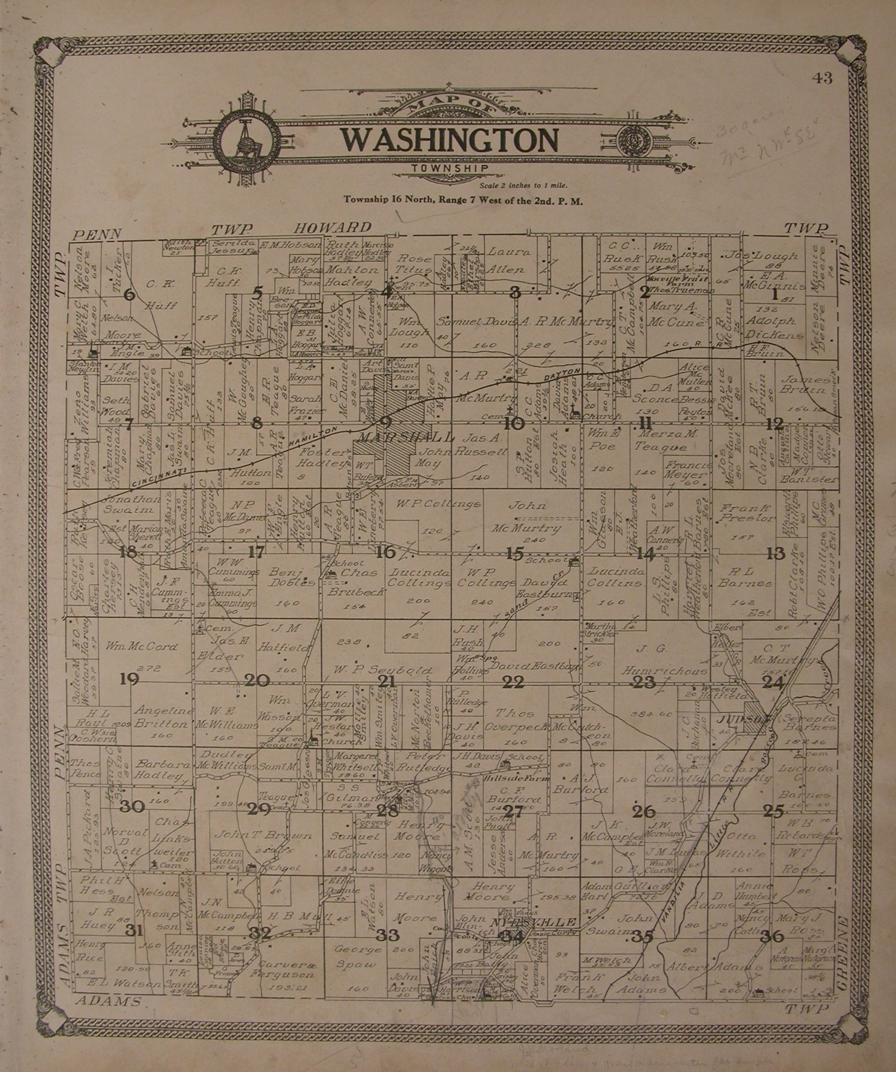
Many of the bridges in Parke County are named after a nearby city or the body of water they cross but due to another bridge across the county being named the [[Marshall Covered Bridge]] it was named after the nearby Beeson family. William H. Beeson, who was born in 1879, owned 53 acres of land near the bridge. It crossed Roaring Creek on C.R. 216, which is now C.R. 200N. Using the map that Parke County sent when filing for NRHP status, the bridge was originally located at: {{coord|39.859715|N|87.197165|W|type:landmark_region:US|display=inline}}.{{sfn|Beeson Bridge}}<ref name="SHAARD">{{cite web| url = https://secure.in.gov/apps/dnr/shaard/welcome.html| title = Indiana State Historic Architectural and Archaeological Research Database (SHAARD) | publisher = Department of Natural Resources, Division of Historic Preservation and Archaeology | format = Searchable database| accessdate = 2016-06-01}} ''Note:'' This includes {{cite web| url =https://secure.in.gov/apps/dnr/shaard/r/1ce09/N/Park_CO_Covered_Bridge_HD_Nom.pdf| title = National Register of Historic Places Inventory Nomination Form: Parke County Covered Bridge Historic District| accessdate = 2016-06-01| author=Charles Felkner| date=December 1977}}, [https://secure.in.gov/apps/dnr/shaard/r/1ce08/N/Parke_CO_Covered_Bridge_HD_2.pdf Site map], and Accompanying photographs.</ref> |
|||
The bridge was closed in 1969 because the abutments were declared unsafe. In March |
The bridge was closed in 1969, because the abutments were declared unsafe. In March 1979, a nearby concrete bridge collapsed. This, along with the earlier closing of the Beeson Covered Bridge, caused a severe problem with access to Marshall, and nearby [[Turkey Run High School]] and [[Turkey Run State Park]]. The Roaring Creek Citizens Association (RCCA) was formed to address this problem.{{sfn|Beeson Bridge}} |
||
At 11:47 pm on August 9, 1979, just shortly after the RCCA had a meeting at Turkey Run High School, a fire was reported at the Beeson Bridge. Firefighters from Marshall fought from the south end while firefighters from [[Bloomingdale, Indiana|Bloomingdale]] fought from the north end of the bridge. The fire was found to be a clear case of arson, fuel oil odors were still strong the following morning. The Parke County Sheriff's Department, [[Indiana State Police|Indiana State Police Department]] and the Indiana State Fire Marshal all were part of the investigation, owing that it is a registered national landmark the [[FBI]] probably had jurisdiction too but declined to join. Due to the fire happening so close to the RCCA meeting the RCCA threatened legal action with anyone accusing them of being connected with the fire. |
At 11:47 pm on August 9, 1979, just shortly after the RCCA had a meeting at Turkey Run High School, a fire was reported at the Beeson Bridge. Firefighters from Marshall, fought from the south end while firefighters from [[Bloomingdale, Indiana|Bloomingdale]], fought from the north end of the bridge. The fire was found to be a clear case of arson, fuel oil odors were still strong the following morning. The Parke County Sheriff's Department, [[Indiana State Police|Indiana State Police Department]] and the Indiana State Fire Marshal all were part of the investigation, owing that it is a registered national landmark the [[FBI]] probably had jurisdiction too but declined to join. Due to the fire happening so close to the RCCA meeting the RCCA threatened legal action with anyone accusing them of being connected with the fire.{{sfn|Beeson Bridge}} |
||
Less than a week later another fire was started just after midnight on August 15, 1979. A nearby neighbor |
Less than a week later another fire was started just after midnight on August 15, 1979. A nearby neighbor saw someone at the bridge and heard a car turn around in his driveway. Shortly after that he saw flames at the bridge and contacted the Fire Department. The Marshall Fire Department found the bridge floor covered in flames but was quickly able to extinguish them.{{sfn|Beeson Bridge}} |
||
On December 4, 1979 the Buchta Trucking Company began moving the |
On December 4, 1979, the Buchta Trucking Company began moving the bridge to its current location over Williams Creek, in [[Billie Creek Village]], [[Rockville, Indiana|Rockville]]. They first removed the roof and sides before transporting the rest of the bridge.{{sfn|Beeson Bridge}} |
||
|title=Beeson Covered Bridge |
|||
|publisher=Parke County Incorporated / Parke County Convention and Visitors Commission |
|||
|accessdate=2015-01-17}}</ref> |
|||
==Gallery== |
|||
<gallery> |
|||
image:Beeson Covered Bridge (Billie Creek Village).JPG|Beeson Covered Bridge at Billie Creek Village |
|||
</gallery> |
|||
==See also== |
==See also== |
||
| Line 161: | Line 139: | ||
==References== |
==References== |
||
{{reflist}} |
{{reflist}} |
||
==Bibliography== |
|||
* {{cite web |
|||
|url= https://www.coveredbridges.com/covered-bridge-gallery/beeson-covered-bridge-38 |
|||
|title= Beeson Covered Bridge (#38) |
|||
|publisher= Parke County Incorporated / Parke County Convention and Visitors Commission |
|||
|accessdate= 21 November 2019 |
|||
|ref= {{sfnRef|Beeson Bridge}} |
|||
}} |
|||
==External links== |
|||
{{commons category|Beeson Covered Bridge}} |
|||
*[http://www.coveredbridges.com/parke-county-covered-bridge-festival Parke County Covered Bridge Festival] |
|||
*{{official website|https://www.coveredbridges.com/covered-bridge-gallery/beeson-covered-bridge-38}} |
|||
{{Portal bar|Indiana|Transport|Engineering|National Register of Historic Places}} |
|||
{{Parkecountycoveredbridges}} |
{{Parkecountycoveredbridges}} |
||
{{National Register of Historic Places in Indiana}} |
|||
{{NRHP bridges}} |
|||
[[Category:Covered bridges |
[[Category:Covered bridges on the National Register of Historic Places in Parke County, Indiana]] |
||
[[Category:Bridges completed in 1906]] |
[[Category:Bridges completed in 1906]] |
||
[[Category:Wooden bridges in Indiana]] |
[[Category:Wooden bridges in Indiana]] |
||
[[Category: |
[[Category:Relocated buildings and structures in Indiana]] |
||
[[Category: |
[[Category:Burr Truss bridges in the United States]] |
||
[[Category:Covered bridges in the United States destroyed by arson]] |
|||
[[Category:1906 establishments in Indiana]] |
|||
Latest revision as of 17:55, 24 September 2022
Beeson Covered Bridge | |
|---|---|
 Beeson Covered Bridge in Billie Creek Village | |
| Coordinates | 39°45′47.68″N 87°12′23.18″W / 39.7632444°N 87.2064389°W |
| Carries | Pedestrian traffic (Not open to vehicular traffic) |
| Crosses | William's Creek |
| Locale | Rockville, Adams Township, Parke County, Indiana |
| Official name | Beeson Bridge |
| Named for | The Beeson Family[1] |
| WGCB # | 14-61-24[2] |
| Characteristics | |
| Design | Burr arch truss bridge |
| Material | Concrete (foundations) |
| Trough construction | Wood |
| Total length | 55 ft (16.8 m) |
| Width | 16 ft (4.9 m) |
| No. of spans | 1 |
| Clearance above | 12.5 ft (3.8 m) |
Beeson Covered Bridge (#38) | |
 Location of Beeson Covered Bridge  Location of Beeson Covered Bridge  Location of Beeson Covered Bridge | |
| Built | 1906 |
| Built by | Frankfort Construction Company |
| Website | Beeson Bridge |
| Part of | Parke County Covered Bridges TR (ID64000193) |
| NRHP reference No. | 78003447 [3] |
| Added to NRHP | December 22, 1978 |
| Location | |
 | |
The Beeson Covered Bridge originally crossed Roaring Creek, one mile (1.6 km) northwest of Marshall, Indiana, on County Road 216, in Washington Township, Parke County. The bridge was moved to its current location in Billie Creek Village in December 1979.
Construction[edit]
The Beeson Covered Bridge is a single span Burr Arch covered bridge structure that was built by the Frankfort Construction Company in 1906. The bridge is 55 feet (17 m) long, 16 feet (4.9 m) wide, with a clearance of 12 feet 6 inches (3.81 m). The bridge had concrete foundations when it was built and was placed on concrete foundations when it was moved, but after a flood in 1989, the bridge was reset on creosoted wood.[4]
History[edit]
Many of the bridges in Parke County are named after a nearby city or the body of water they cross but due to another bridge across the county being named the Marshall Covered Bridge it was named after the nearby Beeson family. William H. Beeson, who was born in 1879, owned 53 acres of land near the bridge. It crossed Roaring Creek on C.R. 216, which is now C.R. 200N. Using the map that Parke County sent when filing for NRHP status, the bridge was originally located at: 39°51′35″N 87°11′50″W / 39.859715°N 87.197165°W.[4][5]
The bridge was closed in 1969, because the abutments were declared unsafe. In March 1979, a nearby concrete bridge collapsed. This, along with the earlier closing of the Beeson Covered Bridge, caused a severe problem with access to Marshall, and nearby Turkey Run High School and Turkey Run State Park. The Roaring Creek Citizens Association (RCCA) was formed to address this problem.[4]
At 11:47 pm on August 9, 1979, just shortly after the RCCA had a meeting at Turkey Run High School, a fire was reported at the Beeson Bridge. Firefighters from Marshall, fought from the south end while firefighters from Bloomingdale, fought from the north end of the bridge. The fire was found to be a clear case of arson, fuel oil odors were still strong the following morning. The Parke County Sheriff's Department, Indiana State Police Department and the Indiana State Fire Marshal all were part of the investigation, owing that it is a registered national landmark the FBI probably had jurisdiction too but declined to join. Due to the fire happening so close to the RCCA meeting the RCCA threatened legal action with anyone accusing them of being connected with the fire.[4]
Less than a week later another fire was started just after midnight on August 15, 1979. A nearby neighbor saw someone at the bridge and heard a car turn around in his driveway. Shortly after that he saw flames at the bridge and contacted the Fire Department. The Marshall Fire Department found the bridge floor covered in flames but was quickly able to extinguish them.[4]
On December 4, 1979, the Buchta Trucking Company began moving the bridge to its current location over Williams Creek, in Billie Creek Village, Rockville. They first removed the roof and sides before transporting the rest of the bridge.[4]
Gallery[edit]
-
 Beeson Covered Bridge at Billie Creek Village
.JPG)
See also[edit]
- Billie Creek Village
- Arch in the Town of Marshall
- Lusk Home and Mill Site, within Turkey Run State Park
- Richard Lieber Log Cabin, within Turkey Run State Park
- Parke County Covered Bridges
- List of Registered Historic Places in Indiana
- Parke County Covered Bridge Festival
References[edit]
- ^ "Parke County 1908". Geo A. Ogle. 1908. Retrieved 1 July 2021.
- ^ "The Beeson Bridge". Indiana Covered Bridge Society. Retrieved 1 July 2021.
- ^ "National Register Information System – Beeson Covered Bridge (#38) (#78003447)". National Register of Historic Places. National Park Service. January 23, 2007. Retrieved August 30, 2018.
- ^ a b c d e f Beeson Bridge.
- ^ "Indiana State Historic Architectural and Archaeological Research Database (SHAARD)" (Searchable database). Department of Natural Resources, Division of Historic Preservation and Archaeology. Retrieved 2016-06-01. Note: This includes Charles Felkner (December 1977). "National Register of Historic Places Inventory Nomination Form: Parke County Covered Bridge Historic District" (PDF). Retrieved 2016-06-01., Site map, and Accompanying photographs.
Bibliography[edit]
- "Beeson Covered Bridge (#38)". Parke County Incorporated / Parke County Convention and Visitors Commission. Retrieved 21 November 2019.
External links[edit]


- Historic district contributing properties in USA Indiana Parke County
- Covered bridges on the National Register of Historic Places in Parke County, Indiana
- Bridges completed in 1906
- Wooden bridges in Indiana
- Relocated buildings and structures in Indiana
- Burr Truss bridges in the United States
- Covered bridges in the United States destroyed by arson
- 1906 establishments in Indiana