
Brzuska
Brzuska | |
|---|---|
Village | |
 Brzuska | |
| Coordinates: 49°46′N 22°29′E / 49.767°N 22.483°E | |
| Country | |
| Voivodeship | Subcarpathian |
| County | Przemyśl |
| Gmina | Bircza |
Brzuska [ˈbʐuska] is a village in the administrative district of Gmina Bircza, within Przemyśl County, Subcarpathian Voivodeship, in south-eastern Poland. It lies approximately 9 kilometres (6 mi) north of Bircza, 21 km (13 mi) west of Przemyśl, and 46 km (29 mi) south-east of the regional capital Rzeszów.[1]
See also[edit]
References[edit]
External links[edit]
-
 View of Brzuska
 -
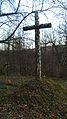 Marker of the Ukrainian Cemetery
 -
 Grave of Rev.Oleksa Bilyk
 -
 Unmarked grave in the Ukrainian Cemetery


| Town and seat |  | |
|---|---|---|
| Villages | ||
This Przemyśl County location article is a stub. You can help Wikipedia by expanding it. |