
Husevågøy
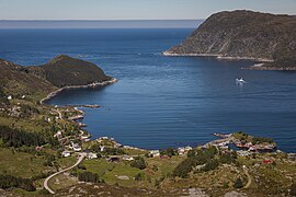
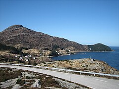
 View from Mt. Blåfjellet towards the island of Vågsøy | |
 | |
 Husevågøy Location of the island  Husevågøy Husevågøy (Norway) | |
| Geography | |
|---|---|
| Location | Vestland, Norway |
| Coordinates | 61°54′35″N 5°02′48″E / 61.9096°N 5.0468°E |
| Area | 9.2 km2 (3.6 sq mi) |
| Length | 6.4 km (3.98 mi) |
| Width | 2.6 km (1.62 mi) |
| Highest elevation | 330 m (1080 ft) |
| Highest point | Krabbestigheida |
| Administration | |
Norway | |
| County | Vestland |
| Municipality | Kinn Municipality |
| Demographics | |
| Population | 50 (2018) |
Husevågøy is an island in Kinn Municipality in Vestland county, Norway. The 9.1-square-kilometre (3.5 sq mi) island is mountainous with few trees. The island lies in the mouth of the Nordfjorden, between the islands of Vågsøy and Bremangerlandet. In 2018, there were about 50 residents on the island. There is a car ferry that runs from the town of Måløy on Vågsøy island (to the north) to Husevågøy and then on to Oldeide on Bremangerlandet (to the south).[1]
Historically, the island was part of the old municipality of Davik. In 1964, Husevågøy and several small surrounding islands were transferred to Vågsøy Municipality. Then in 2020, the area became part of Kinn Municipality.
Media gallery[edit]
-
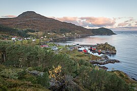
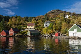
 View of the small village of Husevåg
 -
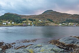
 Husevåg
 -
 Husevåg
 -
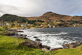
 Husevåg and Mt. Rønelden (321m)
 -
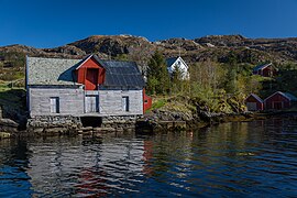
 The harbour in Husevåg
 -
 The harbour in Husevåg
 -
 The harbour in Husevåg
 -
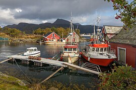 Fishing boats in Husevåg
 -
 Houses in Husevåg
 -
 Husevåg
 -
 Husevåg
 -
 The old school in Husevåg
 -
 Hovdeneset
 -
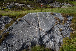 Petroglyphs at Husevågøy
 -
 View of the small village of Husevåg on the northern island
 -
 Panorama of the island


See also[edit]
References[edit]
- ^ Askheim, Svein, ed. (2019-10-03). "Husevågøy i Nordfjord". Store norske leksikon (in Norwegian). Kunnskapsforlaget. Retrieved 2019-10-12.
This article about an island in Vestland is a stub. You can help Wikipedia by expanding it. |