
Hazelbrook, New South Wales
| Hazelbrook Sydney, New South Wales | |||||||||||||||
|---|---|---|---|---|---|---|---|---|---|---|---|---|---|---|---|
| Population | 4,447 (2006) | ||||||||||||||
| Postcode(s) | 2779 | ||||||||||||||
| LGA(s) | City of Blue Mountains | ||||||||||||||
| Federal division(s) | Macquarie | ||||||||||||||
| |||||||||||||||
Hazelbrook is a village in New South Wales, Australia (Elevation: 674 metres, Pop.: 4409[1] (2001)) It is located 93 kilometres west of Sydney and approximately 17 kilometres east of Katoomba in the Blue Mountains on the Great Western Highway.
History and Description
The town was named after Hazelbrook House, built in the 1870s by Edward Higgs. The name Hazelbrook was adopted in 1884 when the railway station was opened opposite the home.[2] Hazelbrook House no longer exists but Selwood House is a heritage-listed building in the nearby vicinity and now houses a science museum. Other attractions in the area include Terrace Falls, Victor Falls and Bedford Pool on the south side of the village, plus Lyre Bird Glen, Oaklands Falls and Burgess Falls on the north side.[3]
The village is serviced by a public school, two child care centres and a lawn bowls club. There is also a shopping centre that includes a supermarket and several restaurants and cafes. Hazelbrook is also the location of the area's Steiner school.
At the current time (April 2008) extensive roadworks are being carried out on the Great Western Highway. Widening from one lane each way to two is underway, along with the completion of a new railway underpass and intersection with the highway at Oaklands Road that will connect the north and south sides of the village, allowing for the removal of the current turning bay and single-lane overpass.
Gallery
-
 Terrace Falls, on the south side of Hazelbrook
 -
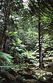 Rainforest pocket near Terrace Falls


See Also
Blue Mountains (Australia) Blue Mountains National Park Woodford, New South Wales Lawson, New South Wales
References
- ^ Blue Mountains Community Profile - Hazelbrook
- ^ "Origin of Blue Mountains Town Names", Blue Mountains City Council
- ^ Sydney and Blue Mountains Bushwalks, Neil Paton (Kangaroo Press) 2004, pp.186-196
External links
This New South Wales geography article is a stub. You can help Wikipedia by expanding it. |