
Ziepniekkalns
You can help expand this article with text translated from the corresponding article in Latvian. (March 2011) Click [show] for important translation instructions.
|
Ziepniekkalns | |
|---|---|
Neighborhood of Riga | |
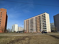
 Typical inner yard in Ziepniekkalns (2022) | |
 Location in Riga | |
| Country | Latvia |
| City | Riga |
| District | Zemgale Suburb |
| Area | |
| • Total | 10.917 km2 (4.215 sq mi) |
| Population (2018) | |
| • Total | 33,016 |
| • Density | 3,000/km2 (7,800/sq mi) |
| Time zone | UTC+2 (EET) |
| • Summer (DST) | UTC+3 (EEST) |
| Website | apkaimes.lv |
Ziepniekkalns is a neighborhood of Riga, Latvia. It is located in the Pārdaugava section of Riga close to the city's southern border. Ziepniekkalns is the latest out of all Riga's neighborhoods.[1] It was built in the late 1980s and early 1990s and mostly consists of Soviet-built 10 story apartment buildings. However, there are still many older buildings in Ziepniekkalns constructed in the early 1960s. There is a major contrast between older 3 story buildings and newer 10 story ones. In the mid-1990s, route 19 trolleybus was extended to the heart of new Ziepniekkalns and now final stop is at the Mego supermarket. The trolleybus route 4 runs through the city center to Jugla.[2]
Gallery[edit]
-
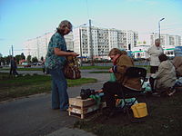 Street market in Ziepniekkalns
 -
 Office of perfumery and cosmetics factory Dzintars
 -
 Ancient Oak Tree of Ēbelmuiža
 -
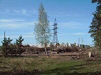 Ziepniekkalns forest
 -
 Longest apartment building in Latvia, Ozolciema street 18.
 -
 Typical inner yard in Ziepniekkalns
 -
-


References[edit]
- ^ "Apkaimes vēsturiskais apraksts". apkaimes.lv. 2013. Retrieved May 7, 2015.
- ^ "Iedzīvotāju aptauja par dzīvi apkaimē 4.Ziepniekkalns" (PDF). Rīgas domes pilsētas attīstības departaments. 2013. Retrieved May 7, 2015.
Sources[edit]
- Jērāns, Pēteris (1988). Latvijas padomju enciklopēdija: Rīga. Rīga: Valērija Belokoņa izdevniecība. p. 733. ISBN 9984-9482-2-6.
| Authority control databases: National |
|---|
56°57′N 24°00′E / 56.95°N 24°E
This Riga location article is a stub. You can help Wikipedia by expanding it. |