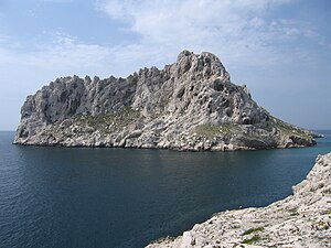
Île Maïre
| Île Maïre | ||
|---|---|---|
| Île Maïre | ||
| Waters | Mediterranean Sea | |
| Geographical location | 43 ° 12 '40 " N , 5 ° 20' 7" E | |
|
|
||
| length | 1 km | |
| width | 500 m | |
| Highest elevation | 138 m | |
| Residents | uninhabited | |
The Île Maïre is a French , uninhabited island in the Mediterranean Sea southwest of Marseille and near the Cap Croisette. Politically, it belongs to the Bouches-du-Rhône department and the Provence-Alpes-Côte d'Azur region .
geography
The island has an east-west extension of less than one kilometer and a north-south extension of 500 m. The highest point is the Pic des Gabians at 138 m.

