Alexandria (British Columbia)
| Fort Alexandria National Historic Site of Canada Lieu historique national du Canada Fort-Alexandria |
|
|---|---|
|
Historic Place of Canada Lieu patrimonial du Canada |
|
| Recognized since | May 15, 1925 |
| Type | National Historic Site of Canada |
| ID | 17741 |
| Coordinates | 52 ° 38 ′ 0 ″ N , 122 ° 27 ′ 0 ″ W |
| Recognized by | Canadian Federal Government |
| Approved by | Historic Sites and Monuments Act |
| Entry Canadian List of Monuments | |
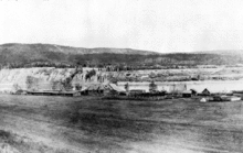
Alexandria - also called Fort Alexandria - was a settlement on the Fraser River south of Quesnel in the province of British Columbia . Alexandria is on Highway 97 , approximately 103 miles north of 100 Mile House . The settlement reached its peak during the Cariboo gold rush .
The village - today a National Historic Site of Canada , to which it was declared on May 15, 1925, developed from a post built here by the North West Company in 1821 as the northern end point of Cariboo Road (also Cariboo Wagon Road or Called Great North Road ). After the North West Company was forcibly merged with the Hudson's Bay Company , the post continued to operate until 1881. The last buildings were demolished in 1915.
The fort was named in honor of Alexander MacKenzie, who reached a First Nations village on the Fraser River on June 21, 1793 on his expedition to cross North America .
The planned construction of a road connection between the mouth of the Bute Inlet and Alexandria, which was promoted by Alfred Waddington , was ultimately the trigger for the Chilcotin War .
Web links
- Alexandria (British Columbia) . In: BC Geographical Names (English)
- Fort Alexandria National Historic Site of Canada . On Parks Canada (English)
Individual proof
- ^ Fort Alexandria National Historic Site of Canada. In: Canadian Register of Historic Places. Retrieved July 3, 2013 .

