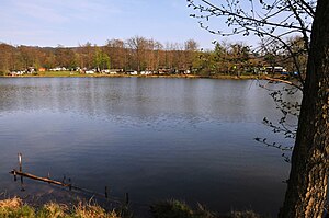
Altenberger See
| Altenberger See | ||
|---|---|---|

|
||
| Geographical location | Wilhelmsthal , Gerstungen municipality , Wartburg district , Thuringia , Germany | |
| Drain | to the parent | |
| Data | ||
| Coordinates | 50 ° 54'30 " N , 10 ° 18'5" E | |
|
|
||
| surface | 3.85 hectares | |
The Altenberger See is an artificially created lake in the municipality of Gerstungen in the Wartburg district in Thuringia with an area of 3.85 hectares .
Geographical data
The Altenberger See is about ten kilometers south of Eisenach and about one kilometer south of the park of the Wilhelmsthal hunting lodge in the Eckardtshausen district , Gerstungen municipality. The lake can be reached via a path that branches off from Bundesstraße 19 south of Wilhelmsthal , not far from the Taubeneller Mühle .
The lake is connected to the Elte by a connecting ditch . The maximum depth is about two meters.
history
The Altenberger See was built as a reservoir in the 19th century. There has been a campsite on the shore since the 1950s . In the GDR era , the lake was one of the most popular excursion destinations for the residents of Eisenach and is still used for tourism today.
On the night of June 14-15, 1980, a tornado in the upper region of strength F1 caused severe damage in the vicinity of the lake and claimed six lives. Another nine people were injured, some seriously.
Web links
Individual evidence
- ^ Topographic map 1: 25000 5027 Eisenach; Thuringian Land Survey Office 1997
- ↑ http://www.tornadoliste.de/19800614eisenach.htm
