Annateich (Hanover)
| Annateich | ||
|---|---|---|

|
||
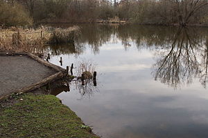
| Annateich in Hermann-Löns-Park, March 2010 | ||
| Geographical location | Hanover , Lower Saxony | |
| Tributaries | no | |
| Drain | none | |
| Islands | 2 | |
| Places on the shore | Hanover | |
| Data | ||
| Coordinates | 52 ° 22 '16 " N , 9 ° 49' 2" E | |
|
|
||
| surface | 7.7 ha | |
| Maximum depth | 2 m | |
| Middle deep | 1 m | |
|
particularities |
||
The Annateich is a former clay pit in the Kleefeld district (Hanover) , Lower Saxony . It is located in Hermann-Löns-Park , an 86 hectare park .
description
Today's park area was a damp fen area in earlier centuries , which was used to quarry clay from the 17th century. The former clay pit later filled with water. From this the originally much smaller Annateich was formed. 1936-1939 the pond for the park in the local recreation area was greatly expanded.
The lake consists of an eastern and a western part, which are separated by a dam pierced in two places. The water is slightly cloudy, the water depth is in the range of 1–2 m. In the western part the water is a little deeper than in the eastern part. Due to the division into two parts with only minimal connection points, Annateiche is also used colloquially in Hanover in the plural .
The lake is used by the Hanover fishing association as angling waters, it is one of the oldest leased waters of the association. Fishing is only allowed in ten marked spots around both parts of the lake.


