Antelope Canyon
| Antelope Canyon | ||
|---|---|---|
|
Sun rays in Upper Antelope Canyon |
||
| location | Arizona (USA) | |
| Geographical location | 36 ° 51 '27 " N , 111 ° 22' 19" W | |
|
|
||
| Type | Canyon | |
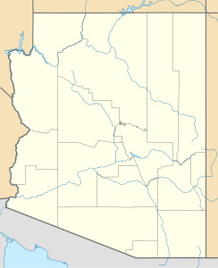
The Antelope Canyon is the most visited slot canyon in the southwestern United States . It consists of the Upper Antelope Canyon and the Lower Antelope Canyon and is located near Page , Arizona . It was formed by Antelope Creek , an approximately 30 km long and only rarely after torrential rain in the area of origin in the Mormon Ridges water-bearing creek. The stream and its canyons run roughly parallel to the Rocky Mountains from south-southeast to north-northwest in a rift direction that is common on the Colorado Plateau .
In addition to the two slot canyons, a side canyon flooded by Lake Powell is also known as Antelope Canyon; this is navigable with boats over a length of a few kilometers. In this area the gorge is around 10 m wide at the narrowest points.
Location and accessibility
The Antelope Canyons are located near Lake Powell on the Navajo Nation Reservation . Most of the time, both parts of the canyon are dry and accessible. When rain has been announced, the canyons are forbidden to enter due to the danger of flash floods . In 1997 such a flash flood - which is completely unspectacular outside the canyons - killed eleven tourists in Lower Antelope Canyon. Both canyons are only accessible with guided tours that are subject to a fee. As both canyons are on the Navajo Reservation, there is an additional fee to enter the reserve. The fee is valid for both canyons. The transport to the Upper Canyon takes place as part of the tour via off-road vehicles. The Lower Canyon is reached via a short walk.
Upper Antelope Canyon
Upper Antelope Canyon, on Navajo Tsé bighánílíní (about "the place where the water flows through the rocks"), is a tip for photographers because here by the erosion of the red sandstone , which is part of the Moenkopi Formation is have formed extraordinary shapes. Mainly in the summer months, the sun shining in from above results in the so-called beams , which, especially around lunchtime, often provide for a fantastic play of colors and light. The Upper Antelope Canyon is accessible at ground level, up to 44.3 m deep and has a length of about 400 m.
Lower Antelope Canyon
The Lower Antelope Canyon, which the Navajos call Hazdistazí (roughly: "winding rock arches"), is located a few kilometers from the Upper Canyon. Due to the inconvenient entry and exit via steel struts and ladders and the not so numerous beams , the Lower Canyon is a little less frequented. The light conditions are best here in the morning and early afternoon.
Northern part of Antelope Canyon
The northern part of the Antelope Canyon can be traveled by motor boats or paddle boats. Coming from the Wahweap Marina, keep south of the Antelope Islands and branch off to the right in the first branch. The gorge becomes narrower and narrower, after a few kilometers a sandbank ends the waterway. This path also offers impressive plays of light, especially in the late afternoon, and is passable without separate admission. Motor boats rented by the day or by the hour must be returned by 5 p.m. at the latest.
Web links
- Antelope Canyon - Lake Powell Navajo Tribal Park - Official Website


