Arizona State Route 73

|
|
|---|---|
| map | |

|
|
| Basic data | |
| Overall length: | 46 mi / 75 km |
| Starting point: |
|
| End point: |
|
| Counties: |
Navajo County Gila County |
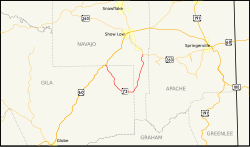
The Arizona State Route 73 is a state highway in the US state of Arizona , the West-East direction is in.
The State Route begins on Arizona State Route 260 in Indiana Pine between McNary and Pinetop-Lakeside and first heads south to the Fort Apache Indian Reservation near Whiteriver and from there west to US Highway 60 near Carrizo .
State Route 73 originally ran from San Carlos to Springerville . The southern part to San Carlos was closed and is still maintained today as Indian Route 9. The section from McNary to Springerville became part of State Route 260.
See also
Web links
- Arizona Roads (English)