Arizona State Route 74

|
|
|---|---|
| map | |

|
|
| Basic data | |
| Overall length: | 31 mi / 49 km |
| Opening: | 1974 |
| Starting point: |
|
| End point: |
|
| County: | Maricopa County |
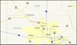
The Arizona State Route 74 is a state highway in the US state of Arizona , the West-East direction is in.
The State Route begins on US Highway 60 at Morristown and ends north of Phoenix on Interstate 17 . Although it is still signposted as AZ 74 as far as Cave Creek , this part is officially not part of the State Route. The road connects Lake Pleasant Regional Park with Interstate 17. Some sections of the road are also called Morristown-New River Highway , Lake Pleasant Road and Carefree Highway .
See also
Web links
- Arizona Roads (English)
- AARoads (English)