Phoenix (Arizona)
| Phoenix | |
|---|---|
| Nickname : Valley of the Sun | |
 |
|
 seal |
 flag |
| Location in Arizona | |
| Basic data | |
| Foundation : | May 4, 1886 |
| State : | United States |
| State : | Arizona |
| County : | Maricopa County |
| Coordinates : | 33 ° 27 ′ N , 112 ° 4 ′ W |
| Time zone : | Mountain Standard Time ( UTC − 7 ) |
|
Inhabitants : - Metropolitan Area : |
1,615,017 (as of 2016) 4,661,537 |
| Population density : | 1,313.1 inhabitants per km 2 |
| Area : | 1,230.5 km 2 (approx. 475 mi 2 ) of which 1,229.9 km 2 (approx. 475 mi 2 ) are land |
| Height : | 340 m |
| Structure: | 8 boroughs |
| Postcodes : | 85001-85099 |
| Area code : | +1 602, 623, 480 |
| FIPS : | 04-55000 |
| GNIS ID : | 0044784 |
| Website : | www.phoenix.gov |
| Mayor : | Kate Gallego ( D ) |
 Satellite imagery of Phoenix |
|
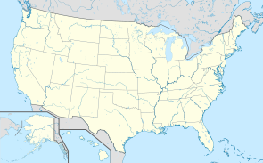
Phoenix on the map of the United States |
Phoenix [ ˈfiːnɪks ] is the capital and largest city of the US state Arizona . The city is also the seat of the county seat of Maricopa County .
geography
Phoenix is centrally located in Arizona in the Valley of the Sun (" Sun Valley ") of the Sonoran Desert . The extended urban area has four million inhabitants. It includes Mesa , Scottsdale , Glendale , Tempe , Chandler , Gilbert , Peoria, and many smaller towns like Goodyear , Avondale, Litchfield Park, and Anthem, as well as retirement communities like Sun City , Sun City West, and Fountain Hills .
The Salt River flows from northeast Maricopa County through south Phoenix. The border with Tempe is formed by the La Toma Crosscut Canal . The greater Phoenix area is bordered by mountains, the McDowell Mountains in the north, the Superstition Mountains (with the distinctive Weavers Needle ) in the east, the Sierra Estrella and the South Mountains in the south and the White Tank Mountains in the west.
Demographics
According to the 2010 census, the population consisted of 46.5 percent white and 6.5 percent African American; 3.2 percent were of Asian origin. 40.8 percent of the population were Hispanics . The median income per household was 2,015 at 47,326 US dollars . 23.1 percent of the population lived below the poverty line.
Population development
| year | Residents |
|---|---|
| 1980 | 789.704 |
| 1990 | 984.310 |
| 2000 | 1,321,045 |
| 2010 | 1,445,632 |
| 2016 | 1,615,017 |
history
The Hohokam people lived in what is now Phoenix for more than 2000 years . The Hohokam created a 135- mile network of irrigation canals that made the desert agricultural. The runways of these canals were later used for the Arizona Canal , the Central Arizona Project, and the Hayden-Rhodes Aqueduct . The Hohokam traded with the neighboring Anasazi , Mogollon and Sinagua and also with the more distant Mesoamerican civilizations. Between 1300 and 1450 the Hohokam allegedly left the area because of a dry period and several floods. After the Hohokam, the Pima , Tohono O'odham and Maricopa tribes began to colonize the region.
The Akimel O'odham were the main indigenous people in the area, they lived in small villages. They had clearly defined irrigation systems. Their crops included corn, beans and pumpkins, cotton and tobacco were also grown. You united with the Maricopa people for your mutual protection against intrusions by the Yuma and Apache people . The Maricopa are part of the larger Yuma people. They migrated east of the lower Colorado and Gila Rivers in the early 1800s when they became enemies of the other Yuma peoples.

One site in Phoenix has National Historic Landmark status , the Pueblo Grande Ruin and Irrigation Sites . 214 buildings and sites in the city are listed on the National Register of Historic Places (NRHP) (as of October 31, 2018).
climate
Phoenix has an average of 312 days of sunshine a year. For a third of the year (from mid-May to mid-September) temperatures are over 38 ° C (100 ° F ). On the hottest days of the year, temperatures can even rise to 46 ° C. However, the dry desert air in Arizona makes the high temperatures somewhat more bearable (“dry heat”). The population is only marginally exposed to the heat - most buildings and vehicles are air-conditioned.
The lowest temperatures in winter are 0 ° C (32 ° F), but rarely stay that low for long periods. There have been measurable amounts of snow twice in the last few years: 1 cm in 1990 and 2.5 cm in 1985. The area has an annual average of around 194 mm of rain. The little rain falls spread over the period of the southwest monsoon from July to mid-September, when warm, humid air from the Gulf of California occasionally displaces the hot desert air.
| Phoenix, Arizona | ||||||||||||||||||||||||||||||||||||||||||||||||
|---|---|---|---|---|---|---|---|---|---|---|---|---|---|---|---|---|---|---|---|---|---|---|---|---|---|---|---|---|---|---|---|---|---|---|---|---|---|---|---|---|---|---|---|---|---|---|---|---|
| Climate diagram | ||||||||||||||||||||||||||||||||||||||||||||||||
| ||||||||||||||||||||||||||||||||||||||||||||||||
|
Average monthly temperatures and rainfall for Phoenix, Arizona
|
|||||||||||||||||||||||||||||||||||||||||||||||||||||||||||||||||||||||||||||||||||||||||||||||||||||||||||||||||||||||||||||||||||||||||||||||||||||||||||||||||||||
education
The most important university in the greater Phoenix area is Arizona State University in Tempe , the second largest university in the USA by student numbers. In August 2006, ASU opened a campus in downtown Phoenix.
The medical school of the Tucson- based University of Arizona has a branch in Phoenix, which expanded significantly through 2007. Students can now take most of the medical classes on the new downtown campus. The University of Arizona's business school, Eller College of Management , also offers an Executive MBA in Phoenix.
In addition to the branch offices of the two most important state universities in Arizona, the Phoenix metropolitan area is home to the largest private university in the USA , the University of Phoenix .
Thunderbird - School of Global Management - is located in the city of Glendale . The school was created in 1946 from the Thunderbird Fields military airfield. There are 10 community colleges in the greater Phoenix area .
economy
Historically, Phoenix has been an agricultural ( cotton and citrus ) city, but electronics and telecommunications companies in particular have invested here over the past two decades. Because of the attractive climate, proximity to the Grand Canyon and other scenic attractions, tourism has become another pillar of the city's economy. In winter, Phoenix is popular with golfers escaping the bad weather in the northern United States. As one of the fastest growing cities in the USA, Phoenix is currently particularly interesting for the real estate industry.
Five Fortune 500 companies are based in the greater Phoenix area : Apollo Group , Avnet , Phelps Dodge , US Airways and Republic Services . Other large Phoenix-based companies include Best Western , Cold Stone Creamery , Mesa Airlines , PF Chang's China Bistro, and Shamrock Foods , among others . The photovoltaic company First Solar also has its headquarters here. Other major employers in the region are Bank of America , General Dynamics , Henkel , Honeywell , Intel , Motorola and Southwest Airlines .
The metropolitan region of Phoenix generated an economic output of 203.3 billion US dollars in 2016, making it 17th among the economically strongest metropolitan regions in the country. A large part of the economic activity of the state of Arizona is generated in the metropolitan area.
traffic
The city is connected to Los Angeles in the west and Tucson (or Mexico and Texas ) in the southeast via Interstate I-10 . The I-17 leads to Flagstaff in northern Arizona . The I-8 leads south of the city via Yuma to San Diego in California .
The greater Phoenix area is very well developed in terms of traffic with a ring road and various city highways. However, traffic jams are very common, so on December 27, 2008 a 32 km (20 mi) long tram was opened (construction began on this in March 2005), the Valley Metro Rail , which connects Phoenix with the airport , Arizona State University and Tempe as well as Mesa connects. It is hoped that the tram will also revitalize the city center.
There are five airports in the greater Phoenix area, Sky Harbor International Airport, one of the busiest airports in the world, Williams Gateway Airport (created from the Williams Air Force Base which was closed in 1993 ), Falcon Field Airport, Phoenix-Goodyear Municipal Airport and Scottsdale Municipal Airport in Scottsdale - the last two are mostly served by private planes.
Phoenix is the largest city in the United States that is not connected to the Amtrak network. Amtrak ceased operations in 1996 and relocated to Maricopa . However, the city is served by rail freight.
leisure
sports clubs
Phoenix is one of the few cities that has a top division team in each of the four major North American sports ( baseball , American football , basketball and ice hockey ):
- Arizona Cardinals in the National Football League
- Arizona Diamondbacks in Major League Baseball
- Arizona Coyotes in the National Hockey League
- Phoenix Suns in the National Basketball Association
Other well-known teams are:
- Arizona Rattlers , Arena Football League
- Phoenix FC , USL Professional Division
- Phoenix Mercury , Women's National Basketball Association
Sports facilities
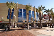
- Talking Stick Resort , home of the Phoenix Suns (NBA) and Phoenix Mercury (WNBA)
- Chase Field , home of the Arizona Diamondbacks
- Firebird International Raceway , boat racing
- Gila River Arena , multifunctional arena, home of the Coyotes (in the suburb of Glendale )
- Manzanita Speedway , dragster racing
- Phoenix International Raceway , NASCAR series car racing
- Phoenix street circuit , former street circuit, on that of 1989 bis 1991 the Grand Prix of the United States of Formula 1 was held
- University of Phoenix Stadium , home of the Arizona Cardinals (NFL) in the suburb of Glendale
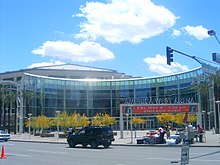
- US Airways Center , multifunctional arena, u. a. Home of the Suns , Roadrunners , Rattlers, and Mercury
Attractions

- Arizona Biltmore
- Arizona Historical Society Museum
- Arizona Science Center
- Arizona State Capitol , seat of the state government
- Arizona Veterans Memorial Coliseum / Arizona State Fairgrounds
- Camelback Mountain
- Castles N 'Coasters Amusement Park
- Desert Botanical Garden, Phoenix Zoo and Hole-in-the-Rock in Papago Park
- Encanto Park
- Hall of Flame
- Heard Museum
- Hotel San Carlos
- Metrocenter Mall
- Musical Instrument Museum
- Phoenix Art Museum
- Phoenix Museum of History
- Pueblo Grande Museum and Cultural Park
- Marienbasilika
- South Mountain Park
- Squaw Peak Recreation Area
- Symphony Hall in the Phoenix Civic Plaza
- Taliesin West and Gammage Auditorium, both of Frank Lloyd Wright designed
- Tovrea Castle
- Wrigley Mansion
Personalities
Bands from Phoenix
Twin cities
In the 1970s, there was an unofficial city partnership with the German city of Karlsruhe . An official city partnership, however, never came about.
literature
- Elizabeth Tandy Shermer: Sunbelt Capitalism: Phoenix and the Transformation of American Politics . University of Pennsylvania Press, Philadelphia 2013, ISBN 978-0-8122-0760-6 .
- Michael F. Logan: Desert Cities: The Environmental History of Phoenix and Tucson. University of Pittsburgh Press, Pittsburgh 2006, ISBN 978-0-8229-4294-8 .
- Bradford Luckingham: Phoenix: The History of a Southwestern Metropolis . University of Arizona Press, Tucson 1995, ISBN 978-0-8165-1116-7 .
Web links
- The City website (English)
- Phoenix. In: Magazinusa.com
- Mike Leco: Phoenix, Arizona. In: USATourist.com (translation by Irmgard Castleberry).
Individual evidence
- ↑ US Census Bureau: American FactFinder - Community Facts. Retrieved November 8, 2017 .
- ↑ 1980–2000: census results; 2006: Update of the US Census Bureau. Annual Estimates of the Population for Incorporated Places in Arizona ( September 20, 2011 memento in the Internet Archive ). In: United States Census Bureau (English).
- ^ City of Phoenix History. In: Phoenix.gov (excerpt from the book Out of the Ashes by James M. Barney, Barry Goldwater , Jack Williams, 1951 and 1962; English); Marshall Trimble: Arizoniana. American Traveler Press, 1988, ISBN 978-1-885590-89-3 , p. 103.
- ^ AR Royo: Prehistoric Desert Peoples: The Hohokam. In: Desert USA (English).
- ^ Gila River Indian Community History . Gila River Indian Community. Archived from the original on October 9, 2014.
- ↑ List of NHL by State . National Park Service , accessed October 31, 2018.
- ↑ Search mask database in the National Register Information System. National Park Service , accessed October 31, 2018.
- ^ US Department of Commerce, BEA, Bureau of Economic Analysis: Bureau of Economic Analysis. Retrieved July 4, 2018 (American English).
- ↑ Karlsruhe City Wiki


