
Alberta
| coat of arms | flag |
|---|---|
 ( Details ) |
 ( Details ) |
| Motto : Fortis et Liber ("Strong and free") | |
| location | |
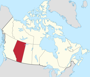  |
|
| Basic data | |
| Official language | English |
| Capital | Edmonton |
| Biggest town | Calgary |
| surface | 661,848 km 2 (6.) |
| Population (2011) | 4,067,175 (4.) |
| Population density | 6.4 people / km 2 |
| GDP in CAD (2006) | Total: 235.593 billion (3rd) Per capita: 69,789 (2nd) |
| Time zone | UTC −7 |
| ISO 3166-2 | CA-AB |
| Postal abbreviation | FROM |
| Website | www.gov.ab.ca |
| politics | |
| Joined Confederation | September 1, 1905 |
| Deputy Governor | Lois Mitchell |
| prime minister | Jason Kenney ( UCP ) |
| Sit in the lower house | 34 |
| Seat in the Senate | 6th |


Alberta [ æɫˈbɝtə ] is the westernmost of Canada's prairie provinces . The capital is Edmonton , the largest city is Calgary . The province is named after Louise Caroline Alberta, Duchess of Argyll , the fourth daughter of Queen Victoria .
Alberta's landscape is shaped by the prairie , which extends east to Saskatchewan . On the western border of the province, however, the foothills of the Rocky Mountains dominate . Alberta has extensive oil reserves and is the richest province in Canada. Grain cultivation and cattle breeding are further economic factors.
geography
Alberta covers an area of 661,848 km 2 , of which 642,317 km 2 is land and 19,531 km 2 is water.
location
Alberta borders the US state of Montana to the south, Saskatchewan Province to the east, the Northwest Territories to the north, and British Columbia to the west .
Waters
With the exception of the southwestern part, Alberta is very water-rich. There are numerous rivers and lakes. The three largest lakes are Lake Athabasca ( 7,898 km 2 ), the greater eastern part of which is in the province of Saskatchewan, Lake Claire ( 1,436 km 2 ) immediately west of Lake Athabasca in Wood Buffalo National Park, and Lesser Slave Lake ( 1,168 km 2 ) northwest of Edmonton .
Landscapes
Alberta's capital, Edmonton , is located near the geographic center of the province and most of Alberta's oil is refined here . Southern Alberta, where Calgary is located, is known for its ranching . Much of the unforested Alberta is used for growing grain or dairy farming , with ranching and grassland dominating in the south. The Alberta Wasteland is to the southeast, where the Red Deer River crosses the flat prairie and farmland, revealing deep canyons and impressive scenery. The Dinosaur Provincial Park , near Brooks , is the venue for the terrain of the wasteland, the flora of the desert and remnants from Alberta's past when dinosaurs roamed the countryside.
ecology
The desertification of the oil shale mining area continues due to the high water consumption. In January 2015, fracking triggered a medium earthquake with a magnitude of 4.4 on the Richter scale in Alberta in a sparsely populated area with the epicenter near the city of Fox Creek . Here the rock was split with large amounts of water and solvents to a depth of 3000 meters and the slate sand was drilled horizontally up to 2000 meters. It is probably the strongest earthquake ever caused by human hands. The United States Geological Survey confirmed the cause, which is denied by the drilling companies. Gail Atkinson, a specialist in artificially induced earthquakes at Western University in London, Ontario , believes that industrially induced earthquakes can be more dangerous than natural ones.
While in British Columbia drilling must be stopped after earthquakes with a magnitude> 4.0, there is no corresponding law in Alberta.
structure
Geographically, Alberta is divided into six regions:
- Alberta's Rockies
- Calgary region
- Central Alberta
- Edmonton Capital Region
- Northern Alberta
- Southern Alberta
Occasionally the Calgary-Edmonton Corridor is counted as an additional region. Partly is assigned to the Central Alberta region.
For administrative purposes there is the division into Municipal Districts ( see: List of Municipal Districts in Alberta ), which in turn are combined into Census Divisions for statistical purposes .
climate
Since Alberta extends 1,200 km north-south (and about 600 km east-west), the climate differs considerably between the 49th and 60th parallel . It is also by the height above sea level. NN influences: It ranges from about 1,000 meters in the south (Calgary is about 1,000–1,200 meters high and Red Deer about 850 m) to 650 meters in the north. The presence of the Rocky Mountains in the west and open prairies in the east also affects the weather. The north of Alberta is mostly covered by taiga and has fewer frost-free days than the south, which has a semi-arid climate . Western Alberta is protected by the mountains and enjoys milder temperatures in winter due to the Chinook wind. Southeast Alberta, on the other hand, is generally flat, dry prairie with a few hills and extreme temperatures. These range from very cold (−35 ° C or lower in winter) to very hot (38 ° C or more in summer). Central and parts of northwest Alberta in the Peace River area are largely Aspen Parklands , a transitional biome between the prairie in the south and the taiga in the north. After southern Ontario , central Alberta is the region of Canada with the greatest likelihood of tornadoes . Thunderstorms are common in summer especially in central and southern Alberta. The region around the Calgary-Edmonton Corridor is notorious for the highest frequency of hail in Canada.
In general, Alberta has cold winters with average temperatures between −10 ° C in the south to −24 ° C in the north. In the south along the foothills of the Rocky Mountains , winter is sometimes interrupted by the Chinook , which quickly increases temperatures to up to 20 ° C and more. This usually happens in February or March. In summer, the average daily temperature in the valleys of the Rocky Mountains and in the far north reaches around 21 ° C, and in the dry prairie of the southwest up to 30 ° C. The northern and western parts of the province have more rain and evaporation rates are lower because of the cooler summer temperatures. Southern and east-central areas are prone to drought-like conditions; this sometimes for years, although there can be heavy rainfall in these areas too. The northern parts of Alberta get a fair amount of sunshine because of the fairly dry climate; the east-central part of the province bordering Saskatchewan is the sunniest place in Canada with an average of over 2,500 hours of sunshine annually.
fauna
Alberta's three climatic regions ( alpine , forest and prairie) are home to many different animal species. The southern and central prairies were the land of the bison . The grass provided fodder for millions of buffalo. The buffalo population has been decimated since it was first colonized, but the buffalo have re-reproduced and are thriving on farms and parks across Alberta.
Alberta is home to many large carnivores . Among them are the grizzly and the black bear , which can be found in the mountain and forest regions. Smaller representatives of the carnivores of the dog and cat families are the coyote , the wolf , the red fox and swift fox , the Canadian lynx , the bobcat and the puma . The coyote is also found in some parts of the major urban centers.
Herbivores can be found all over the province. Moose and deer (both mule deer and white-tailed deer ) are found in forested areas, and the pronghorn is found in the prairies of southern Alberta. Bighorn sheep and mountain goats live in the Rocky Mountains. Rabbits , tree pricks , skunks , gray squirrels , and many species of rodents and reptiles live in every region of the province. Alberta only has one species of venomous snake , the prairie rattlesnake .
population
In the 2011 census, Alberta had 3,645,257 residents, an increase of 10.8% over the 2006 census. This means that Alberta is well above the national average in terms of population development, with a national increase of 5.9%. The population growth is mainly attributable to continued immigration. Alberta makes up 10.89% of the total population of Canada. The population density in 2016 was 6.4 inhabitants per square kilometer.
Approx. 77% of the population stated English as their mother tongue in the 2011 census , the proportion of the population with French as their mother tongue is around 2%. Around 2.2% of the population said German as their mother tongue in the survey .
About 70,000 citizens of Alberta are Indians . The majority are Cree and Blackfoot ( Siksika ). There are also a large number of Métis . In 1990, the Supreme Court of Canada awarded them a reserve of 500,000 hectares, divided into eight settlements. The province is one of the centers of the Hutterites in Canada.
According to the 2006 census, the population is made up of 27.2% of English, 20.9% of German , 20.5% of "Canadian", 20.3% of Scottish, 16.6% of Irish, 11.9% of French and 10.2% % Of people of Ukrainian origin together (multiple answers were possible).
Biggest cities


The largest metropolitan areas are Calgary (with Airdrie ), Edmonton (with Sherwood Park , Spruce Grove and St. Albert ), Red Deer , Lethbridge and Medicine Hat .
| City (municipality) | Residents | |
|---|---|---|
| 2001 | 2006 | |
| Calgary | 879.003 | 988.193 |
| Edmonton | 666.104 | 730.372 |
| Red deer | 67,829 | 82,772 |
| Strathcona County ( Sherwood Park ) | 71,986 | 82,511 |
| Lethbridge | 67,374 | 74,637 |
| St. Albert | 53,081 | 57,719 |
| Medicine Hat | 51,249 | 56,997 |
| Wood Buffalo ( Fort McMurray ) | 41,445 | 51,496 |
| Grande Prairie | 36,983 | 47,076 |
| Rocky View | 29,925 | 34,171 |
| Parkland County (Stony Plain) | 27,217 | 29,265 |
| Airdrie | 20,407 | 28,927 |
| Foothills | 16.602 | 19,736 |
| Spruce Grove | 15,983 | 19,496 |
history
Alberta was named after Princess Louise Caroline Alberta .
The southern part of the province of Alberta had been part of Rupert's Land since the Hudson's Bay Company (HBC) was founded in 1670 and was thus under the administration of the HBC. The northern part of the area was still administered by the North West Company , but in 1821 it became part of the HBC (see Pemmican War ).
By 1731 the French reached the western Canadian prairie. They later founded communities such as Lac La Biche and Bonnyville . Fort La Jonquière was built near present-day Calgary in 1752. The first explorer of the Athabasca region was Peter Pond , who built Fort Athabasca on Lac La Biche on behalf of the North West Company in 1778. In 1788 Roderick Mackenzie founded Fort Chipewyan , the oldest European settlement in Alberta, on the north-western tip of Lake Athabasca .
Alexander Mackenzie , Roderick Mackenzie's cousin, followed the North Saskatchewan River to its northernmost point near Edmonton, then continued on foot north, and then followed the Athabasca River to Lake Athabasca . There he discovered an outflow, the Mackenzie River , which he followed to its mouth in the Arctic Ocean . He came back to Lake Athabasca and followed the Peace River upstream and reached the Pacific . Mackenzie is thus the first European to cross the American double continent north of Mexico.
In 1882 Alberta became a separate district of the Northwest Territories , and in 1905, after a long campaign for autonomy, its area was enlarged and made a province. Alexander Cameron Rutherford became the first prime minister.
politics

Alberta's political system is based on the Westminster system with a unicameral parliament. The legislative assembly consists of 87 members who are elected by majority voting in as many constituencies . The lieutenant governor , who represents the head of state, can, in agreement with the prime minister, dissolve parliament early and call new elections within a certain time frame (at the latest after five years) , in accordance with British parliamentary tradition. The Prime Minister is always the leader of the party which has won the most seats. The Prime Minister-designate since the April 16, 2019 elections has been Jason Kenney , and Lois Mitchell has been Vice-Governor .
Politically, Alberta is one of the most conservative provinces in Canada. 33 of the 34 representatives of Alberta in the Canadian House of Commons belong to the Conservative Party of Canada . At the provincial level, the Progressive Conservative Association of Alberta has been in government uninterruptedly since 1971, until it suffered a serious election defeat in 2015 and was replaced by the social democratic Alberta New Democratic Party . In 2019, the United Conservative Party , formed from a merger of the PCA and the Wildrose Party , won an absolute majority and has been the provincial government since then. Alberta was sometimes referred to as "Texas North" for this reason. According to the Canadian Constitution , Alberta has six Senate seats , all of which are currently held by independent senators.
Culture and sights

Alberta developed as a popular tourist destination at the beginning of the 20th century, with several sights and sporting attractions such as skiing, mountain hiking, camping as well as a popular shopping metropolis thanks to the largest shopping center in all of North America, the West Edmonton Mall . In addition to the shopping mall, Stephen Avenue in Calgary is also a popular shopping street with several shops, restaurants and cafes. Various outdoor festivities and events are very popular, such as the Professional Athletics Event, the International Sporting Competitions, the Commonwealth Games and Olympic Games and other events. Alberta is also called the land of the cowboys. Nowhere in Canada are there as many working and guest ranches as here. The Calgary Stampede also takes place every year, it is the largest rodeo of its kind in the world and around 1.2 million people take part every year.
Alberta's Rocky Mountains are well known by tourists, including Banff National Park and Jasper National Park . The two parks are connected by one of the most beautiful highways, the Icefields Parkway . Banff is located approximately 128 km west of Calgary and is connected to Highway 1. Jasper is 226 miles west of Edmonton on the Yellowhead Highway .
Natural monuments
Alberta has a number of national and provincial parks . To the west lies Jasper National Park and Banff National Park , north of the Wood Buffalo National Park , in the east of Elk Iceland National Park , in the southeast of Dinosaur Provincial Park and south of Waterton Lakes National Park . The following parks have been awarded the title of World Heritage by UNESCO . The Canadian Rocky Mountain Parks , the Waterton-Glacier International Peace Park , the Wood Buffalo National Park, the Dinosaur Provincial Park and Head-Smashed-In Buffalo Jump . The Writing-on-Stone Provincial Park has also been a World Heritage Site since 2019 , partly because of its petroglyphs. Thus six of Canada's World Heritage Sites are located in the Province of Alberta.
One of the largest erratic boulders in the world, the 16,000-ton, 18-meter-high Big Rock , is located near Calgary. It was transported to its present location about 18,000 years ago by a migrating ice glacier.
Economy and Infrastructure

Oil deposits (Athabasca oil sands)
With 1.7 trillion barrels (≈ 2.70 km³), around a third of the world's oil sand deposits are stored here in the so-called Athabasca oil sands near Fort McMurray . They make Canada, after Saudi Arabia, the country with the world's second largest oil reserve and establish the province's wealth . However, the degradation is associated with major environmental problems and high CO 2 emissions. Extraction of oil from oil sands has only recently become profitable thanks to new technologies and a persistently high oil price . At least 65 percent of the oil produced here goes to the United States on the basis of a clause in the North American Free Trade Agreement (NAFTA); one of the world's largest oil pipelines , the so-called Keystone Pipeline, was built for this purpose . In 2010, per capita investment in Alberta was $ 18,930, more than twice the Canadian average. Since mining is very energy-intensive, there is a risk that Canada will not be able to meet its obligations under the Kyoto Protocol (as of 2006).
In the course of the fall in the oil price since autumn 2014, the extraction of oil sands, which is expensive compared to conventional oil production, has been cut back significantly; the forecasts of a further steep increase in production have not been fulfilled. This threatens the province with a recession. In February 2015, unemployment in the region was 12.6% (2010: 6.5%), but was still well below the Canadian average when seasonally adjusted.
agricultural economics
After the oil industry, agriculture is the most important branch of the economy; it consists mainly of grain growing and cattle breeding for export to the USA. Cattle exports were severely affected in 2003 when cases of BSE emerged and the US temporarily closed its borders to imports.
tourism
The responsible tourism authority, Alberta Economic Development, registered an annual average of about four million tourists in Edmonton and Calgary, and another three million in Banff , Jasper and the Rocky Mountains .
Other important economic sectors
Aerospace and defense industries : Around 170 companies have settled in the province and employ more than 6,000 people. The business sector contributes Canadian $ 1.3 billion annually to the province's added value. 40 percent of the goods produced in this sector are exported to other countries.
The information and communication technology sector is one of the province's larger and more stable industrial sectors. This includes around 4,300 companies with around 54,500 employees who generated around 10.2 billion Canadian dollars. Alberta's IT sector has an excellent international reputation, primarily through research and development. There are also many media companies. Calgary has the highest start-up rate per inhabitant in Canada.
Education and Research
The province comprises 42 school districts, with around 589,000 students enrolled in elementary and secondary schools. There are also six public universities and 15 colleges as well as other private educational institutions. The University of Alberta at Edmonton is the largest and oldest public university in the province, with around 37,588 students enrolled in 2009. The second largest university is the University of Calgary with around 28,000 students. Another university is Athabasca University , which operates as a distance university, with around 30,000 students. Other smaller universities are the University of Lethbridge in Lethbridge , Mount Royal University in Calgary , Grant MacEwan University in Edmonton. The main colleges include the Northern Alberta Institute of Technology and Southern Alberta Institute of Technology. The Alberta Research Council is a research institute primarily focused on the energy sector.
traffic
Highways
Alberta has 180,000 km of freeways and roads. The important north-south connection is served by Alberta Highway 2 . Highway 2 begins south of Cardston, passes the Carway Border, and is part of the CANAMEX corridor that connects Canada with Mexico and runs through the United States. Highway 4 , which joins Interstate 15 , is also the most important and busiest main route connecting the United States with the province. The main east-west connection is the Trans-Canada Highway . It connects all provinces from coast to coast and crosses the province in an east-west direction with a north and a south route, the south route following Highway 1 and the north following Highway 16 .
Other major highways in the province are:
- Highway 2 connects Calgary with Edmonton, among others.
- The Highway 11 connects Saskatchewan River Crossing and ends at Red Deer . On the way there he crosses Highway 2.
- The Highway 12 connects compeer and Bentley .
- The Highway 43 connects Athabasca with Grande Prairie.
Flight connections
Alberta has two major international airports, from which several domestic and international connections are offered. These airports are served by every major international airline. The Calgary International Airport is the third largest and the Edmonton International Airport is the fifth busiest airport in Canada. Calgary Airport is a hub for WestJet Airlines as well as Air Canada . From Calgary Airport there are flight connections to several Canadian provinces as well as to 15 larger US airports, nine European destinations, one flight connection to Asia and four to Mexico and the Caribbean. Edmonton Airport offers connections to all major Canadian airports, as well as ten US airports, three European airports and six Mexican and Caribbean airports.
Rail connection
A 9500 km long rail network, which is served by several railway companies, runs through the province. The companies VIA Rail Canada , Rocky Mountaineer as well as the Canadian Pacific Railway and Canadian National Railway offer several connections in the province and connect several larger cities inside and outside the province.
literature
- Susan Berry, Jack Brink: Aboriginal Cultures in Alberta: Five Hundred Generations . Provincial Museum of Alberta, 2004, ISBN 0778528529 .
- Catherine Anne Cavanaugh, Michael Payne; Donald Wetherell; Catherine Cavanaugh: Alberta formed, Alberta transformed, Volume 1 . University of Alberta Press, 2006, ISBN 1552381943 .
- Richard Connors, John M. Law: Forging Alberta's constitutional framework . University of Alberta - Center for Constitutional Studies, 2005, ISBN 0888644574 .
- Faye Reineberg Holt: Alberta: A History in Photographs . Heritage House; Lancaster: Gazelle, 2009, ISBN 9781894974875 .
- George Melnyk: The literary history of Alberta . University of Alberta Press, 1999, ISBN 0888642962 .
- Alison Taylor: The politics of educational reform in Alberta . University of Toronto Press, 2001, ISBN 0802048137 .
- Darryl Raymaker: Trudeau's Tango. Alberta Meets Pierre Elliott Trudeau , 1968-1972. University of Alberta Press, 2017
Web links
- Government of Alberta (English)
- Alberta Tourism (German / English)
- Statistics Canada (English)
- Alberta ( English, French ) In: The Canadian Encyclopedia . Retrieved March 22, 2015.
- Der deutsche Kriegsgefangene in Alberta - Alberta and the keeping of german prisoners of war, 1939-1947 , several sites in English. By John Joseph Kelly. This is a chapter from: Provincial Museum of Alberta: For King and Country: Alberta in the Second World War. Ed. Ken Tingley ISBN 1-895073-81-2 .
Individual evidence
- ↑ a b Population and Dwelling Count Highlight Tables, 2016 Census . Statistics Canada , February 8, 2018, archived from the original on August 1, 2018 ; accessed on May 31, 2019 (English, original website no longer available).
- ↑ Office Of The Lieutenant Governor (Engl.)
- ^ Andrew Nikiforuk: Did Alberta Just Break a Fracking Earthquake World Record? January 29, 2015, online: [1]
- ^ Website of the City of Edmonton: Coyotes - City of Edmonton . In: edmonton.ca, accessed July 25, 2019.
- ^ Website of the City of Calgary: Urban coyotes - A vital part of Calgary's wildlife . In: calgary.ca, accessed July 25, 2019.
- ↑ Statistics Canada: Census 2006
- ↑ Alexander Mackenzie Biography. In: Dictionary of Canadian Biography. Retrieved January 5, 2006 .
- ^ AG Friedensforschung Uni Kassel: The new oil sheikdom Canada ( Memento from February 16, 2009 in the Internet Archive ). July 8, 2006
- ↑ Le Monde diplomatique, April 9, 2010: The last drops are expensive
- ↑ Alberta's oilsands ( Memento of March 17, 2005 in the Internet Archive )
- ^ Alberta Industry Sector, Analysis and Forecast July 17, 2011
- ^ The energy province of Alberta is suffering. In: NZZ, International Edition, March 18, 2015, p. 11.
- ^ Aerospace and Defense Industry in Alberta , July 17, 2011
- ^ Informations and communications technology in Alberta , July 17, 2011
- ^ Calgary Economic Development , accessed April 8, 2016.
- ↑ Government of Alberta Education Annual Report 2010, July 18, 2011 (PDF; 2.0 MB)
Provinces: Alberta | British Columbia | Manitoba | Newfoundland and Labrador | New Brunswick | Nova Scotia | Ontario | Prince Edward Island | Québec | Saskatchewan
Territories: Northwest Territories | Nunavut | Yukon
Coordinates: 55 ° 29 ′ N , 114 ° 34 ′ W