Medicine Hat
| Medicine Hat | ||
|---|---|---|
| Nickname : The Hat | ||
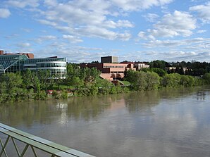
 Partial view of the city from the river |
||
| Location in Alberta | ||
|
|
||
| State : |
|
|
| Province : | Alberta | |
| Coordinates : | 50 ° 3 ′ N , 110 ° 40 ′ W | |
| Height : | 670 m | |
| Area : | 112.01 km² | |
| Residents : | 60,120 (as of 2006) | |
| Population density : | 536.7 inhabitants / km² | |
| Time zone : | Mountain Time ( UTC − 7 ) | |
| Postal code : | T1A - T1C | |
| Medicine Hat, Alberta | ||||||||||||||||||||||||||||||||||||||||||||||||
|---|---|---|---|---|---|---|---|---|---|---|---|---|---|---|---|---|---|---|---|---|---|---|---|---|---|---|---|---|---|---|---|---|---|---|---|---|---|---|---|---|---|---|---|---|---|---|---|---|
| Climate diagram | ||||||||||||||||||||||||||||||||||||||||||||||||
| ||||||||||||||||||||||||||||||||||||||||||||||||
Medicine Hat [ ˈmɛdəsən ˈhæt ] is a city in southeast Alberta province in Canada . It is located 300 km southeast of Calgary and is Alberta's fifth largest metropolitan area after Calgary, Edmonton , Red Deer and Lethbridge .
Medicine Hat is located in the river valley of the South Saskatchewan River , into which the Seven Persons Creek and Ross Creek flow within the city . The area has a very dry, continental climate with warm summers and cold winters, which are, however, mitigated by the chinook winds .
history
In two places the presence of people was confirmed by 2500 BC at the latest. (Cf. Medicine Hat (archaeological site) ).
The city's name is derived from the Blackfoot word Saamis , which denotes the eagle feather that medicine men wore on their hats.
Medicine Hat was founded in 1883 when the Canadian Pacific Railway discovered a vast reservoir of natural gas while drilling for water . To this day, the lighting in the city center consists of gas lamps. In 1906 Medicine Hat became an independent city.
A symbol of the city is the Samis Tipi , a tribute to the First Nations in Canada. The 65 m high steel structure was made for the 1988 Winter Olympics in Calgary and brought to Medicine Hat in 1991.
Economy and Infrastructure
An important economic factor is the extraction of natural gas, coal and oil, as well as the mining of raw materials such as clay and sand. In addition, agriculture and industrial production play an important role. 35 miles northwest is the Canadian Forces Base Suffield .
sons and daughters of the town
- Glen Edwards (1918–1948), American test pilot
- Bruno Gerussi (1928–1995), actor
- Richard E. Taylor (1929–2018), physicist and Nobel Prize winner (1990)
- Jamie Bartman (* 1962), German-Canadian ice hockey player and coach
- Murray Craven (born 1964), ice hockey player
- Clayton Young (* 1969), German-Canadian ice hockey player
- Trevor Linden (* 1970), ice hockey player
- Corey Hirsch (born 1972), ice hockey player
- Jadyn Wong (born 1985), actress
- Kirsti Lay (* 1988), cyclist
- Darren Dietz (* 1993), ice hockey player
- Sage Watson (* 1994), hurdler
Web links
- Website of the City Medicine Hat (english)
- AlbertaFirst.com: Medicine Hat (English)

