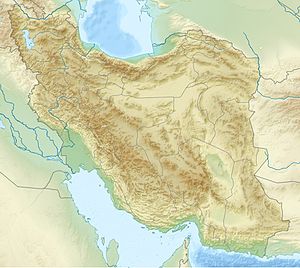
Azad cow
| Āzād cow | ||
|---|---|---|
| height | 4355 m | |
| location | Māzandarān Province ( Iran ) | |
| Mountains | Elburs Mountains | |
| Coordinates | 36 ° 10 ′ 0 ″ N , 51 ° 30 ′ 0 ″ E | |
|
|
||
| Normal way | Kalaak-e-Baalaa | |
| particularities | Kegelberg | |
The Āzād cow ( Persian آزاد کوه) as a free-standing cone hill lives up to its name.
Translated, his name means "free mountain" (kuh = "mountain"; āzād = "free"). With an altitude of 4355 m , it marks the central Elburs chain , east of the pass from Karaj to Tschālūs at the level of the village of Gachsar .
Usually the mountain is climbed via the south side. Climbing equipment is occasionally required for winter ascents. The starting point for tours are the villages of Kalaak-e-Baalaa at an altitude of 2650 meters or Vaarange Rud , of which an additional day is required for the ascent. The Chooren Pass is reached at 3800 meters and offers a view of the large gravel fields on the south side of the mountain. The summit consists of a double peak. When visibility is good, the towering Elburs summit of the Damavand opens up to the east . There is an increased risk of avalanches in winter.
See also
Individual evidence
- ↑ Ehsan Yar-Shater: from: Encyclopaedia iranica, Volume 1, Issues 5-9
- ↑ Mountaineering on Azad Kuh

