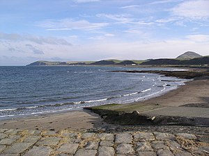
Ballantrae Bay
| Ballantrae Bay | ||
|---|---|---|
|
View from the south along Ballantrae Bay |
||
| Waters | Firth of Clyde | |
| Land mass | Scotland | |
| Geographical location | 55 ° 6 '40 " N , 5 ° 0' 20" W | |
|
|
||
| width | approx. 6.5 km | |
| depth | approx. 600 m | |
| Tributaries | Stinchar | |
Ballantrae Bay is a bay on the west coast of Scotland . The small town of Ballantrae is located roughly in the center of the bay belonging to the South Ayrshire Council Area . Historically, it was part of the traditional county of Ayrshire .
geography
The approximately 6.5 km long bay stretches along the lower Firth of Clyde near Cape Corsewall Point , where the inlet merges into the Scottish Sea . Ballantrae, the only and eponymous settlement along the bay, which only reaches around 650 meters into the land mass, is roughly in the middle. South of the village flows into the Stinchar, the only notable tributary. Bennane Head borders Ballantrae Bay to the north , while Downan Point marks the southern end.
The northern part of the bay is dominated by sandy and rocky sections, while the southern part is dominated by a pebble beach. A nature reserve is also demarcated there. In Ballantrae there is a small fishing port built in the 1840s on a short headland. The complex is a listed building.
Individual evidence
- ↑ a b c Entry in the Gazetteer for Scotland
- ↑ Measurement on Google Maps
- ↑ Entry on Ballantrae Harbor in Canmore, the database of Historic Environment Scotland (English)
- ↑ Listed Building - Entry . In: Historic Scotland .

