Banahaw
| Banahaw | ||
|---|---|---|
|
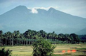
The Banahaw Volcano in 2007 |
||
| height | 2158 m | |
| location | Luzon , Philippines | |
| Coordinates | 14 ° 4 ′ 0 ″ N , 121 ° 29 ′ 0 ″ E | |
|
|
||
| Type | complex volcano | |
| Last eruption | unknown | |
The Banahaw Volcano (also known as Banahao ) is the highest of a group of volcanoes south and east of the Philippine capital Manila . The neighboring volcanoes are the 1,470 meter high San Cristobal and the 1,875 meter high Banahaw de Lucban. A few Andesite and Dazite lava domes rise on the flanks of the Banahaw. The deposits of two debris avalanches reach in the northeast up to a distance of 13 kilometers and in the southeast up to a distance of 26 kilometers. The volcano's caldera has a diameter of 2 kilometers and a depth of 600 meters and has broken open to the south-southwest. Until 1730 there was a crater lake in the caldera, which emptied in the form of lahars . There are no scientifically proven data on outbreaks.
The area around the Banahaw and San Cristobal was declared Mounts Banahaw San Cristobal National Park in 1941 .
Web links
- Banahaw in the Global Volcanism Program of the Smithsonian Institution (English)


