Banggai
| Banggai | ||
|---|---|---|
| Topographic map of Banggai, southeast of Peleng | ||
| Waters | Banda Lake , Moluccan Sea | |
| Archipelago | Banggai Islands | |
| Geographical location | 1 ° 37 ′ S , 123 ° 34 ′ E | |
|
|
||
| length | 30 km | |
| width | 14 km | |
| surface | 260.7 | |
| Highest elevation | 491 m | |
| Residents | 37,155 (2010) | |
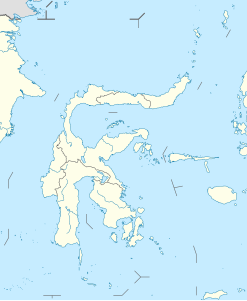
Banggai is an island off the east coast of Sulawesi in Indonesia .
It is the second largest island of the Banggai Islands and is located about one kilometer southeast of the larger neighboring island of Peleng . Labobo is 12 kilometers to the west. There are other small islands scattered in the southeast.
The approximately 260 km² island reaches a height of 491 m above sea level.
Banggai belongs to the Sulawesi Tengah province and forms its own district ( Kecamatan ).
Web links
Individual evidence
- ↑ cf. OpenStreetMap , accessed December 24, 2013.
- ↑ UNEP Islands (English)

