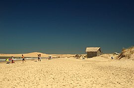
Barra de Valizas
| Barra de Valizas | ||
|---|---|---|
|
Coordinates: 34 ° 20 ′ S , 53 ° 48 ′ W Barra de Valizas on the map of Uruguay
|
||
| Basic data | ||
| Country | Uruguay | |
| Department | Rocha | |
| Residents | 330 (2011) | |
| Detailed data | ||
| Barra de Valizas beach | ||
| Sand dunes between Barra de Valizas and Cabo Polonio | ||
| Valizas by night | ||
Barra de Valizas , also Fondo de Valizas , is a town in the southeast of Uruguay .
geography
It is located in the Rocha Department in Sector 4 on the Atlantic coast. The Arroyo Valizas flows into the southern edge of the village . To the north-north-west lie Castillos and Barrio Torres inland a few kilometers away . Up the coast in a north-easterly direction is the coastal town of Aguas Dulces , while in the south Cabo Polonio is the closest coastal town.
Infrastructure
In the hinterland of Barra de Valizas, Ruta 10 passes a short distance .
Residents
Barra de Valizas had 330 inhabitants at the 2011 census, of which 176 were men and 154 were women.
| year | Residents |
|---|---|
| 1963 | 22nd |
| 1975 | 53 |
| 1985 | 113 |
| 1996 | 254 |
| 2004 | 356 |
| 2011 | 330 |
Source: Instituto Nacional de Estadística de Uruguay
Web links
- www.luckyvalizas.com
- City map of Barra de Valizas (PDF; 90 kB)


