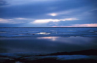
Beaufortsee
|
Beaufort Sea Beaufort Sea |
|
|---|---|
| Spring in the Beaufort Sea | |
| Art | Partial sea |
| ocean | Northern ocean |
| location | between Canada, Alaska and the Amundsen Gulf |
| Tributaries | Mackenzie River |
| Important islands | Banks Island , Prince Patrick Island , Herschel Island |
| Data | |
| surface | 476,000 km² |
| Maximum depth | 4683 m |
| Middle deep | 1004 m |
| Location of the disputed territory in the Beaufort Sea | |
Coordinates: 72 ° N , 137 ° W
The Beaufort Sea ( English Beaufort Sea ) is part of the Arctic Ocean off the coast of the North Slope of Alaska and the Canadian Territories of Yukon and Northwest . It borders the Amundsen Gulf , McClure Strait, and Banks Island to the east and extends north to Prince Patrick Island . In the west it borders the Chukchi Sea at Point Barrow .
It was named after Sir Francis Beaufort (1774-1857).
The lake has an area of about 476,000 km² and is up to 4683 m deep. The average depth is 1004 m. The sea part is home to oil and gas deposits .
The borderline (exclusively on the water) is part of a territorial dispute between Canada and the United States of America .
Web links
Commons : Beaufortsee - Collection of images, videos and audio files

