Beaumont Provincial Park
|
Beaumont Provincial Park
|
||
|
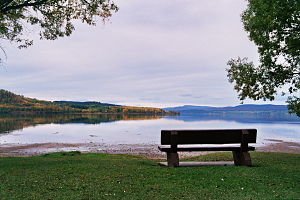
View of Fraser Lake |
||
| location | British Columbia (Canada) | |
| surface | 178 ha | |
| WDPA ID | 65101 | |
| Geographical location | 54 ° 3 ' N , 124 ° 37' W | |
|
|
||
| Setup date | February 16, 1960 | |
| administration | BC parks | |
The Beaumont Provincial Park is a provincial park in the Canadian province of British Columbia . It is located on the Yellowhead Highway , 40 km west of the community Vanderhoof and 85 km east of the community Burns Lake , on the Nechako Plateau (part of the Interior Plateau ). It is surrounded in the west and north by mountain ranges such as the Hazelton, Skeena and Omineca Mountains. The park also includes the former Indian settlement of Nathleh, which Simon Fraser turned into a fort in 1806, which was later named after him.
history
The area around Fraser Lake is one of the traditional territories of the Cheslatta , Nadleh Whut'en and Stellat'en First Nations . Several First Nations used the paths in the park area to transport goods. Therefore, archaeological sites exist in the park area and in the neighboring areas. One of the most important sacred sites is Mount Intatuk, a conical mountain between Ormond and Oona Lake.
Members of the fur trading companies, particularly the Hudson's Bay Company , used these trails to connect Fort Fraser, Fort McLeod, and Fort St. James. The park itself is on the site of the former Fort Fraser, which was built in 1806 by Simon Fraser and his companions. His indigenous name was Natleh, the decisive factor in choosing the location was the view over the lake and the breeze that kept the mosquitos away.
Beaumont Provincial Park was a gift from Captain Ernest Godfrey Beaumont (1876-1967), a supporter of BC Provincial Parks , who made the establishment of two more parks possible. So he gave the province his private property, from which the Discovery Island Marine Provincial Park emerged . In 1976 he left the area in his will to the province on condition that it be turned into a protected area.
The park was established in 1960, but at that time it only comprised 376 acres , i.e. little more than 150 hectares. Through three expansions in the years 1964 to 1966, it grew to 497 acres. In 1966 and 1969, however, it was again reduced by 24 acres so that it only had 473 acres. In 1998 the rights of way of Highway 16 crossing the park were changed so that the provincial park grew to 191.3 hectares. Another change in the park boundaries in 2004 resulted in the park shrinking back to an area of 178 ha.
Two Indian reservations exist at Fraser Lake today, namely that of the Stellat'en and that of the Nad'leh Whut'en.
investment
The protected area on the southeastern shore of Fraser Lake is cut through in an east-west direction by Highway 16 and a railroad line of the Canadian National Railway . Of the 178 ha protected area area, 164 ha are land and 14 ha are water.
The park is a category II protected area ( national park ).
Flora and fauna
Within the British Columbia ecosystem, the park area is assigned to the Sub-Boreal Spruce Zone with the subzones Dry Cool (SBSdk) and Dry Warm (SBSdw). This biogeoclimatic zone is characterized by a similar climate and the same or similar biological and geological conditions. This results in a very similar population of plants and animals in the respective zone.
literature
- Barry P. Booth: Fraser Lake. Important Bird Area Conservation Plan , Canadian Nature Federation, Federation of BC Naturalists, Wild Bird Trust of BC 2001.
- Deeper roots and greener valleys , ed. from the Fraser Lake & District Historical Society, Fraser Lake 1986.
Web links
- Beaumont Provincial Park . In: BC Geographical Names (English)
- Beaumont Provincial Park . In: English language website of the park at BC Parks
- Information to the park on britishcolumbia.com (Engl.)
Remarks
- ↑ World Database on Protected Areas - Beaumont Park (English)
- ^ Beaumont Provincial Park - Purpose Statement and Zoning Plan. (PDF; 447 KB) British Columbia Ministry of Environment, Lands and Parks , December 2002, accessed April 13, 2016 .
- ^ Ecosystems of British Columbia. British Columbia Ministry of Forests, Lands and Natural Resource Operations , February 1991, accessed April 13, 2016 .
- ↑ Biogeoclimatic Zones of British Columbia. British Columbia Ministry of Forests, Lands and Natural Resource Operations, accessed April 13, 2016 .

