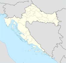
Bijaći
Coordinates: 43 ° 32 ′ 27 ″ N , 16 ° 17 ′ 14 ″ E
Bijaći is an ancient ruin site near Plano in Croatia .
history
Bijaći was founded in 100 by Roman war veterans and settlers under the name Siculi, the place lies between Tragurium ( Trogir ) and the colony of Salona ( Solin ) in today's Plano .
From 700 onwards Siculi came under Croatian rule and was renamed Bijaći. In the 9th century, under the rule of Prince Trpimir I, an early Christian basilica , the Basilica of St. Marta, was built. The prince's grave was also located there. The church was destroyed to the ground.
Today there is only a small chapel on the foundation walls, it is dedicated to St. Martha and stands on the slope, north of Split airport. There is a Roman cemetery nearby.
Web links
Commons : Bijaći - album with pictures, videos and audio files
Individual evidence
- ↑ Interactive map of the city of Kastela. (No longer available online.) In: Kastela-Info (Tourist Office of the City of Kastela). Formerly in the original ; Retrieved February 27, 2011 . ( Page no longer available , search in web archives ) Info: The link was automatically marked as defective. Please check the link according to the instructions and then remove this notice.
- ↑ Srednjovjekovna Arheologija II. Archaeological Institute of the University of Zadar, 2011, p. 3 , accessed on February 27, 2011 (Croatian).
