Blind graphic

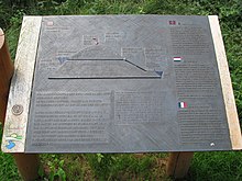
Graphic representation as a tactile relief with explanations in Braille of the course of the Kermeter tunnel from Urftsee under the Kermeter (500 m) to a hydroelectric power station.
A tactile graphic is for blind palpable human form of a fact graphically illustrated. Graphics for the blind are used wherever a textual description in Braille would not be sufficient or would not be easy enough. In the area of geographical maps, floor plans and directions, one speaks of maps for the blind .
Graphics for the blind in publications for the blind can be produced using the embossing process or using special tactile inks in inkjet printers . Embossed metal panels are used in public spaces. Braille graphics are combined with braille.
literature
- Panek, Bernhard Walter: "Braille: writing - graphics - printing. Production and duplication of tactile publications", Wiener Universitätsverlag, ISBN 978-3-7089-0153-4
Web links
Commons : Tactile Graphics - collection of images, videos and audio files