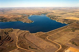
Bowman-Haley Dam
| Bowman-Haley Dam | |||||||
|---|---|---|---|---|---|---|---|
|
|||||||
|
|
|||||||
| Coordinates | 45 ° 58 '54 " N , 103 ° 14' 48" W | ||||||
| Data on the structure | |||||||
| Height of the barrier structure : | 24 m | ||||||
| Crown length: | 1746 m | ||||||
| Data on the reservoir | |||||||
| Water surface | 7.3 km² | ||||||
| Total storage space : | 25.17 million m³ | ||||||
The dam Bowman-Haley ( English Bowman-Haley Dam ) is located in Bowman County in the US state of North Dakota . It dams the North Fork Grand River to Bowman-Haley Reservoir ( English Bowman-Haley Lake ). The town of Bowman is about 20 km northwest of the dam.
The dam was built by the United States Army Corps of Engineers (USACE). Construction of the dam began in June 1964; it was completed in 1966. It is used for flood protection and water supply.
Barrier structure
The barrier is an earthfill dam approximately 24 m (79 ft ) high . The length of the dam crest is 1746 m (5730 ft).
Reservoir
At the normal storage target , the reservoir extends over an area of around 7.3 km² (1811 acres ). At this dam target it holds 25.17 million m³ (20,409 acre-feet ) of water.
Individual evidence
- ^ A b Additional Dams & Lakes. United States Army Corps of Engineers (USACE), accessed September 4, 2018 .
- ^ Bowman-Haley. gf.nd.gov, accessed on September 4, 2018 (English).

