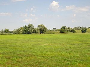
Groß Below castle wall
| Groß Below castle wall | |
|---|---|
|
View of the ramparts |
|
| Alternative name (s): | Schlossberg |
| Creation time : | 6th to 9th centuries |
| Castle type : | Niederungsburg |
| Conservation status: | Castle mounds, moats |
| Place: | Bartow -Groß Below |
| Geographical location | 53 ° 48 '22 " N , 13 ° 16' 58" E |
The castle wall near Groß Below , a district of the municipality of Bartow in the Mecklenburg Lake District , is located a good two kilometers southwest on the Tollense . The river has been straightened at this point. In the Slav times the castle was still on the other side of the water. The Slavic rampart is now in the area of the municipality of Golchen .
The castle wall had an oval floor plan and existed for almost the entire Slavic settlement period. Some finds also indicate an even older settlement from the Germanic era. The lowland castle must have been taken in the past centuries earth, for former earthworks are no longer seen on the ground. The inner surface of the castle is somewhat lower than the edge of the same. This suggests that it was a real hill fort. How naturally protected the area once was can still be seen today. When it has rained for a long time, all the meadows around the so-called "Schlossberg" are so damp and boggy that the castle site cannot be reached without dry feet.
