
Bartow (Western Pomerania)
| coat of arms | Germany map | |
|---|---|---|

|
Coordinates: 53 ° 49 ' N , 13 ° 21' E |
|
| Basic data | ||
| State : | Mecklenburg-Western Pomerania | |
| County : | Mecklenburg Lake District | |
| Office : | Treptower Tollensewinkel | |
| Height : | 23 m above sea level NHN | |
| Area : | 24.95 km 2 | |
| Residents: | 450 (Dec. 31, 2019) | |
| Population density : | 18 inhabitants per km 2 | |
| Postal code : | 17089 | |
| Area code : | 039991 | |
| License plate : | MSE, AT, DM, MC, MST, MÜR, NZ, RM, WRN | |
| Community key : | 13 0 71 006 | |
| Community structure: | 3 districts | |
| Office administration address: | Rathausstrasse 1 17087 Altentreptow |
|
| Website : | ||
| Mayor : | Roland Heiden ( CDU ) | |
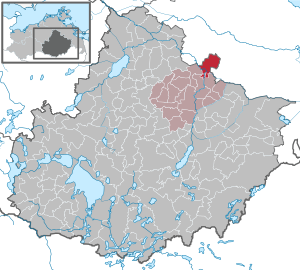
| Location of the municipality of Bartow in the Mecklenburg Lake District | ||
  |
||

Bartow is a municipality in the northeast of the Mecklenburg Lake District . The community is south of Jarmen . Until January 1, 2004, the community was part of the Tollensetal office and has been part of the Treptower Tollensewinkel office since then, based in Altentreptow .
Geography and traffic
Bartow is about ten kilometers south of Jarmen. Landesstraße 35 ( formerly Bundesstraße 96 ) runs through the Groß Below district of the municipality. The A 20 runs through the municipality. It can be reached via the Anklam connection . The Tollense flows through the west of the municipality .
Districts
- Bartow
- Big Below
- Pritzenow
history
Bartow
Bartow was first mentioned in 1277 as Bertekowe in a document from Duke Barnim I of Pomerania . This allowed Johann Thuring, who had bought ten hooves from the village from the knights Heidenreich and Gerhard von Heydebreck, to donate these lands to a monastery of his choice. Part of the village came into the possession of the Stolpe monastery . The Heydebrecks still owned two farms in Bartow, which later passed to a branch of the von Schwerin family. The von Blücher family , who lived on Daberkow , owned another farm . This was sold to the von Linden family in 1738 and later passed to the von Netzow family.
The monastic part of the place was assigned to the ducal office of Klempenow after the introduction of the Reformation in Pomerania in the course of the secularization of the monastery property . After the transition of Old Western Pomerania from Swedish Pomerania to Prussia , the sovereign part of Bartow belonged to the Klempenow domain office . Around 1865 there were 546 residents in the sovereign part and 89 in the knightly part.
From 1897 to 1945, the Demminer Kleinbahnen Ost railway ran through Bartow. The local cooperative dairy had its own port.
Big Below
The Groß Below estate was a domain until 1791 and was then sold to the governor Fleischmann for his son-in-law von Winterfeld. In the first half of the 19th century the property came into the von Heyden family, and finally to von Rosenstiel through the marriage of a von Heyden family. This family remained in possession of the estate until 1945. The von Heyden family built the manor house in 1855 and expanded the park. In 1862 Groß Below had 169 inhabitants. The manor house burned down in 1945.
politics
Coat of arms, flag, official seal
The municipality has no officially approved national emblem, neither a coat of arms nor a flag . The official seal is the small state seal with the coat of arms of the region of Western Pomerania . It shows an upright griffin with a raised tail and the inscription "GEMEINDE BARTOW • LANDKREIS MECKLENBURGISCHE SEENPLATTE".
Attractions

- Late Gothic Bartow Church : Plastered field and brick church from the 14th / 15th centuries. Century with boarded west tower from the 16th century; In the 18th century, the church was given its present-day form through additions.
- War memorial 1914/18 in Bartow as an obelisk
- Manor house in Pritzenow
Web links
Individual evidence
- ↑ Statistisches Amt MV - population status of the districts, offices and municipalities 2019 (XLS file) (official population figures in the update of the 2011 census) ( help ).
- ^ A b Heinrich Berghaus : Land book of the Duchy of Pomerania and the Principality of Rügen . 2nd part band 1 . Dietze, Anklam 1865, p. 74-75 ( online [accessed June 19, 2015]).
- ^ Hermann Hoogeweg : The founders and monasteries of the province of Pomerania . tape 2 . Leon Saunier, Stettin 1925, p. 687 ( online [accessed June 23, 2015]).
- ^ Heinrich Berghaus : Land book of the Duchy of Pomerania and the Principality of Rügen . 2nd part band 1 . Dietze, Anklam 1865, p. 45-46 ( online [accessed June 19, 2015]).
- ^ Heinrich Berghaus : Land book of the Duchy of Pomerania and the Principality of Rügen . 2nd part band 1 . Dietze, Anklam 1865, p. 37-38 ( online [accessed June 19, 2015]).
- ↑ Walter Bauchspies, Torsten Berg: The Demminer Kleinbahnen - History of two narrow-gauge Lenz railways . EK-Verlag 2004, ISBN 3-88255-693-5 .
- ^ Hubertus Neuschäffer: Western Pomerania's castles and mansions. Husum Druck- und Verlagsgesellschaft 1993, p. 70, ISBN 3-88042-636-8
- ↑ Main Statute, Section 1, Paragraph 3 (PDF).
Alt Schwerin | Altenhagen | Altenhof | Altentreptow | Ankershagen | Bartow | Basedow | Beggerow | Ownership | Blankenhof | Blankensee | Flower wood | Bollewick | Borrentine | Bredenfelde | Breesen | Breest | Briggow | Brunn | Buchholz | Stargard Castle | Burow | Bütow | Carpin | Cölpin | Dargun | Datzetal | Demmin | Eldetal | Rotten rust | Feldberger Seenlandschaft | Fincken | Friedland | Five lakes | Galenbeck | Gielow | Gnevkow | Godendorf | Goehren-Lebbin | Golchen | Gotthun | Grabowhöfe | Grammentin | Grapzow | Grischow | Large trowel | Groß Miltzow | Gross Nemerow | Large plastic | Groß Teetzleben | Grünow | Validity | Gülzow | High Wangelin | Hohenbollentin | Hohenmocker | Hohenzieritz | Holldorf | Ivenack | Jabel | Jürgenstorf | Kargow | Kentzlin | Kieve | Kittendorf | Little Thank You | Kletzin | Klink | Klocksin | Knorrendorf | Kratzeburg | Kriesow | Sublank | Kuckssee | Kummerow | Larz | Leizen | Lindenberg | Lindetal | Malchin | Malchow | Meesiger | Melz | Mirow | Möllenbeck | Möllenhagen | Mölln | Moltzow | Neddemin | Neetzka | Neubrandenburg | Neuenkirchen | Recalculation | Neustrelitz | Neverin | Nossendorf | Nossentiner Hut | Peenehagen | Penkow | Penzlin | Pragsdorf | Priborn | Priepert | Pripsleben | Rechlin | Ritzerow | Röbel / Müritz | Röckwitz | Rosenow | Sarov | Schloen-Dratow | Schönbeck | Schönfeld | Schönhausen | Black | Siedenbollentin | Siedenbrünzow | Sietow | Silz | Sommersdorf | Sponholz | Staven | Stavenhagen | Steer | Südmüritz | Torgelow am See | Trollenhagen | Tützpatz | Userin | Utzedel | Forgive | Voigtsdorf | Vollrathsruhe | Walow | Waren (Müritz) | Warrenzin | Werder | Wesenberg | Wildberg | Woggersin | Wokuhl-Dabelow | Wolde | Woldegk | Wulkenzin | Wustrow | Zettemin | Zirzow | Zislow