
Hohenmocker
| coat of arms | Germany map | |
|---|---|---|

|
Coordinates: 53 ° 49 ' N , 13 ° 11' E |
|
| Basic data | ||
| State : | Mecklenburg-Western Pomerania | |
| County : | Mecklenburg Lake District | |
| Office : | Demmin country | |
| Height : | 42 m above sea level NHN | |
| Area : | 26.85 km 2 | |
| Residents: | 431 (Dec. 31, 2019) | |
| Population density : | 16 inhabitants per km 2 | |
| Postal code : | 17111 | |
| Area code : | 039993 | |
| License plate : | MSE, AT, DM, MC, MST, MÜR, NZ, RM, WRN | |
| Community key : | 13 0 71 065 | |
| Community structure: | 6 districts | |
| Office administration address: | Goethestrasse 43 17109 Demmin |
|
| Website : | ||
| Mayor : | Thomas Korrmann | |
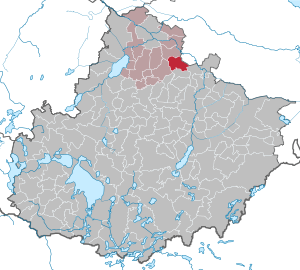
| Location of the community Hohenmocker in the Mecklenburg Lake District | ||
  |
||

Hohenmocker is a municipality in the northeast of the Mecklenburg Lake District . Historically, however, it belongs to Pomerania. The community is south of Demmin. It belongs to the Demmin-Land office , which has its administrative seat in the city of Demmin .

geography
Geographical location
Hohenmocker is 12.5 km southeast of Demmin and 15 km northwest of Altentreptow . The Strehlower Bach flows through the community , which later flows into the Augraben at the Leistenower Mühle . The community lies on a cut plateau from 40 to 50 m above HNH.
Community structure
Districts:
|
Neighboring communities
In the north, the municipality borders on Utzedel , in the east on Alt Tellin , in the southeast on Golchen , in the south on Gnevkow , in the west on Sarow and in the northwest on Beggerow .
history
Hohenmocker
West of the place was a large Old Slavonic (600 to 800) settlement, which indicates an early settlement of the area.
Hohenmocker was first mentioned in a document in 1239. In the certificate of April 29, 1239, Duke Wartislaw III. von Pomerania and the widow of his former chamberlain Dobislaw the monastery Klatzow before Altentreptow the church of Hohenmocker (called Mokere ) and accessories as well as the tithe from the village.
The Swedish registration cards from 1696 show the place with the church and the compact farming settlement around the Anger with the village pond.
The village was run as a knightly farming village. In the 18th century it consisted of three parts:
- Part a) had a parish house, sexton and school house, 5 farmers, a jug and a forge, a total of 29 fireplaces. This part of the village belonged to the von Normann family as a fief from 1728 to 1776. Then in 1776 Heinrich Peter von Podewils acquired it as an allodial property .
- Part b) had 3 farmers and belonged to Hans Bogislaw von Schwerin
- Part c) had only one farmer and belonged to Heinrich Peter von Podewils auf Sanzkow
In 1779 Podewils united all three parts and was the total owner of the village. In 1799 Podewils sold the village to Christian Gottlieb Krause (ennobled in 1817).
At the end of the 18th century Hohenmocker was a farming village with a mother church, including branch churches in Hohenbüssow and Gnevkow. The villages of Peeselin , Hohenbrünzow and Strehlow as well as the Vorwerke Tentzerow and Buchholz were part of the parish of Hohenmocker.
In the Prussian original measurement table from 1835, the development is no longer as compact and coherent as in the register card from 1696. A post mill was added to the northeast.
In 1862 the following were registered: eight farms, 18 day laborer families, a parish, school and local council house, a total of 19 fire pits with 247 residents. In 1871 Hohenmocker had 19 houses with 34 households and 187 inhabitants, in 1867 there were still 213. All were members of the Protestant denomination. In the measuring table (MTB) from 1880, 10 farmsteads can be recognized and the farm workers' cottages are distributed between them. The windmill was rebuilt as a Dutchman. There are no changes in the MTB of 1920.
The structure of the village was preserved during the GDR era. Some old buildings disappeared, but there were new ones. Most of the farmers were in an LPG, but there was no agricultural facility in the village.
The Protestant pastoral office of Hohenmocker has existed for the parish of Hohenmocker since 1997.
Peeselin
Peeselin was first mentioned in 1237 as "Perselyn". It was a domain farm with the estate and small farms.
Hohenbrünzow
The manor has always been owned by the von Schwerin family . The master of the Hohenbrünzow and Strehlow (Pertinenz) estates was Captain Hans Bogislaw von Schwerin from 1768 , Lieutenant Carl August Bogislaw von Schwerin from 1798 , Hennig von Schwerin from 1830 and Landscape Councilor Wilhelm von Schwerin from 1858 . The estate had about 650 hectares. The two-storey, late classicist manor house dates from 1865. At the same time, the associated park was designed.

Star field
Sternfeld was laid out in 1817 by Gottlieb Ferdinand von Krause as a preliminary to Tentzerow. The landlord had the Vorwerk laid out on the part of the Feldmark that the farmers of Hohenmocker had to cede to the landlord in the separation of peasant and manorial property on the basis of the Stein-Hardenberg reforms in order to be freed from their burdens and official duties towards him . The estate later went to the von Seckendorf family.
Strehlow
The place was a pertinence (ancillary property) to Gut Hohenbrünzow with approx. 400 ha. The place consisted of the estate and the farms in the village part. From 1800 onwards, all of the property shares went to the von Schwerin family.
Tentzerow
Tenzerow was a fief of the von Voss family . On March 26, 1720, King Friedrich Wilhelm I gave the estate to Lieutenant General von Borke .
The two-storey manor house is a renovation from the beginning of the 19th century. From 1934 it was the headquarters of the settlement society of the Society for the Promotion of the Inner Colonization of Berlin-Dahlem. After 1945 the council of the community used the manor u. a. for apartments. Tentzerow was the original name of the community. On January 1, 1951, it was changed to Hohenmocker.
politics
Coat of arms, flag, official seal
The municipality has no officially approved national emblem, neither a coat of arms nor a flag . The official seal is the small state seal with the coat of arms of the region of Western Pomerania . It shows an upright griffin with a raised tail and the inscription "GEMEINDE HOHENMOCKER * LANDKREIS MECKLENBURGISCHE SEENPLATTE".
Attractions
Buildings
- Hohenmocker church from the 13th century. With financial support from the German Foundation for Monument Protection rehabilitated
- Classicist, two-storey, twelve-axis Tentzerow manor from after 1800 with Lenné Park
- Late classical, two-storey, nine-axle Hohenbrünzow manor from 1865 with a park
Green spaces and recreation
- Lenné Park in Tentzerow
- Hohenbrünzow Park
Economy and Infrastructure

Companies
- The area is predominantly agricultural
traffic
The state road L 271, which branches off from the B 194 at Demmin, runs through the towns of Sternfeld and Hohenmocker, where the district roads branch off via Hohenbrünzow to Sarow and via Tentzerow to Alt Tellin . The place can be reached from the A 20 from the junction Anklam (near Klempenow ) via the state roads L 35 and L 271.
Sternfeld station is located on the Neustrelitz-Stralsund route ( Berlin Northern Railway ) between the towns of Strehlow and Sternfeld.
literature
- Heinrich Berghaus : Land book of the Duchy of Pomerania and the Principality of Rügen , Part II - Volume I., The districts of Demmin, Anklam, Usedom-Wollin and Ückermünde, Anklam 1868.
- Royal Statistical Bureau, “Municipalities and manor districts and their population”, III. Province of Pomerania, census of December 1, 1871, Berlin 1874.
Web links
- Literature about Hohenmocker in the state bibliography MV
- Hohenmocker (places in MV)
Individual evidence
- ↑ Statistisches Amt MV - population status of the districts, offices and municipalities 2019 (XLS file) (official population figures in the update of the 2011 census) ( help ).
- ^ Pomeranian document book . (PUB), Volume 1, Part 1, No. 368 of April 29, 1239, p. 299.
- ↑ Royal. Statistical Bureau, “Municipalities and manor districts and their population”, III. Province of Pomerania, census of December 1, 1871, Berlin 1874
- ^ Hubertus Neuschäffer: Western Pomerania's castles and mansions. Husum Druck- und Verlagsgesellschaft 1993, p. 82, ISBN 3-88042-636-8 .
- ^ Heinrich Berghaus : Land book of the Duchy of Pomerania and the Principality of Rügen , Part II - Volume I., The districts of Demmin, Anklam, Usedom-Wollin and Ückermünde, Anklam 1868, p. 117 ( digitized version ).
- ↑ Main Statute, Section 1, Paragraph 2 (PDF).
Alt Schwerin | Altenhagen | Altenhof | Altentreptow | Ankershagen | Bartow | Basedow | Beggerow | Ownership | Blankenhof | Blankensee | Flower wood | Bollewick | Borrentine | Bredenfelde | Breesen | Breest | Briggow | Brunn | Buchholz | Stargard Castle | Burow | Bütow | Carpin | Cölpin | Dargun | Datzetal | Demmin | Eldetal | Rotten rust | Feldberger Seenlandschaft | Fincken | Friedland | Five lakes | Galenbeck | Gielow | Gnevkow | Godendorf | Goehren-Lebbin | Golchen | Gotthun | Grabowhöfe | Grammentin | Grapzow | Grischow | Large trowel | Groß Miltzow | Gross Nemerow | Large plastic | Groß Teetzleben | Grünow | Validity | Gülzow | High Wangelin | Hohenbollentin | Hohenmocker | Hohenzieritz | Holldorf | Ivenack | Jabel | Jürgenstorf | Kargow | Kentzlin | Kieve | Kittendorf | Little Thank You | Kletzin | Klink | Klocksin | Knorrendorf | Kratzeburg | Kriesow | Sublank | Kuckssee | Kummerow | Larz | Leizen | Lindenberg | Lindetal | Malchin | Malchow | Meesiger | Melz | Mirow | Möllenbeck | Möllenhagen | Mölln | Moltzow | Neddemin | Neetzka | Neubrandenburg | Neuenkirchen | Recalculation | Neustrelitz | Neverin | Nossendorf | Nossentiner Hut | Peenehagen | Penkow | Penzlin | Pragsdorf | Priborn | Priepert | Pripsleben | Rechlin | Ritzerow | Röbel / Müritz | Röckwitz | Rosenow | Sarov | Schloen-Dratow | Schönbeck | Schönfeld | Schönhausen | Black | Siedenbollentin | Siedenbrünzow | Sietow | Silz | Sommersdorf | Sponholz | Staven | Stavenhagen | Steer | Südmüritz | Torgelow am See | Trollenhagen | Tützpatz | Userin | Utzedel | Forgive | Voigtsdorf | Vollrathsruhe | Walow | Waren (Müritz) | Warrenzin | Werder | Wesenberg | Wildberg | Woggersin | Wokuhl-Dabelow | Wolde | Woldegk | Wulkenzin | Wustrow | Zettemin | Zirzow | Zislow