
Werder (near Altentreptow)
| coat of arms | Germany map | |
|---|---|---|

|
Coordinates: 53 ° 43 ' N , 13 ° 22' E |
|
| Basic data | ||
| State : | Mecklenburg-Western Pomerania | |
| County : | Mecklenburg Lake District | |
| Office : | Treptower Tollensewinkel | |
| Height : | 22 m above sea level NHN | |
| Area : | 30 km 2 | |
| Residents: | 559 (Dec. 31, 2019) | |
| Population density : | 19 inhabitants per km 2 | |
| Postal code : | 17089 | |
| Area code : | 03969 | |
| License plate : | MSE, AT, DM, MC, MST, MÜR, NZ, RM, WRN | |
| Community key : | 13 0 71 158 | |
| Community structure: | 3 districts | |
| Office administration address: | Rathausstrasse 1 17087 Altentreptow |
|
| Mayor : | Michael Frese | |
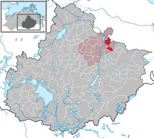
| Location of the municipality Werder in the Mecklenburg Lake District | ||
  |
||

Werder is a municipality in the northeast of the Mecklenburg Lake District . It is located north of Neubrandenburg in Mecklenburg-Western Pomerania . Until January 1, 2004, the community was part of the Tollensetal office and has been part of the Treptower Tollensewinkel office since then, based in Altentreptow .
Geography and traffic
Werder is about six kilometers northeast of Altentreptow. The B 96 runs west of the community. The A 20 runs through the municipality . It can be reached via the Altentreptow connection . The community is located on the Treptower Werder, a lowland between Tollense , Große Landgraben and Kleiner Landgraben .
Districts
history
- Wodarg
The knighthood of Wodarg was an old property of the von Walsleben family, then that of Preen and finally it came to the widespread von Maltzahn. The latter owned the 900 hectare estate until 1945. The manor house was built in 1733, and in 1919 it was added to the side according to plans by the architect Wilhelm Freiherr von Tettau . The manor house is a one-storey plastered building with 7 axes, three more are accounted for by the extension and the recessed connecting wing. The estate with three massive barns is still preserved. An English landscape park completes the property.
The last owner, Gerhard von Maltzahn, was picked up by the Soviet Army in 1945 and was considered missing. After 1989 it was found out that he was shot by Soviet troops in a sand pit near Kölln. The family was expelled and the property was settled in the land reform. After the phase as a residential building for refugees, various uses such as restaurants, administration, consumption, etc. were added to the manor house.
- Incorporations
The municipality of Wodarg was incorporated into Werder on July 1, 1950 and the municipality of Kölln on January 1, 1974.
politics
Coat of arms, flag, official seal
The municipality has no officially approved national emblem, neither a coat of arms nor a flag . The official seal is the small state seal with the coat of arms of the region of Western Pomerania . It shows an upright griffin with a raised tail and the inscription "GEMEINDE WERDER • LANDKREIS MECKLENBURGISCHE SEENPLATTE".
Attractions

→ See also the list of architectural monuments in Werder (near Altentreptow)
- Baroque stone church of Werder from 1751 with baptismal font from the 13th century,
- Conerow castle ruins ; 2.5 km west of the district of Wodarg
- Kölln Church , field stone church from the 15th / 16th centuries Century with high, wooden west tower.
- Neo-Romanesque Church in Wodarg ; Brick building with individual field stones from the second half of the 19th century.
- Wodarg manor complex and manor house from 1733 with central risalit , two-axis side elevation and mansard roof .
- Werder manor house
Web links
- Literature about Werder (near Altentreptow) in the state bibliography MV
- Werder at www.orte-in-mv.de
Individual evidence
- ↑ Statistisches Amt MV - population status of the districts, offices and municipalities 2019 (XLS file) (official population figures in the update of the 2011 census) ( help ).
- ^ Ulrich Maximilian Schumann : Wilhelm Freiherr von Tettau. 1872-1929. Architecture in the crisis of liberalism , gta Verlag, Zurich 2002, ISBN 3-85676-101-2 , pp. 130/131.
- ↑ Location of the war grave: http://www.openstreetmap.org/node/2601529169#map=19/53.77783/13.33342
- ^ Hubertus Neuschäffer: Western Pomerania's castles and mansions . Husum Druck- und Verlagsgesellschaft 1993, p. 212, ISBN 3-88042-636-8
- ↑ Main Statute, Section 1, Paragraph 3 (PDF).
Alt Schwerin | Altenhagen | Altenhof | Altentreptow | Ankershagen | Bartow | Basedow | Beggerow | Ownership | Blankenhof | Blankensee | Flower wood | Bollewick | Borrentine | Bredenfelde | Breesen | Breest | Briggow | Brunn | Buchholz | Stargard Castle | Burow | Bütow | Carpin | Cölpin | Dargun | Datzetal | Demmin | Eldetal | Rotten rust | Feldberger Seenlandschaft | Fincken | Friedland | Five lakes | Galenbeck | Gielow | Gnevkow | Godendorf | Goehren-Lebbin | Golchen | Gotthun | Grabowhöfe | Grammentin | Grapzow | Grischow | Large trowel | Groß Miltzow | Gross Nemerow | Large plastic | Groß Teetzleben | Grünow | Validity | Gülzow | High Wangelin | Hohenbollentin | Hohenmocker | Hohenzieritz | Holldorf | Ivenack | Jabel | Jürgenstorf | Kargow | Kentzlin | Kieve | Kittendorf | Little Thank You | Kletzin | Klink | Klocksin | Knorrendorf | Kratzeburg | Kriesow | Sublank | Kuckssee | Kummerow | Larz | Leizen | Lindenberg | Lindetal | Malchin | Malchow | Meesiger | Melz | Mirow | Möllenbeck | Möllenhagen | Mölln | Moltzow | Neddemin | Neetzka | Neubrandenburg | Neuenkirchen | Recalculation | Neustrelitz | Neverin | Nossendorf | Nossentiner Hut | Peenehagen | Penkow | Penzlin | Pragsdorf | Priborn | Priepert | Pripsleben | Rechlin | Ritzerow | Röbel / Müritz | Röckwitz | Rosenow | Sarov | Schloen-Dratow | Schönbeck | Schönfeld | Schönhausen | Black | Siedenbollentin | Siedenbrünzow | Sietow | Silz | Sommersdorf | Sponholz | Staven | Stavenhagen | Steer | Südmüritz | Torgelow am See | Trollenhagen | Tützpatz | Userin | Utzedel | Forgive | Voigtsdorf | Vollrathsruhe | Walow | Waren (Müritz) | Warrenzin | Werder | Wesenberg | Wildberg | Woggersin | Wokuhl-Dabelow | Wolde | Woldegk | Wulkenzin | Wustrow | Zettemin | Zirzow | Zislow