
Altenhof (Mecklenburg)
| coat of arms | Germany map | |
|---|---|---|

|
Coordinates: 53 ° 21 ' N , 12 ° 21' E |
|
| Basic data | ||
| State : | Mecklenburg-Western Pomerania | |
| County : | Mecklenburg Lake District | |
| Office : | Röbel-Müritz | |
| Height : | 82 m above sea level NHN | |
| Area : | 16.58 km 2 | |
| Residents: | 334 (Dec. 31, 2019) | |
| Population density : | 20 inhabitants per km 2 | |
| Postal code : | 17209 | |
| Area code : | 039924 | |
| License plate : | MSE, AT, DM, MC, MST, MÜR, NZ, RM, WRN | |
| Community key : | 13 0 71 003 | |
| Office administration address: | Marktplatz 1 17207 Röbel / Müritz |
|
| Website : | ||
| Mayor : | Sven Becher | |
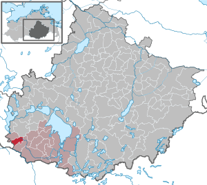
| Location of the municipality Altenhof in the Mecklenburg Lake District | ||
  |
||

Altenhof is a municipality in the southwest of the Mecklenburg Lake District in Mecklenburg-Western Pomerania . It is administered by the Office Röbel-Müritz based in the city of Röbel / Müritz .
geography
The municipality of Altenhof is located on the southwestern edge of the Mecklenburg Lake District . In the basic moraine area around Altenhof a maximum height of 112 m above sea level is achieved. NN reached. The neighboring community of Ganzlin to the west belongs to the Ludwigslust-Parchim district . Other neighboring communities are Stuer in the northwest, Fünfseen in the northeast and Fincken in the east and south. The cities of Röbel / Müritz, Malchow and Plau am See are each about 15 kilometers away. The Elde rises west of the Altenhof district of Darze .
history
The old farm was first mentioned as a hunting lodge from 1572. The hunting lodge could go back to the Breten farm, which was mentioned in the 14th century . A village around the Alte Hof was laid out from 1748 and in 1774 already had 20 houses with 76 inhabitants.
Forestry and fishing were the main sources of income for the inhabitants before tourism emerged in the 20th century.
politics
Coat of arms, flag, official seal
The municipality has no officially approved national emblem, neither a coat of arms nor a flag. The official seal is the small state seal with the coat of arms of the state of Mecklenburg. It shows a looking bull's head with torn off neck fur and crown and the inscription "GEMEINDE ALTENHOF".
Attractions

- Feldsteinhaus in Schulstrasse 6/8
- old trainstation
→ See also the list of architectural monuments in Altenhof (Mecklenburg)
Economy and Infrastructure
Altenhof is characterized by wide fields, meadows and pastures and the associated agriculture. The community is a primary school location, also for surrounding villages.
The former station building on the disused railway line between Ganzlin and Röbel / Müritz is still well preserved and is used as a residential building.
Transport links
There are connections to Plau am See, Röbel / Müritz and the Röbel motorway junction on the 19 motorway (Berlin-Rostock) via the federal highway 198 , which runs through the Altenhof municipal area . Other connecting roads lead to Malchow and Wittstock / Dosse in Brandenburg .
Altenhof owned a train station on the Ganzlin – Röbel railway line. Passenger traffic on the route ceased in 1966. The next train station with passenger traffic is in Malchow.
Web links
Individual evidence
- ↑ Statistisches Amt MV - population status of the districts, offices and municipalities 2019 (XLS file) (official population figures in the update of the 2011 census) ( help ).
- ↑ main statute § 1
Alt Schwerin | Altenhagen | Altenhof | Altentreptow | Ankershagen | Bartow | Basedow | Beggerow | Ownership | Blankenhof | Blankensee | Flower wood | Bollewick | Borrentine | Bredenfelde | Breesen | Breest | Briggow | Brunn | Buchholz | Stargard Castle | Burow | Bütow | Carpin | Cölpin | Dargun | Datzetal | Demmin | Eldetal | Rotten rust | Feldberger Seenlandschaft | Fincken | Friedland | Five lakes | Galenbeck | Gielow | Gnevkow | Godendorf | Goehren-Lebbin | Golchen | Gotthun | Grabowhöfe | Grammentin | Grapzow | Grischow | Large trowel | Groß Miltzow | Gross Nemerow | Large plastic | Groß Teetzleben | Grünow | Validity | Gülzow | High Wangelin | Hohenbollentin | Hohenmocker | Hohenzieritz | Holldorf | Ivenack | Jabel | Jürgenstorf | Kargow | Kentzlin | Kieve | Kittendorf | Little Thank You | Kletzin | Klink | Klocksin | Knorrendorf | Kratzeburg | Kriesow | Sublank | Kuckssee | Kummerow | Larz | Leizen | Lindenberg | Lindetal | Malchin | Malchow | Meesiger | Melz | Mirow | Möllenbeck | Möllenhagen | Mölln | Moltzow | Neddemin | Neetzka | Neubrandenburg | Neuenkirchen | Recalculation | Neustrelitz | Neverin | Nossendorf | Nossentiner Hut | Peenehagen | Penkow | Penzlin | Pragsdorf | Priborn | Priepert | Pripsleben | Rechlin | Ritzerow | Röbel / Müritz | Röckwitz | Rosenow | Sarov | Schloen-Dratow | Schönbeck | Schönfeld | Schönhausen | Black | Siedenbollentin | Siedenbrünzow | Sietow | Silz | Sommersdorf | Sponholz | Staven | Stavenhagen | Steer | Südmüritz | Torgelow am See | Trollenhagen | Tützpatz | Userin | Utzedel | Forgive | Voigtsdorf | Vollrathsruhe | Walow | Waren (Müritz) | Warrenzin | Werder | Wesenberg | Wildberg | Woggersin | Wokuhl-Dabelow | Wolde | Woldegk | Wulkenzin | Wustrow | Zettemin | Zirzow | Zislow