
User
| coat of arms | Germany map | |
|---|---|---|

|
Coordinates: 53 ° 20 ' N , 12 ° 59' E |
|
| Basic data | ||
| State : | Mecklenburg-Western Pomerania | |
| County : | Mecklenburg Lake District | |
| Office : | Neustrelitz-Land | |
| Height : | 63 m above sea level NHN | |
| Area : | 45.84 km 2 | |
| Residents: | 671 (Dec. 31, 2019) | |
| Population density : | 15 inhabitants per km 2 | |
| Postal code : | 17237 | |
| Primaries : | 03981, 039832 | |
| License plate : | MSE, AT, DM, MC, MST, MÜR, NZ, RM, WRN | |
| Community key : | 13 0 71 147 | |
| Office administration address: | Marienstraße 5 17235 Neustrelitz |
|
| Website : | ||
| Mayor : | Axel Malonek | |
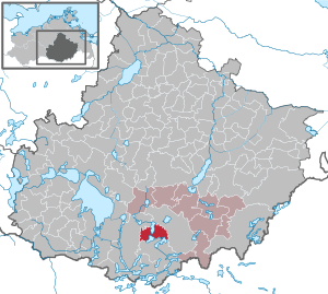
| Location of the municipality Userin in the Mecklenburg Lake District | ||
  |
||

Userin is a municipality in the Mecklenburg Lake District in southern Mecklenburg-Western Pomerania (Germany). The municipality is administered by the Neustrelitz-Land office , which is based in the non-official city of Neustrelitz .
geography
location
The community of Userin is located in the middle of the Mecklenburg Lake District , eight kilometers from Neustrelitz . The four kilometer long and one kilometer wide Useriner See , on whose east bank Userin lies, belongs to the Müritz National Park . The Useriner See is traversed by the upper Havel ; the slight gradient made it possible to create the Useriner Mühle district. The Havel flows further into the approximately four square kilometers large Woblitzsee - from here shipping is possible via the Kammer Canal to Neustrelitz and the Obere Havel waterway in the direction of Berlin . In the southwest of the municipality is the Great Labussee , on the north bank of which is the district of Zwenzow .
Community structure
The districts belong to Userin
- Great Quassow
- Lindenberg with the Lindenberg Arboretum
- User
- Useriner mill
- Vosswinkel
- Zwentsow
history
On July 1, 1950, the previously independent communities Vosswinkel and Zwenzow were incorporated.
politics
Coat of arms, flag, official seal
The municipality has no officially approved national emblem, neither a coat of arms nor a flag. The official seal is the small state seal with the coat of arms of the state of Mecklenburg. It shows a looking bull's head with torn off neck fur and crown and the inscription "GEMEINDE USERIN * LANDKREIS MECKLENBURGISCHE SEENPLATTE".
Attractions
- Userin half-timbered church from 1778
- As a replacement for an octagonal Fachwerkzentralbau of 1806 at the instigation of the Grand Ducal Chamber from 1876 to 1877 by Georg Daniel , the neo-Gothic brick church in Gros Quassow built by George Daniel.
- "Kirchsteigbrücke" - pedestrian bridge over the Kammerkanal near Voßwinkel
- Former district forester in Zwenzow

Useriner Church

Gross Quassow Church

Useriner mill

Uh District forester Zwenzow


Transport links

The connecting road from Neustrelitz to Mirow runs through Userin . The connection of the districts of the municipality of Neustrelitz is during the week with the buses of MVVG ensured. During the school holidays, the offer is partly limited to individual days of the week. The district of Groß Quassow also has a stop on the Neustrelitz – Mirow railway line .
Web links
Individual evidence
- ↑ Statistisches Amt MV - population status of the districts, offices and municipalities 2019 (XLS file) (official population figures in the update of the 2011 census) ( help ).
- ↑ www.wald-mv.de
- ↑ Main Statute, Section 1, Paragraph 2
Alt Schwerin | Altenhagen | Altenhof | Altentreptow | Ankershagen | Bartow | Basedow | Beggerow | Ownership | Blankenhof | Blankensee | Flower wood | Bollewick | Borrentine | Bredenfelde | Breesen | Breest | Briggow | Brunn | Buchholz | Stargard Castle | Burow | Bütow | Carpin | Cölpin | Dargun | Datzetal | Demmin | Eldetal | Rotten rust | Feldberger Seenlandschaft | Fincken | Friedland | Five lakes | Galenbeck | Gielow | Gnevkow | Godendorf | Goehren-Lebbin | Golchen | Gotthun | Grabowhöfe | Grammentin | Grapzow | Grischow | Large trowel | Groß Miltzow | Gross Nemerow | Large plastic | Groß Teetzleben | Grünow | Validity | Gülzow | High Wangelin | Hohenbollentin | Hohenmocker | Hohenzieritz | Holldorf | Ivenack | Jabel | Jürgenstorf | Kargow | Kentzlin | Kieve | Kittendorf | Little Thank You | Kletzin | Klink | Klocksin | Knorrendorf | Kratzeburg | Kriesow | Sublank | Kuckssee | Kummerow | Larz | Leizen | Lindenberg | Lindetal | Malchin | Malchow | Meesiger | Melz | Mirow | Möllenbeck | Möllenhagen | Mölln | Moltzow | Neddemin | Neetzka | Neubrandenburg | Neuenkirchen | Recalculation | Neustrelitz | Neverin | Nossendorf | Nossentiner Hut | Peenehagen | Penkow | Penzlin | Pragsdorf | Priborn | Priepert | Pripsleben | Rechlin | Ritzerow | Röbel / Müritz | Röckwitz | Rosenow | Sarov | Schloen-Dratow | Schönbeck | Schönfeld | Schönhausen | Black | Siedenbollentin | Siedenbrünzow | Sietow | Silz | Sommersdorf | Sponholz | Staven | Stavenhagen | Steer | Südmüritz | Torgelow am See | Trollenhagen | Tützpatz | Userin | Utzedel | Forgive | Voigtsdorf | Vollrathsruhe | Walow | Waren (Müritz) | Warrenzin | Werder | Wesenberg | Wildberg | Woggersin | Wokuhl-Dabelow | Wolde | Woldegk | Wulkenzin | Wustrow | Zettemin | Zirzow | Zislow