
Klocksin
| coat of arms | Germany map | |
|---|---|---|

|
Coordinates: 53 ° 38 ' N , 12 ° 32' E |
|
| Basic data | ||
| State : | Mecklenburg-Western Pomerania | |
| County : | Mecklenburg Lake District | |
| Office : | Lake landscape goods | |
| Height : | 68 m above sea level NHN | |
| Area : | 23.9 km 2 | |
| Residents: | 305 (Dec. 31, 2019) | |
| Population density : | 13 inhabitants per km 2 | |
| Postal code : | 17194 | |
| Area code : | 039933 | |
| License plate : | MSE, AT, DM, MC, MST, MÜR, NZ, RM, WRN | |
| Community key : | 13 0 71 078 | |
| Office administration address: | Friedensstrasse 11 17192 Waren (Müritz) |
|
| Website : | ||
| Mayor : | Rolf-Werner Janecke | |
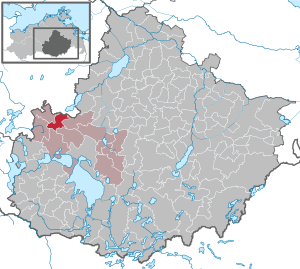
| Location of the municipality of Klocksin in the Mecklenburg Lake District | ||
  |
||

Klocksin is a municipality in the Mecklenburg Lake District in Mecklenburg-Western Pomerania, Germany. It is administered by the Lake Landscape Department in Waren , based in the city of Waren (Müritz) .
Location and districts
The municipality of Klocksin in the Mecklenburg Lake District lies on the North Sea-Baltic Sea watershed . While the Malchiner See , located north of Klocksin, drains over the Peene to the Baltic Sea, the waters flow south of Klocksin ( meltwater channel of the Loppiner-Klocksin Lake District , including Flat Lake ) over the Müritz , Elde and Elbe to the North Sea. Most of the community is located in the Nossentiner / Schwinzer Heide nature reserve . The towns of Teterow and Waren (Müritz) are each 16 km from Klocksin.
Klocksin is surrounded by the neighboring communities of Dahmen in the north, Moltzow in the east, Grabowhöfe and Jabel in the south, Hohen Wangelin in the west and Vollrathsruhe in the northwest.
The districts of Blücherhof, Lütgendorf, Neuhof and Sapshagen belong to Klocksin.
history
The Klocksin estate belonged to the von Linstow family until the 14th century , who then pledged it to the von Bassewitz family . In 1782 the von Frisch family owned the estate. Around 1900 a chapel was built on a lime tree avenue. In 1933 the estate was sold to the Mecklenburgische Siedlungsgesellschaft . Twelve settlements arose and the rest of the yard went to Otto Grambow.
Official seal
The municipality has no officially approved national emblem, neither a coat of arms nor a flag. The official seal is the small state seal with the coat of arms of the state of Mecklenburg. It shows a looking bull's head with a torn neck fur and crown and the inscription GEMEINDE KLOCKSIN • LANDKREIS MECKLENBURGISCHE SEENPLATTE .
Attractions

The village church of Lütgendorf from the 13th century is a field stone church . In 1775 the east gable was designed in half-timbered houses. The pulpit altar and the patron's box date from the second half of the 18th century. Church, free-standing belfry with a bell from 1860 and the former village school form an ensemble that is well worth seeing.
On the road to Blücherhof there is a very old dead elm in the reeds of the flat lake. There is a mighty oak tree above.
The manor house in Klocksin is a two-story, thirteen-axis plastered building with a basement and a hipped roof . During renovations around 1830, the building was given its classicist shape. The stucco facade was smoothly plastered during the GDR era. The estate belonged to the von Linstow family until the 14th century , who then pledged it to the von Bassewitz family . Today the manor house is the town hall. The romantic park leads to the lake. On the way is the cemetery with a memorial stone for those who fell in World War II and a burial place for 15 dead from 1945.

Blücherhof Palace is a neo-baroque plastered building from 1902. The complex also includes a neo-baroque farm building with a roof tower and a pigeon house. Alexander Koenig had the important garden for dendrology laid out by Georg Kuphaldt in 1900–1906 . The metalsmith dit come from the Godesberger workshop of Georg Gernhard (1860-1943).
Economy and Transport

The municipality is dominated by agriculture, tourism plays an increasingly important role. In the last few years many private homes have been built in Klocksin. In 1995 the construction of the gravel and sand works began, which went into operation in 1996. It has a siding to the Neustrelitz – Warnemünde railway line (Lloydbahn).
Klocksin is close to the federal highway 108 from Teterow to Waren (Müritz) , the Linstow ( A 19 ) motorway junction is 13 km away. The next train stations are in Waren and Teterow.
Web links
Individual evidence
- ↑ Statistisches Amt MV - population status of the districts, offices and municipalities 2019 (XLS file) (official population figures in the update of the 2011 census) ( help ).
- ↑ Main Statute, Section 2, Paragraph 1
- ↑ Klocksin Cemetery (dorfkirchen-in-mv.de)
- ↑ The memorial stone and the small cemetery in Klocksin (heimat-mecklenburgische-seenplatte.de)
- ^ Heiko Zerwer: The dendrological park Blücherhof: preliminary work for a park maintenance work with the help of a computer-aided information system. Berlin: TU, Univ.-Bibliothek, Abt. Publ., 1998 (materials on the history of garden art; 3) ISBN 3-7983-1784-4 ( digitized version ( memento of the original from April 20, 2015 in the Internet Archive ) Info: Der Archive link was automatically inserted and not yet checked. Please check the original and archive link according to the instructions and then remove this note. )
- ^ Horst Heidermann : The blacksmith Gernhard . In: Godesberger Heimatblätter: Annual volume of the Association for Home Care and Local History Bad Godesberg eV , ISSN 0436-1024 , Volume 54/2016, Association for Home Care and Local History Bad Godesberg , Bad Godesberg 2017, p. 32–52 (here: p. 41– 45).
Alt Schwerin | Altenhagen | Altenhof | Altentreptow | Ankershagen | Bartow | Basedow | Beggerow | Ownership | Blankenhof | Blankensee | Flower wood | Bollewick | Borrentine | Bredenfelde | Breesen | Breest | Briggow | Brunn | Buchholz | Stargard Castle | Burow | Bütow | Carpin | Cölpin | Dargun | Datzetal | Demmin | Eldetal | Rotten rust | Feldberger Seenlandschaft | Fincken | Friedland | Five lakes | Galenbeck | Gielow | Gnevkow | Godendorf | Goehren-Lebbin | Golchen | Gotthun | Grabowhöfe | Grammentin | Grapzow | Grischow | Large trowel | Groß Miltzow | Gross Nemerow | Large plastic | Groß Teetzleben | Grünow | Validity | Gülzow | High Wangelin | Hohenbollentin | Hohenmocker | Hohenzieritz | Holldorf | Ivenack | Jabel | Jürgenstorf | Kargow | Kentzlin | Kieve | Kittendorf | Little Thank You | Kletzin | Klink | Klocksin | Knorrendorf | Kratzeburg | Kriesow | Sublank | Kuckssee | Kummerow | Larz | Leizen | Lindenberg | Lindetal | Malchin | Malchow | Meesiger | Melz | Mirow | Möllenbeck | Möllenhagen | Mölln | Moltzow | Neddemin | Neetzka | Neubrandenburg | Neuenkirchen | Recalculation | Neustrelitz | Neverin | Nossendorf | Nossentiner Hut | Peenehagen | Penkow | Penzlin | Pragsdorf | Priborn | Priepert | Pripsleben | Rechlin | Ritzerow | Röbel / Müritz | Röckwitz | Rosenow | Sarov | Schloen-Dratow | Schönbeck | Schönfeld | Schönhausen | Black | Siedenbollentin | Siedenbrünzow | Sietow | Silz | Sommersdorf | Sponholz | Staven | Stavenhagen | Steer | Südmüritz | Torgelow am See | Trollenhagen | Tützpatz | Userin | Utzedel | Forgive | Voigtsdorf | Vollrathsruhe | Walow | Waren (Müritz) | Warrenzin | Werder | Wesenberg | Wildberg | Woggersin | Wokuhl-Dabelow | Wolde | Woldegk | Wulkenzin | Wustrow | Zettemin | Zirzow | Zislow