
Kentzlin
| coat of arms | Germany map | |
|---|---|---|

|
Coordinates: 53 ° 45 ' N , 12 ° 59' E |
|
| Basic data | ||
| State : | Mecklenburg-Western Pomerania | |
| County : | Mecklenburg Lake District | |
| Office : | Demmin country | |
| Height : | 56 m above sea level NHN | |
| Area : | 11.76 km 2 | |
| Residents: | 207 (Dec. 31, 2019) | |
| Population density : | 18 inhabitants per km 2 | |
| Postal code : | 17111 | |
| Area code : | 039952 | |
| License plate : | MSE, AT, DM, MC, MST, MÜR, NZ, RM, WRN | |
| Community key : | 13 0 71 072 | |
| Community structure: | 2 districts | |
| Office administration address: | Goethestrasse 43 17109 Demmin |
|
| Website : | ||
| Mayor : | Reinhard Schumacher | |
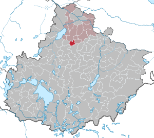
| Location of the municipality of Kentzlin in the Mecklenburg Lake District | ||
  |
||

Kentzlin is a municipality in the state of Mecklenburg-Western Pomerania in the Mecklenburg Lake District . It is located about 16 kilometers south of Demmin, about eight kilometers north of Stavenhagen and about eight kilometers east of the Kummerower See . Until July 1, 2004, the municipality was part of the Borrentin office and has been part of the Demmin-Land office since then, with its seat in Demmin.
Districts
- Old Kentzlin
- New Kentzlin
history
The first documentary mention (Cancelyn) took place around 1300. The foundation of New Kentzlin took place in 1764. The community changed its name on June 3, 1998 from New Kentzlin to New Kentzlin. On August 21, 2002 she was given the name Kentzlin.
politics
Coat of arms, flag, official seal
The municipality has no officially approved national emblem, neither a coat of arms nor a flag . The official seal is the small state seal with the coat of arms of the region of Western Pomerania . It shows an upright griffin with a raised tail and the inscription "GEMEINDE KENTZLIN * LANDKREIS MECKLENBURGISCHE SEENPLATTE".
Population development
|
Attractions
- Peace Oak in New Kentzlin
- Castle wall in New Kentzlin
- Motte (medieval castle hill with ring wall) in Old Kentzlin
- Manor house in Old Kentzlin
traffic
The community is connected to federal road 194 via state road 272 .
Web links
Individual evidence
- ↑ Statistisches Amt MV - population status of the districts, offices and municipalities 2019 (XLS file) (official population figures in the update of the 2011 census) ( help ).
- ↑ StBA: Changes in the municipalities in Germany, see 2002
- ↑ Main Statute, Section 1, Paragraph 2 (PDF).
Alt Schwerin | Altenhagen | Altenhof | Altentreptow | Ankershagen | Bartow | Basedow | Beggerow | Ownership | Blankenhof | Blankensee | Flower wood | Bollewick | Borrentine | Bredenfelde | Breesen | Breest | Briggow | Brunn | Buchholz | Stargard Castle | Burow | Bütow | Carpin | Cölpin | Dargun | Datzetal | Demmin | Eldetal | Rotten rust | Feldberger Seenlandschaft | Fincken | Friedland | Five lakes | Galenbeck | Gielow | Gnevkow | Godendorf | Goehren-Lebbin | Golchen | Gotthun | Grabowhöfe | Grammentin | Grapzow | Grischow | Large trowel | Groß Miltzow | Gross Nemerow | Large plastic | Groß Teetzleben | Grünow | Validity | Gülzow | High Wangelin | Hohenbollentin | Hohenmocker | Hohenzieritz | Holldorf | Ivenack | Jabel | Jürgenstorf | Kargow | Kentzlin | Kieve | Kittendorf | Little Thank You | Kletzin | Klink | Klocksin | Knorrendorf | Kratzeburg | Kriesow | Sublank | Kuckssee | Kummerow | Larz | Leizen | Lindenberg | Lindetal | Malchin | Malchow | Meesiger | Melz | Mirow | Möllenbeck | Möllenhagen | Mölln | Moltzow | Neddemin | Neetzka | Neubrandenburg | Neuenkirchen | Recalculation | Neustrelitz | Neverin | Nossendorf | Nossentiner Hut | Peenehagen | Penkow | Penzlin | Pragsdorf | Priborn | Priepert | Pripsleben | Rechlin | Ritzerow | Röbel / Müritz | Röckwitz | Rosenow | Sarov | Schloen-Dratow | Schönbeck | Schönfeld | Schönhausen | Black | Siedenbollentin | Siedenbrünzow | Sietow | Silz | Sommersdorf | Sponholz | Staven | Stavenhagen | Steer | Südmüritz | Torgelow am See | Trollenhagen | Tützpatz | Userin | Utzedel | Forgive | Voigtsdorf | Vollrathsruhe | Walow | Waren (Müritz) | Warrenzin | Werder | Wesenberg | Wildberg | Woggersin | Wokuhl-Dabelow | Wolde | Woldegk | Wulkenzin | Wustrow | Zettemin | Zirzow | Zislow