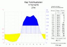
Cape York (Australia)
|
Cape York Cape York |
||
 Cape York, view of Eborac Island |
||
| Geographical location | ||
|
|
||
| Coordinates | 10 ° 41 '14 " S , 142 ° 31' 54" E | |
| Waters 1 | Torres Street | |
The Cape York is a headland and the northernmost point of the Australian mainland (many of the associated also with Australia Torres Strait Islands lie to the north). Cape York is part of the state of Queensland . It lies in the Northern Peninsula Area administrative region . Immediately to the north are the islands of York and Eborac , at a distance of 200 and 400 meters respectively.
Cape York is 1,170 km north of Cairns and 140 km south of New Guinea . It is the namesake of the Cape York Peninsula .

