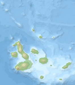
Cerro Azul (Ecuador)
| Cerro Azul | ||
|---|---|---|
|
A tuff cone in the summit caldera |
||
| height | 1640 m | |
| location | Galápagos Island Isabela | |
| Coordinates | 0 ° 55 ′ 0 ″ S , 91 ° 24 ′ 30 ″ W | |
|
|
||
| Type | Shield volcano | |
| Last eruption | 2008 | |
The Cerro Azul is located at the southwest end of the Galápagos island Isabela . The volcano is dominated by a steep-walled caldera with a diameter of 4 × 5 kilometers and a maximum depth of 650 meters.
At 1640 meters, Cerro Azul is the second highest of all volcanoes in the Galapagos Archipelago. Younger lava flows cover much of the bottom of the caldera. Cerro Azul is one of the most active volcanoes in the Galapagos Islands. Known eruptions of the volcano: 1250, 1850, 1932, 1940 (east flank), April 1943, June 1948, 1951, June 29, 1959 (east flank), January 29, 1979, September 15 to October 21, 1998 (north and west -Side of the caldera, southeast flank, ejection of 110 million cubic meters of lava), May 29 to June 17, 2008 (summit and southeast flank).
Web links
- Cerro Azul in the Global Volcanism Program of the Smithsonian Institution (English)

