Isabela (Galápagos)
| Isabela (Albemarle) | ||
|---|---|---|
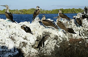
| Blue-footed boobies on the Bahía Elizabeth | ||
| Waters | Pacific Ocean | |
| Archipelago | Galapagos Islands | |
| Geographical location | 0 ° 27 ′ S , 91 ° 11 ′ W | |
|
|
||
| length | 137 km | |
| width | 83 km | |
| surface | 4th 588 km² | |
| Highest elevation |
Wolf 1707 m |
|
| Residents | 2200 <1 inh / km² |
|
| main place | Puerto Villamil | |
| Satellite image of the Wolf volcano | ||
With a size of 4588 km² and a length of 120 kilometers Isabela ( English also Albemarle , Spanish Isla Isabela ) is by far the largest of the Galápagos Islands , and almost five times the size of the second largest island, Santa Cruz . The island takes up well over half (58 percent) of the land area of the entire archipelago . It grew from up to six originally separate shield volcanic islands to form an island due to the outflowing lava, further merging with the neighboring island Fernandina to the west and separated by the 4.4 km wide Canal Bolívar is possible due to volcanic activity.
The name Isabela is derived from the name of the Spanish Queen Isabella I (1451–1504), who financially supported Christopher Columbus' voyages of discovery . Around 2200 people live on Isabela today, most of them in and around the main town of Puerto Villamil on the southeast coast. Puerto Villamil was founded in 1897. West of the city are the ruins of a convict colony, which was closed in 1959, with a high wall built by convicts from black lava rock, known as the "Wall of Tears ( Muro de las Lágrimas )".
The highest point on the island is the Wolf volcano at 1707 m . In total, there are five other volcanoes in addition to Wolf with Alcedo , Cerro Azul , Darwin , Ecuador and Sierra Negra . The bare lava fields form an insurmountable barrier for most living things and so evolution has produced several subspecies of the Galápagos tortoise on this island alone . The Mangrove Darwin's Finch is only found on this island.
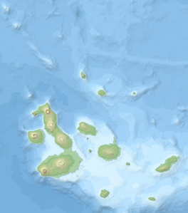
![]() Map with all coordinates: OSM | WikiMap
Map with all coordinates: OSM | WikiMap
| No | volcano | Height (m) |
Last eruption |
Coordinates |
|---|---|---|---|---|
| 1 | Ecuador | 790 | 1150 | 00 ° 01 ′ 28.0 ″ S , 091 ° 33 ′ 43.0 ″ W. |
| 2 | wolf | 1707 | 2015 | 00 ° 01 ′ 15.0 ″ N , 091 ° 20 ′ 33.0 ″ W. |
| 3 | Darwin | 1330 | 1813 | 00 ° 11 ′ 28.0 ″ S , 091 ° 17 ′ 31.0 ″ W. |
| 4th | Alcedo | 1130 | 1993 | 00 ° 25 ′ 31.0 ″ S , 091 ° 07 ′ 15.0 ″ W. |
| 5 | Sierra Negra | 1124 | 2005 | 00 ° 48 ′ 59.0 ″ S , 091 ° 07 ′ 50.0 ″ W. |
| 6th | Cerro Azul | 1640 | 2008 | 00 ° 55 ′ 39.0 ″ S , 091 ° 23 ′ 37.0 ″ W. |
Isabela also has the northernmost natural occurrence of penguins, the Galápagos penguins, and the only one in the northern hemisphere.
The individual craters are clearly visible on satellite images: from above Wolf, Darwin, Alcedo and (below right) the Cerro Azul on Isabela, in the center of the picture La Cumbre on Fernandina
Web links
Individual evidence
- ↑ https://www.ecostravel.com/ecuador/ciudades-destinos/puerto-villamil-isabela.php
- ↑ Galo Martín Aparicio: Lo Esencial de Ecuador y las Islas Galápagos , p. 207. Madrid 2018
- ↑ http://www.volcano.si.edu/world/region.cfm?rnum=1503


