Sierra Negra (Galápagos)
| Sierra Negra | ||
|---|---|---|
|
Sierra Negra in the distance |
||
| height | 1124 m | |
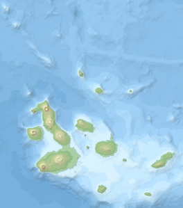
| location | Isabela , Galapagos Islands , Ecuador | |
| Coordinates | 0 ° 49 ′ 48 ″ S , 91 ° 10 ′ 12 ″ W | |
|
|
||
| Type | Shield volcano | |
| rock | Basalt / Picrobasalt | |
| Last eruption | June 2018 | |
The Sierra Negra volcano is a large shield volcano at the southeast end of the Galapagos Island Isabela with a height of 1124 m. It is one of the most active volcanoes in the Galapagos Islands, the most recent eruption began on June 26, 2018 hours after an earthquake series with a maximum magnitude of 5.3.
Other eruptions took place in 1911, 1948, 1953, 1954, 1957, 1963, 1979 and 2005. Eruptions in previous years were dated due to the flow of lava , but the exact location of the volcano and the date of the eruption are not known exactly. There are extensive lava fields between the Sierra Negra and the southeastern town of Puerto Villamil .
In the northeast of the Sierra, the Volcán Chico rises to a height of 860 m, which last erupted in November 1979.
At 7 × 10.5 km, the Sierra Negra has the largest caldera of all volcanoes in the Galapagos Islands. The bottom of the caldera is completely covered by lava that flowed from a slightly elevated fissure during the 2005 eruption .
Web links
- Sierra Negra (Galápagos) in the Global Volcanism Program of the Smithsonian Institution (English)
Individual evidence
- ↑ Sierra Negre volcano news & eruption updates (Galapagos Islands, Ecuador). In: VolcanoDiscovery.com. June 27, 2018, accessed June 27, 2018 .
- ↑ Isabela Island - Galapagos. In: GalapagosIslands.com. Retrieved December 14, 2018 .


