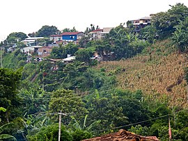
Comasagua
| Comasagua | ||
|---|---|---|
|
Coordinates: 13 ° 38 ′ N , 89 ° 23 ′ W Comasagua on the map of El Salvador
|
||
| Basic data | ||
| Country | El Salvador | |
| La Libertad | ||
| Residents | 12,839 (2013) | |
| Detailed data | ||
| surface | 75.05 km² | |
| height | 1070 m | |
| Time zone | UTC −6 | |
| City Presidency | Héctor Pérez | |
Comasagua is a municipality (municipality) in the La Libertad department in El Salvador .
history
The settlement history of Comasagua goes back to the pre-Columbian time of the Pipilen population. In 1533 the area was discovered by the Spanish conquistadores . In 1740 the place on the edge of the Cordillera del Bálsamo was first mentioned in literature as Comatzahua , Cutmatzahuat . A communal report dated November 20, 1860 states that around 500 people lived in the congregation at that time and that there were 205 houses and two churches. With the law of January 28, 1865, the municipality became part of the political-administrative district of Nueva San Salvador and La Libertad.
In 1890 Comasaqua had 1,895 inhabitants. In 1924 Comasaqua received city rights (villa). On January 13, 2001, the city was badly damaged by an earthquake with a magnitude of 7.6 ( Richter scale ).
In the census at the end of 2013, 12,839 inhabitants were registered. The community covers an area of 75.05 km² and is located at an altitude of 1070 meters (msnm). 74.75 km² correspond to the rural area. The city center has an area of 0.3 km².
economy
Comasagua was and is still today a settlement of the farmers, whose ancestors grew balsam plants and made balsam products, later the cultivation of coffee followed. The economic activity is complemented by other agricultural productions, such as: rearing cattle, pigs, horses, mules and poultry.
Worth seeing
Tourist attractions in the area include visits to the coffee plantations with an educational trail that shows the process from cultivation to harvest, and a visit to Finca San Ernesto with the only well-preserved colonial manor in the area and the parish church of St. Matthew and the House of Culture in the center of the city.
The cool subtropical rainforest surrounding the place contains numerous remarkable tree species, such as balsam trees , medlar and cedar , oak, walnut, cypress and pine. The most important rivers and streams in the hilly vicinity are the San Antonio, El Refugio, Cuyanigua and La Máquina.
Web links
Individual evidence
- ↑ Newspaper report El Diario de Hoy ( Memento of the original from February 1, 2014 in the Internet Archive ) Info: The archive link was inserted automatically and has not yet been checked. Please check the original and archive link according to the instructions and then remove this notice.
- ↑ DYGESTIC: Proyecciones municipales


